REVIEW · GREAT SMOKY MOUNTAINS NATIONAL PARK
Scenic Blue Ridge Parkway Self-Guided Driving Audio Tour
Book on Viator →Operated by Adventures with Action · Bookable on Viator
Your car becomes the tour guide. This self-guided Blue Ridge Parkway driving audio tour strings together major overlooks and culture stops with stories that play by GPS and works even when your cell signal drops. You’ll start from Cherokee, Asheville, Roanoke, or Afton and cruise between the Great Smokies area and Shenandoah, with lots of reasons to pull over for wildlife and photo stops.
Two things I really like about this setup are the hands-free audio that starts automatically when you reach each spot, and the value of paying $24.99 per group (up to 4) instead of per person. It’s built for independent pace: start when you want, pause for snacks, then roll on down the Parkway.
One big consideration: you must download the tour while you’re in strong Wi‑Fi or cellular, because the mountains can be rough on signal. If your download fails or your phone can’t stay connected, you may lose the “just works” benefit.
In This Review
- Key highlights you’ll care about
- Why a GPS-triggered Blue Ridge Parkway audio drive makes sense
- Price and value: $24.99 per group for up to 4
- How the app and offline maps work on the Parkway
- What to expect from the route: speed, timing, and stop reality
- Stop-by-stop: the most interesting turnouts and what each one adds
- The audio narration: what people love and what can annoy you
- Who this self-guided Blue Ridge Parkway drive is best for
- Should you book this Blue Ridge Parkway audio tour?
- FAQ
- How much does the Blue Ridge Parkway audio tour cost?
- How long does the tour take?
- Where can I start the tour?
- Do the audio stories play automatically?
- Do I need cell service to use it?
- Are entry tickets included for the stops?
- Is this a guided group tour with someone meeting me?
- Can I pause the audio and start again later?
- Can I use the tour again on another trip?
- Is there free cancellation?
Key highlights you’ll care about
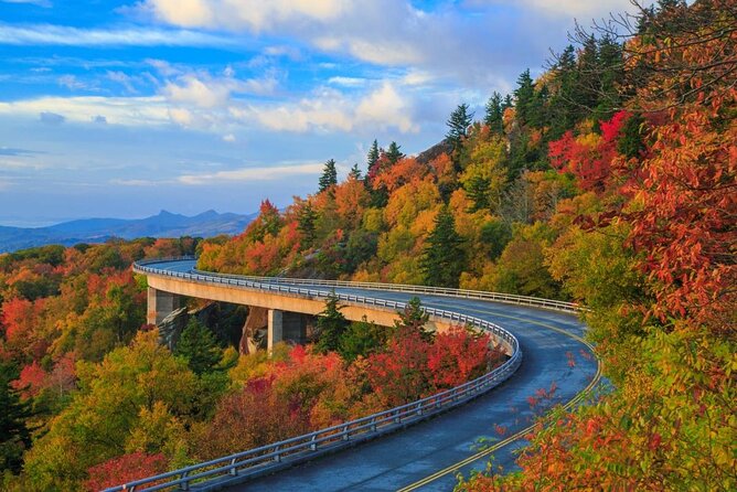
- GPS-triggered stories: audio plays based on where you are, so you’re not hunting menus.
- Offline maps after download: you can keep driving without relying on bars.
- Pick your pace: skip stops, linger at overlooks, and restart anytime.
- One year of use: buy once and reuse across multiple trips.
- No entry tickets included: you’re paying for the guide, not the attractions.
Why a GPS-triggered Blue Ridge Parkway audio drive makes sense
The Blue Ridge Parkway is a road made for slowing down. You want to stop at lookouts that catch your eye, not follow a rigid group schedule. This audio format fits that style: you drive your own vehicle and the stories arrive right when you pull into the right area.
I like that it acts like a calm co-pilot. You’re not replaying audio in the wrong place or trying to interpret directions while the road curves and your parking spot disappears. The tour also flags the kinds of things you might overlook—like what you’re actually looking at, why an overlook matters, or what a landmark name refers to—so each turnout feels purposeful.
It also helps that you’re not stuck with a single “one and done” day. You can reuse the tour for a year, which matters on the Parkway where weather changes fast and clouds can blank out views.
You can also read our reviews of more tours and experiences in Great Smoky Mountains National Park.
Price and value: $24.99 per group for up to 4
At $24.99 per group (up to 4), the pricing is much closer to the cost of a single person’s guided bus day than to a per-person ticket. If you’re driving with a couple plus kids, or a small group of friends, the math gets even better.
Think of it as paying for a guided experience you can control. You’re getting:
- automatically timed GPS audio,
- offline use after download,
- lots of stop-specific context (not just generic narration),
- and the ability to redo the drive later without buying again.
Where the value can wobble is if app setup goes wrong on your side. Several low ratings point to download or playback failures, and those are the moments when a “cheap add-on” feels like wasted time. So if you’re the kind of person who likes to test technology early, you’ll benefit.
How the app and offline maps work on the Parkway
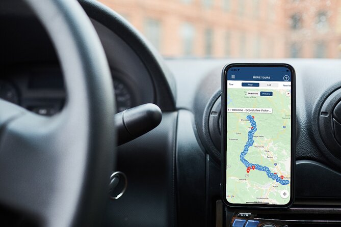
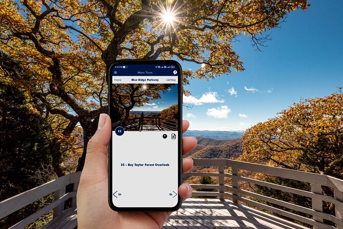
This runs through Action’s Tour Guide App. After booking, you get an email and text with setup instructions and a password. You’re expected to download the tour while you’re on strong Wi‑Fi/cellular, then the experience works offline after that.
On-site, there’s no staff waiting to hand you anything. You open the Action app, start the tour for your planned starting point and direction, then follow the audio prompts. If you have multiple tour versions, pick the one that matches where you’ll begin.
A practical tip: before you leave civilization, make sure your phone battery is healthy and that your audio output is set how you want (phone speaker or car audio). One common complaint is that people could see the audio playing but couldn’t hear it well through their car system, which is a quick fix if you test before the drive gets scenic.
What to expect from the route: speed, timing, and stop reality
The tour is listed as about 4 hours (approx.), but it also notes it covers the essentials of a 550+ mile Parkway run in 5+ hours. Translation: your actual time depends on how long you park, how often you step out, and whether you choose the shorter “just drive and listen” style or the “get out for every viewpoint” style.
Many stops are designed around a quick 5-minute window. That doesn’t mean the view takes 5 minutes. It means the tour expects you to move along. If the weather is clear, you’ll fly through. If clouds roll in, you’ll want extra time—especially at the sunset-facing lookouts.
Also note what’s not included: attraction entry tickets. Many stops are simply pull-offs or free areas, but if a stop has a paid component, you’ll need to handle that separately.
Stop-by-stop: the most interesting turnouts and what each one adds
Below is the run in order, with what makes each stop worth your time—and a couple of practical cautions.
Stop 1: Blue Ridge Parkway (the pull-off overlook intro)
You start with classic Parkway turnouts. The memorable part here is the large wooden signage that names the mountain or ridge and even lists your current elevation. There are 200+ overlooks across the entire Parkway, so this gives you a fast way to give labels to the scenery you’re seeing.
Stop 2: Oconaluftee Visitor Center Parking C
This is a great first “anchor” stop. You learn how the Parkway story connects to native Cherokee presence, pioneer settlers, and Appalachian culture today. When you’re ready, you exit the visitor center parking lot and turn left back onto the main road.
Stop 3: Ballhoot Scar Overlook
This lookout frames a visible blemish in the terrain that resembles landslide damage, but the story behind it is man-made. It’s one of those “you’re looking at evidence” stops that makes the Parkway feel more like geology class than just scenery.
Stop 4: Blue Ridge Parkway (Cherokee time depth)
This section focuses on Cherokee presence long ago, with artifacts dating back 11,000 years. It also shares how the Cherokee referred to themselves as Aniuywiya, and how Spanish explorers recorded a different name. If you like history that connects directly to place names, this one works.
Stop 5: Thomas Divide Overlook (ghost lights)
This is where the Parkway turns spooky-in-a-friendly-way. There are reports of ghost lights—dancing white orbs—with stories traced back to the 1700s in local accounts. At night, you may see cars parked here hoping to catch them, which is a reminder to bring patience if you’re aiming for nighttime sightings.
Stop 6: Big Witch Overlook
Big Witch is named as a Cherokee medicine man, with an added twist: he was also an eagle hunter. The angle here is how eagle feathers were viewed as sacred and used in healing ceremonies. It’s a good stop if you want the cultural details, not just the view.
Stop 7: Bunches Bald Overlook
Most of the mountains here are forested, but Appalachian bald spots look more like grassy prairie. Bunches Bald is one of those openings, so you get a different silhouette and a different feel than you’ll see in dense woods.
Stop 8: Plott Balsam Overlook
You get a family story with a very specific detail: Henry Plott’s family immigrated from Germany in the late 1700s and settled in the Blue Ridge with their children and five German hunting hounds. If you like names that become characters, this stop will stick.
Stop 9: Soco Gap
This one is about separation and conflict: Cherokee and Shawnee were at war in the early 1700s, and the Blue Ridge Mountain range kept them apart most of the time. It’s a compact reminder that geography shapes history.
Stop 10: Thunder Struck Ridge Overlook (sunset timing)
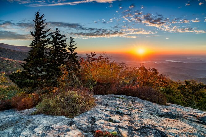
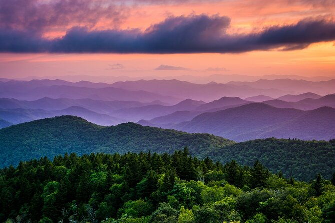
Facing to the west, it’s designed for sunset watching. If the timing clicks, you can catch a brilliant orange sky above foggy blue mountains. Practical note: if clouds cover your horizon, you may not get the full effect, so this is a “best effort” stop.
Stop 11: Waterrock Knob
This is the Parkway’s tallest visitor center stop, and the elevation is listed at 5,820 feet. It’s a long-range viewing stop with views across major Appalachian mountain chains, so it’s a strong choice when visibility is good.
Stop 12: Yellow Face Overlook
This is framed as perhaps the best overall view of the Blue Ridge Mountains. You can see Yellow Face Mountain clearly, plus rows of ridges fading into mist. If you have limited time, prioritize this type of overlook where distance is part of the wow-factor.
Stop 13: Cherokee Rose
This is a legend tied to the Trail of Tears. The flower’s story says each white petal represents a band of the Cherokee nation, and the gold in the center is what settlers tore away the petals to reach. Since it’s a heavy theme, treat it as a moment to slow down and listen.
Stop 14: Roy Taylor Forest Overlook
Instead of just pointing at trees, this adds a structure: there’s a wooden observation deck so you can take in the view from a slightly different angle. The story behind it is that the forest was once in serious danger, so it adds a conservation layer.
Stop 15: Cowee Mountain Overlook
This is about scale. You get 180-degree views from one of the highest spots on the Parkway. Bring your camera ready, but also bring common sense: watch for footing if it’s windy or damp.
Stop 16: Rough Butt Bald Overlook
Here the name is a clue. “Butt” is used as a topographical term for a ridge that comes to an abrupt end, like a broken-off butt. The point is to show how the ridge changes suddenly, turning the terrain into a visible story.
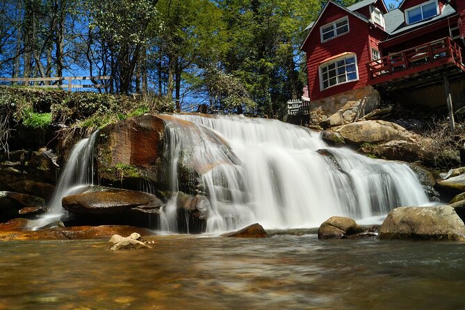
Stop 17: Cathedral Falls and French Broad Falls
This stop includes walking. A half-mile trail leads over three wooden bridges toward an abandoned historical mill at Mill Shoals. Across the river, French Broad Falls adds a second waterfall viewpoint, and the stop is framed at the intersection of the French Broad River and Shoal Creek. Practical caution: you’ll want water shoes or solid grip if it’s wet.
Stop 18: Black Balsam Knob
This is described as one of the Parkway’s most popular hikes because it has a mix: dense forests, wide-open meadows, and mountaintop vistas. If you like variety in short hikes, this is a great place to step out rather than just look from the car.
Stop 19: Skinny Dip Falls Trailhead
Swimming is part of the legend and the culture here—swimming is not only tolerated, it’s encouraged. You get a waterfall plus a swimming hole, and the instructions indicate you can climb right up the boulders to reach the top of the falls area. This is the stop for energetic people, but go with judgment and safety.
Stop 20: Cherry Cove Overlook
This one is about seasons and food for wildlife. You’ll find tons of black cherry trees, and in early fall thousands of birds are attracted. There’s also a potential sightline to Looking Glass Rock, and after rainfall the wet cliff can reflect sunlight like a huge mirror.
Stop 21: Fryingpan Mountain Lookout Tower
A lookout with two legends: a pan-shaped freshwater spring, or a frying pan hanging from a tree. Either way, it’s a playful naming story that fits the “why are these mountains named like this?” feeling you’ll get across the Parkway.
Stop 22: Pisgah Inn
This is a practical break and a viewpoint stop. You’ll find a public cafe, a gift shop of local artisan crafts, and a country store for Parkway travel necessities. Yes, the view is the main draw, but it’s also a place to reset your energy.
Stop 23: Mount Pisgah
For the “I want one real hike” moment. The guide suggests taking a right ahead and parking, which leads to the Mount Pisgah Trailhead. It’s both a hike option and an overlook option, so it’s a good choice if you’re tired of pull-offs that are over before you’ve even stretched.
Stop 24: Beaver Dam Gap Overlook
This is a 360-degree style viewpoint from the Mills River area. The key detail is you can see from both sides: Chestnut Ridge to the west and Big Ridge to the east. If you want maximum panorama with a single stop, this is one to watch for.
Stop 25: Bad Fork Valley Overlook
A valley stop with a creek-focused view: Bad Fork meanders below, and it’s described as covered by laurel blossoms surrounded by hardwood forests. It’s a good “slow look” stop when you want something a bit quieter than the bigger named peaks.
Stop 26: French Broad Overlook
This closes the story with river facts. French Broad River is described as one of the oldest rivers (250 million years old, as stated), and it’s noted as one of the few rivers in the U.S. that flows to the north rather than south. It’s a solid final stop if you want the “why this water matters” perspective.
The audio narration: what people love and what can annoy you
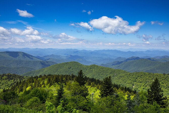
The strongest positive theme is that the narration helps you see what you’re looking at. The auto-timed stories give practical context for overlooks, and the tone is described as easy to understand with a sense of humor. Some people also mentioned music woven into the experience, including Indian-based music cues.
The most common friction points are also predictable:
- The app must be downloaded before you lose service.
- Some users reported playback glitches or trouble getting audio to work.
- In a few cases, the audio appeared to be playing but wasn’t loud enough through the phone or car sound setup.
- If the day is cloudy, any driving tour loses the main payoff: views.
So the best strategy is simple: test audio output once before you head deeper into the mountains, and plan an alternate “Plan B” mindset for mist and clouds.
Who this self-guided Blue Ridge Parkway drive is best for
This works especially well if you:
- want the freedom to pull in and out without keeping pace with a group,
- like your driving scenic, not exhausting,
- enjoy history and culture stories tied to specific places,
- are traveling with up to four people and want value pricing.
It’s also a smart pick if you’ve already done a guided tour and want a second pass at your own speed. Since you can reuse the audio for a year, you can listen again on a later trip and focus on different stops.
It may be less ideal if you need guaranteed tech-free operation. The experience depends on the app download and audio playback working on your phone.
Should you book this Blue Ridge Parkway audio tour?
Yes—if you’re planning a self-driving Blue Ridge Parkway day and you can handle the “download before you go” rule. At $24.99 per group up to 4, the value is real, especially because you’ll likely get more out of each turnout once you know what you’re seeing and why it’s there.
Skip it or at least prepare carefully if:
- you know your phone has spotty app behavior,
- you hate troubleshooting audio settings,
- you’re arriving without strong Wi‑Fi time to download first.
For most people, the big win is control: you get guidance without losing independence. Pair it with good daylight for lookouts, and you’ll turn a scenic drive into a guided one where the story lands exactly when you arrive.
FAQ
How much does the Blue Ridge Parkway audio tour cost?
It costs $24.99 per group, up to 4 people.
How long does the tour take?
It’s listed at about 4 hours, though it notes the essentials of the long Parkway route can take 5+ hours depending on how you move through the stops.
Where can I start the tour?
You can start from Cherokee, Asheville, Roanoke, or Afton.
Do the audio stories play automatically?
Yes. The stories play automatically based on your GPS location.
Do I need cell service to use it?
No signal is needed after you download. You do need strong Wi‑Fi or cellular to download the tour first.
Are entry tickets included for the stops?
No. The tour does not include attraction passes or entry tickets. Some stop areas are free, but paid sites would be separate.
Is this a guided group tour with someone meeting me?
No. It’s self-guided. No one meets you at the start, and it’s private for your group.
Can I pause the audio and start again later?
Yes. You can start and stop whenever you like and go at your own pace.
Can I use the tour again on another trip?
Yes. It’s described as buy once and use for one year.
Is there free cancellation?
Yes. You can cancel for a full refund up to 24 hours in advance.