REVIEW · GREAT SMOKY MOUNTAINS NATIONAL PARK
Great Smoky Mountains & Cades Cove Self-Guided Driving Tours
Book on Viator →Operated by Travel with Action · Bookable on Viator
The Smokies come alive with GPS audio.
This self-guided driving tour is built for your own car, but it still feels like you have a guide riding shotgun, with offline maps and hands-free story playback that follows where you are.
I especially like the range of stops: quiet walks like the Beech Flats Quiet Walkway, big-view overlooks, and then the slower, history-rich Cades Cove side with mills and cabins. The main thing to consider is that road or trail closures can block parts of the route, and there’s no one waiting onsite to reroute you.
In This Review
- Quick hits: what makes this drive tour worth your time
- Why a GPS audio drive works so well in the Smokies
- Price for up to four: what you’re paying for
- Getting set up: app download, offline maps, and car stereo audio
- Starting at Oconaluftee Visitor Center: the “comfort of your own car” route
- Mingus Mill detour and Beech Flats Quiet Walkway: a gentle start
- Rockefeller Memorial and Newfound Gap: the Smokies aren’t just nature
- Alum Cave Trail highlights and two classic overlooks: Morton and Carlos Campbell
- Chimney Tops wildfire story and the Sugarlands Valley accessible trail
- Cataract Falls and Roaring Fork Motor Nature Trail: waterfalls in a slow-motion rhythm
- Rainbow Falls glimmer, Grotto Falls seclusion, and Baskin Creek’s name story
- Cades Cove and the cabins, mills, and churches that explain everyday life
- The stories you’ll remember: Cherokee homeland, Sequoyah, and even astronomy
- Timing and driving tips so the audio stays in sync
- Road closures and winter gotchas near US-441 and Cades Cove
- Who should book this Smoky Mountains and Cades Cove self-guided drive?
- Should you book this tour?
- FAQ
- How much does the Great Smoky Mountains and Cades Cove self-guided driving tour cost?
- How long does the tour take?
- Do I need cellular service during the tour?
- Can I pause the tour and resume later?
- Where does the tour start?
- Do I need to meet a guide at the start?
- How do I play the audio while driving?
- What if the tour doesn’t work because of timing or technical issues?
- Can I cancel and get a refund?
Quick hits: what makes this drive tour worth your time

- Offline-first GPS storytelling so the audio keeps going even when signal disappears
- A long, stop-and-start route (25+ miles, 30+ audio stories) that fits real vacation pacing
- Views plus history in one loop from Rockefeller’s dedication to salt-mine remains and grist mills
- Waterfalls you can stack including Roaring Fork, Rainbow Falls, and quieter Grotto Falls
- Easy-access nature options like the Sugarlands Valley Trail for wheelchair or stroller use
- Flexibility that beats a bus schedule—you can pause for photos, stretch breaks, or detours
Why a GPS audio drive works so well in the Smokies
The Smokies are a place where the scenery does half the work. The other half is figuring out what you’re looking at, and that’s where a GPS-triggered audio tour shines.
Here, the audio plays automatically based on location, so you’re not juggling phone screens. You can focus on the overlooks, waterfall pull-offs, and the little details you’d miss if you were just driving by. And because it’s self-guided, you can linger at a viewpoint that’s hitting the light just right, then move on when you’re ready.
I also like that the design supports real-world mountain travel: cell service can be unreliable, but the tour is meant to be downloaded ahead and used offline once you’re there.
You can also read our reviews of more tours and experiences in Great Smoky Mountains National Park.

Price for up to four: what you’re paying for

The cost is $24.99 per group (up to 4). In practice, that’s how you keep this affordable in a park that can quickly rack up “little costs” with parking, snacks, and last-minute shuttles.
Why that matters: in a traditional guided model, the price often climbs fast with every person. This is priced for a car load, so couples, families, and small friend groups can spread the expense. It’s also good value if you’re the type who stops for photos, reads signs slowly, and actually enjoys the drive time instead of racing through.
Duration is listed as about 4 to 5 hours, depending on how many stops you make and how long you linger. On average, the route is described as taking about 2 to 3 hours to complete if you keep things moving, so you’re really buying flexibility.
Getting set up: app download, offline maps, and car stereo audio

Plan your tech before you hit the mountains. You’ll download the tour app and unlock it with a password sent by email/text. The instructions specifically say you must download while you have strong Wi‑Fi/cellular, then it works offline after that.
Starting the tour is simple: you open the app onsite, then begin at the first story’s point and follow the GPS cues. There’s no staff member meeting you at the start. If you start in the wrong place (or let another app try to reroute you), you can lose the clean flow of the audio.
For sound, you have options:
- Connect your phone to the car stereo using Bluetooth, USB, or AUX
- Audio playback is compatible with Apple CarPlay, with navigation features coming soon (Android Auto support is described as on the way)
One practical tip: if you’re using Bluetooth and the first bit sounds delayed, try a different connection method (USB/AUX/phone speaker) before you judge the tour. Some setups can cause a short timing hiccup at the beginning.
Starting at Oconaluftee Visitor Center: the “comfort of your own car” route
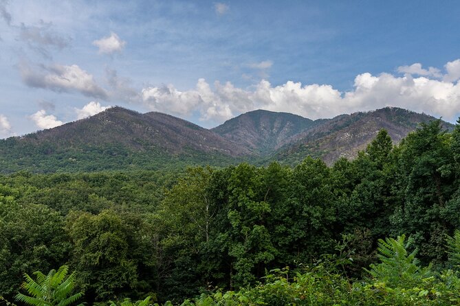
Your drive begins at Oconaluftee Visitor Center, which is a strong first move. You’re not dealing with a bus drop-off or a schedule you can’t control. You’re also already in the right mindset: slow down, park when you want, and let the audio guide your next stop.
The tour runs over 25+ miles per tour and includes 30+ audio stories. That’s a lot for a driving route, and it changes the experience from scenic-driving into “scenic with context.”
You’ll also get detours and side excursions where you can trade effort for reward. For example, there’s an option to detour to Mingus Mill, an 1886 grist mill that’s still functional. On weekends, you can even see operators grinding corn the way it was done in the 1800s.
Mingus Mill detour and Beech Flats Quiet Walkway: a gentle start
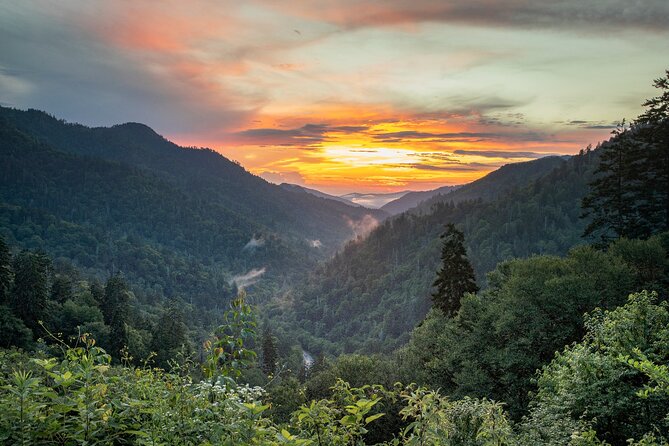
If you’re arriving and need an easy entry, this start is smart. You can go straight into the main story stops, or take the Mingus Mill detour for a living example of early Appalachian industry.
Next up is the Beech Flats Quiet Walkway. This is the kind of stop that works for nearly everyone: you get mountain views and forest atmosphere without needing a strenuous hike. It’s a good choice if your group includes kids, older adults, or anyone who doesn’t want to commit to a long trail before lunch.
Why I like this early rhythm: it gives you quick wins—views, sounds, and stories—before the driving stretches and the bigger overlooks.
Rockefeller Memorial and Newfound Gap: the Smokies aren’t just nature
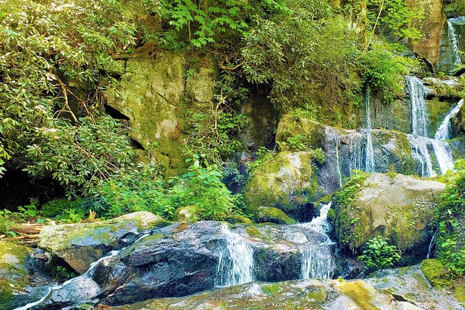
Two stops in particular help the drive feel more than scenic wallpaper.
First, the Rockefeller Memorial, dedicated by President Theodore Roosevelt. That single detail gives the area a different frame: the Smokies weren’t only protected because they looked good, but because people fought to preserve them.
Then the story shifts at Newfound Gap, a mountain pass with huge historical significance. The audio explains how trappers, farmers, and merchants used the gap to cross the region—and how those crossings shaped what happened on both sides.
These stops give you a sense of time and movement. You’re not just seeing a pass; you’re understanding why people kept returning to it.
Alum Cave Trail highlights and two classic overlooks: Morton and Carlos Campbell

You’ll pass the Alum Cave Trail, which leads hikers toward the remains of an old salt mine. Even if you don’t hike it, learning the salt-mine connection changes how you interpret the slope and the landscape around it.
Then come the overlook stops, which are where you cash in on that slower mountain driving:
- Morton Overlook: extremely popular for sunset
- Carlos Campbell Overlook: panoramic views of towering mountains and lush forest
The key advantage of these audio stops is that the stories make the viewpoints feel earned. You’re not just pulling over and snapping a quick picture. You’re getting a reason to look longer.
Chimney Tops wildfire story and the Sugarlands Valley accessible trail
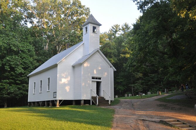
Next is Chimney Tops Overlook, where the audio focuses on wildfires and how they can cause lasting damage to mountains like this one.
This part can hit harder than you expect, because it turns a scenic pull-off into a lesson about change over time. If you’ve ever wondered why burned areas can still look “alive” months or years later, this segment helps you connect the dots.
After that, the route offers an easy win for families and mixed-mobility groups: Sugarlands Valley Trail. It’s described as the most accessible trail in the park, and can be accessed by wheelchair or stroller. That’s a rare type of option in a mountain park where many trails are steep or rough.
You’ll also pass the Sugarlands Visitor Center, which is a good reset point for snacks, restroom breaks, and trailheads.
Cataract Falls and Roaring Fork Motor Nature Trail: waterfalls in a slow-motion rhythm
This is the “let’s actually slow down” section. You start with Cataract Falls, described as secluded and shaded beneath beech trees. If you want a calmer feel, this is one of the spots where the environment does the calming for you.
There’s also a quirky stop in the middle of the water-and-forest pacing: a funky museum display with odd collections (including shrunken human heads and rare animal skeletons), plus a story about how it grew from a one-panel comic strip into a national phenomenon.
Then comes Roaring Fork Motor Nature Trail, where you’re encouraged to slow down and enjoy the forest and historic buildings. Importantly, it features three of the park’s most famous waterfalls, which is efficient if you want multiple big moments without endless driving.
Rainbow Falls glimmer, Grotto Falls seclusion, and Baskin Creek’s name story
You’ll reach Rainbow Falls, described as the tallest waterfall in the Smokies at about 80 feet. The audio adds color to the name: when the sun hits it right, it can glimmer like a rainbow.
After that, Grotto Falls is the quieter contrast. It’s described as less crowded and more secluded than Rainbow Falls, and the audio includes a note about a rare salamander you can only find here. Even if you’re not a wildlife spotter, this kind of detail helps you pay attention to the “micro-world” around waterfalls—shade, moisture, and the rock-and-leaf conditions animals depend on.
Finally, Baskin Creek Falls brings a lighter story. The audio covers the amusing (and slightly misguided) history behind the name. This is a good place to reset your brain after more intense wildfire and survival tales.
Cades Cove and the cabins, mills, and churches that explain everyday life
Once you shift into the Cades Cove side, the stories become less about landforms and more about people.
You’ll pass:
- Ephraim Bales Cabin, a window into 19th-century life, with a notable hole in the cabin
- Reagen Cabin, showing old technology in the form of a tub mill
- Ely’s Mill on the outskirts of Gatlinburg, tied to Andrew Ely, a lawyer who abandoned his practice after his wife died and moved to Gatlinburg to start over
On the town side of the route, you can also catch faith and community history through:
- A Methodist Church built in 1902 for $115
- A Missionary Baptist Church that split from the Primitive Baptist Church due to ideological divides
- The Elijah Oliver Place, reachable via a half-mile trail, tied to an abolitionist who faced danger when the Civil War broke out
The audio continues with more specific stops like:
- Abrams Falls Trail (described as about a 1-hour hike to a powerful waterfall)
- John Cable Grist Mill, dating back to 1870 and still seen in operation
- Tipton Place, once home to a war hero of the American Revolution
- Carter Shields Cabin, described as staunchly abolitionist and affected during the Civil War
This is where the driving tour earns its keep. You’re not just watching nature. You’re learning how people ate, worked, worshiped, and fought for their beliefs—all in a tight geography.
The stories you’ll remember: Cherokee homeland, Sequoyah, and even astronomy
The audio lineup covers Cherokee history, settler arrival, and the long arc of conflict and survival. It also includes science and place-based lessons that make the Smokies feel larger than a single state park.
A few of the story themes included on the route:
- Cherokee homeland and ancestral Cherokee land
- Tsali and the Trail of Tears
- Revolt against the Ani’kutani
- Sequoyah’s new storytelling system
- Great Smoky geology and Appalachian balds
- Smokies wildlife and other natural features
- Funding the Smokies
- The Milky Way and Selu’s sacrifice
This mix matters because it prevents “only scenery” fatigue. You keep learning without it turning into a lecture.
Timing and driving tips so the audio stays in sync
This tour works best when you drive with intention, not rush. The audio is triggered by location, so if you slam the gas and skip far ahead, stories can feel early or late.
From practical experience with how GPS audio tours behave, the simplest rule is:
- follow the posted speed limits
- park and return without jumping the route
Also, build time for traffic. The Smokies can be slow, and the route is long enough that delays compound. One review-style note you’ll want to take seriously: people found the tour took longer than suggested when they allowed themselves to stop at more spots than planned.
For most people, that means giving yourself a half-day mindset. If you plan for 4 to 5 hours, you’ll be happier when it’s 5 instead of stressed if it runs longer.
Road closures and winter gotchas near US-441 and Cades Cove
Mountain driving isn’t static. The tour info includes a heads-up that delays and closures can happen around early January through February, including:
- Single-lane traffic on US-441 / Newfound Gap Rd from Jan 5–30
- Some parking closures
- Hazard tree impacts affecting roads like The Spur, Little River Rd, Cades Cove Loop, and more
My advice is straightforward: check current conditions right before you go, especially if you’re traveling in winter. If a segment of the route is closed, you may not be able to reach some story points. That’s the tradeoff with self-guided tours: you’re in charge, but you also need to be flexible.
Who should book this Smoky Mountains and Cades Cove self-guided drive?
Book this if you want:
- a value-priced driving plan for up to four people
- a way to see a lot without committing to a rigid group schedule
- history blended with nature: mills, cabins, churches, and Cherokee and settler stories
- a route that supports offline use, helpful for areas with limited signal
You’ll likely love it most if your group includes people with different hiking levels. There are options that are easy to reach, like the quiet walkways and accessible trails, plus optional hikes like Abrams Falls Trail.
Should you book this tour?
Yes, if you’re aiming for a half-day or afternoon drive that teaches you what you’re seeing and lets you control the pace. The value is strong for a car group, the audio setup is designed for offline use, and the stop mix hits viewpoints, waterfalls, and everyday history.
I’d think twice if you’re visiting during a period when road closures are likely and you only have one tight day with no wiggle room. In that case, a flexible, check-the-conditions approach is essential.
FAQ
How much does the Great Smoky Mountains and Cades Cove self-guided driving tour cost?
It costs $24.99 per group for up to four people.
How long does the tour take?
It’s listed at about 4 to 5 hours approximately, and the route is described as taking around 2 to 3 hours to complete on average.
Do I need cellular service during the tour?
No. The tour includes offline maps, but you need to download the tour while you have strong Wi‑Fi/cellular first.
Can I pause the tour and resume later?
Yes. You can start at your convenience, pause anywhere, and resume when you’re ready.
Where does the tour start?
The drive begins at Oconaluftee Visitor Center.
Do I need to meet a guide at the start?
No. It’s self-guided, and there is no one waiting at the start point.
How do I play the audio while driving?
You can connect your phone to your car stereo using Bluetooth, USB, or AUX. The audio plays automatically based on your location.
What if the tour doesn’t work because of timing or technical issues?
If you have audio issues, the instructions say to contact support. If you downloaded and used the app incorrectly, you may be able to get assistance with fixes or next steps.
Can I cancel and get a refund?
Yes. Free cancellation is available if you cancel at least 24 hours before the experience’s start time for a full refund.