REVIEW · WASHINGTON
Ultimate Mount Rainier National Park Self-Guided Driving Tour
Book on Viator →Operated by Adventures with Action · Bookable on Viator
Mount Rainier feels bigger with the right soundtrack. This self-guided drive strings together 70+ miles of key pull-offs with GPS-triggered audio and 85+ stories, from Nisqually Entrance to the Sunrise Rim. I love the hands-free, location-based narration and the fact that you get new lifetime access you can use on future trips, not just once.
One possible drawback: you still need to handle the park entrance pass on your own, and you must download the tour before you lose cell service, so do the prep at home or on the edge of the park. Also, make sure you start the correct tour direction in the app, or the audio timing can feel off.
In This Review
- Key things to know before you press play
- GPS Audio Makes Mount Rainier a Self-Driving Tour
- Before You Go: park pass, car audio setup, and offline download
- Nisqually Entrance to Longmire Museum: the forest start that teaches fast
- Waterfalls and creek crossings: Carter Falls, Comet Falls, Christine Falls, and Ricksecker Point
- Frog Heaven wetlands, Tatoosh peaks, and Narada Falls short walk
- Nisqually Vista, Paradise services, Inspiration Point, and Reflection Lakes mirror view
- Pick your trail: Snow Lake, Box Canyon, Wonderland Trail, and Backbone Ridge
- Ohanapecosh and Tipsoo Lake: old forest fame, hot-springs naming, and lakeside pauses
- White River to Owyhigh Lakes and Sunrise Rim: the drive’s calmer finale
- Should you book this Mount Rainier self-guided audio drive?
- FAQ
- Do I need a Mount Rainier park pass?
- How long and how much driving is this?
- Does the tour work without cell service?
- What language is the narration in?
- Is this guided by a person?
- How do I get the audio in my car?
Key things to know before you press play
- Download before cell service disappears: the tour works offline after the initial download.
- Value is per group, not per person: $14.99 per group (up to 4) is cheaper than most guided options.
- Audio starts as you approach stops: no button-mashing required once you’re on the route.
- You choose your effort level: quick walks like Twin Firs Loop or longer hikes like Comet Falls and Snow Lake.
- You’ll get place-and-people context: meanings of names like Puyallup and Ohanapecosh make viewpoints stick.
GPS Audio Makes Mount Rainier a Self-Driving Tour
This driving tour is built for the way Mount Rainier actually works: you drive between trailheads, pull-offs, and lookouts, then step out for short walks. The real win here is that the narration plays when you’re near each spot, so you’re not stopping your drive every time you want a story.
I like that it’s designed around practical moments: right after the Nisqually Entrance arch, right as you cross Tahoma Creek, and at big view moments like Reflection Lakes. The audio includes history, natural notes, and what to look for next, so you’re not just sightseeing—you’re spotting with purpose.
There’s a lot to cover in one run. Expect about 2–3 hours and 70+ miles total, plus optional hikes that can stretch your time fast. If you want a relaxed day, treat this as a guided framework: do the easy stops, then pick one or two hikes that match your energy.
You can also read our reviews of more tours and experiences in Washington.
Before You Go: park pass, car audio setup, and offline download
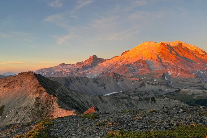
The tour costs $14.99 per group (up to 4), and it’s valid for lifetime use—no expiry. But the park itself is separate: Mount Rainier National Park requires a standard entrance pass, and some roads may need seasonal reservations. Plan for that extra item so you don’t arrive thinking the tour covers everything.
You’ll also want to set yourself up for the low-signal reality. The instructions say you MUST download the tour while you have strong Wi‑Fi/cellular, then it works offline afterward. That matches what you’d expect in the park. If you wait until you’re inside to download, you’re gambling with your schedule.
For listening: connect your phone to your car stereo using Bluetooth, USB, or AUX. If you take short walks, headphones can help you keep the story going while you step away from the car. And one more pro tip: when you start, make sure you launch the version that matches your planned starting point and direction, so the audio lines up with what you’re actually seeing.
Nisqually Entrance to Longmire Museum: the forest start that teaches fast
Your drive opens at the Nisqually Entrance. There’s a park arch that’s an easy photo stop, then right beyond it you hit the entrance station area. Even if you’ve been to national parks before, this is a good place to start listening because the narration sets the stage: how the mountain’s water system shapes the forest you’re about to enter.
Next comes Tahoma Creek. It may look modest from the road, but the story is about why Mount Rainier stays green year-round—small tributaries matter. The narration also notes that hikers once used its banks to reach a suspension bridge deep in the wilderness, which is the kind of detail that makes a random creek crossing feel intentional.
Then you reach Twin Firs Loop Trail, an easy half-mile loop that’s perfect for stretching your legs. This stop is especially useful if you’re new to the park, because old growth forest is hard to find in most of the U.S. It’s short, but it helps you understand what people mean when they talk about mature trees and layered forest structure.
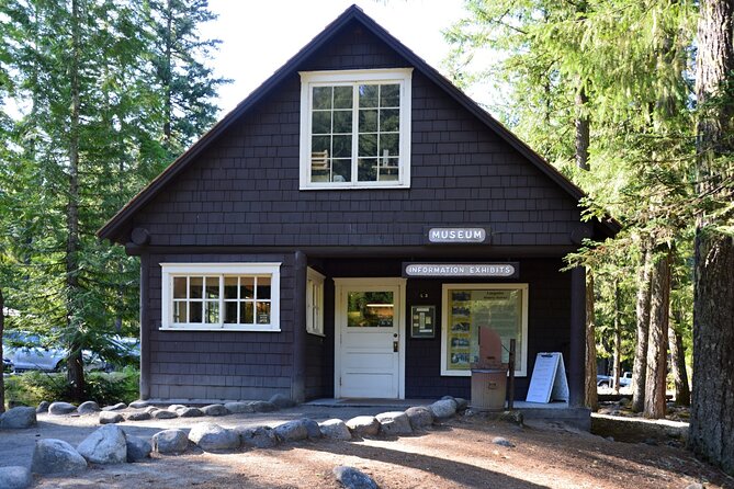
Longmire Museum is your pit-stop. You’ll find food, bathrooms, and a small museum, plus a gift shop. It also serves as a starting point for trails, so it’s a good moment to decide: do you want a moderate hike next, or keep it lighter and save your legs for later viewpoints?
Waterfalls and creek crossings: Carter Falls, Comet Falls, Christine Falls, and Ricksecker Point
After Longmire, you head toward the waterfall-heavy zone. Carter Falls Trailhead is next. The trail is moderate at about 1.5 miles to a waterfall tucked into the forest. The best part is optional flexibility: if you don’t want the hike, you can still get a solid overlook of the Nisqually River.
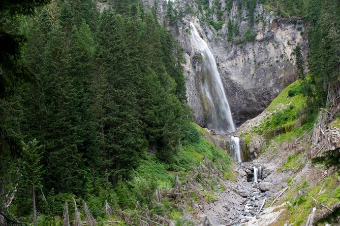
Then it’s Comet Falls. The tour pushes you toward a bigger effort here—a challenging 4-mile hike to a 301-foot waterfall. If you’re the kind of traveler who likes payoff per step, this is the stop. And yes, it breaks the usual advice about not chasing waterfalls, because the payoff is the point.
Christine Falls Bridge is a nice change of pace. Built in 1927 with rustic stonework meant to blend into the surroundings, it’s both a viewpoint and a story. The big line here is the 60-foot waterfall dropping into Van Trump Creek Canyon below.
Ricksecker Point follows. It’s an overlook with views of Mount Rainier and the surrounding forest. One thing to remember: the area was once considered dangerous, and the tour explains that it wasn’t always protected the way it is now. Today you’ve got rock wall and guard rails, so you can stop for photos with a lot less worry.
If you’re trying to keep the tour to 2–3 hours, don’t overbook these hikes back-to-back. Choose one real leg-burner (Comet Falls or another later trail) and treat the rest like quick excursions.
Frog Heaven wetlands, Tatoosh peaks, and Narada Falls short walk
Frog Heaven is the name alone worth a stop. This wetlands area sits by a ribbeting stretch of road and connects to the idea that Mount Rainier’s lakes support frogs year-round. The audio ties it together with amphibian needs: moist ecosystems for jelly-like eggs, then the food web that follows when predators show up.
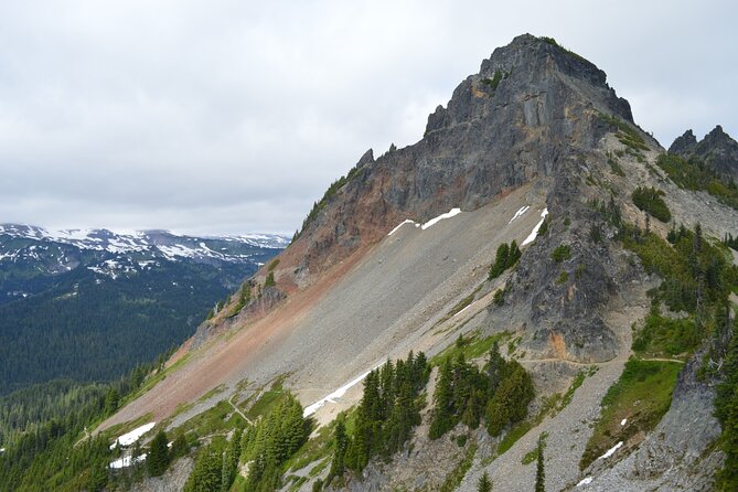
Then you roll into the Tatoosh Range viewpoint zone, where Pinnacle Peak and Plummer Peak appear ahead. The tour gives you easy identification points, plus Plummer Peak’s name origin through Fred Plummer, a cartographer who worked for the Forest Service. Having those name clues matters because it turns a wall of peaks into something you can talk about later.
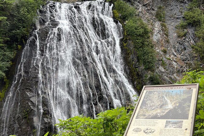
After the peak intro, you park and walk down to Narada Falls. The waterfall is 168 feet, and the narration includes the naming background: Arthur F. Knight of Tacoma, described as a leader of the Narada Branch of the Theosophical Society of Western Washington. That’s an odd detail in the best way. It makes the waterfall more than just water.
Unicorn Peak and the Puyallup name add more context. Unicorn Peak is pointed out as the tallest in the set, while Puyallup is explained as a name meaning people from the bend at the bottom of the river in the Puyallup language. If you like your nature stops with human geography attached, you’ll appreciate this part.
Nisqually Vista, Paradise services, Inspiration Point, and Reflection Lakes mirror view
Nisqually Vista Trail is a crowd-favorite because it’s quick and easy. It’s a 1-mile paved route that takes about 30 minutes, with Mount Rainier views that reward minimal effort. The tour also notes what to do if parking is full: there’s more parking later on, or you can keep driving.
Paradise arrives next, and this is where comfort shows up. The narration points out snacks, water, a sit-down dining room, and additional parking tied to the Nisqually Vista Trail. Paradise is also your gateway to Myrtle Falls from the area.
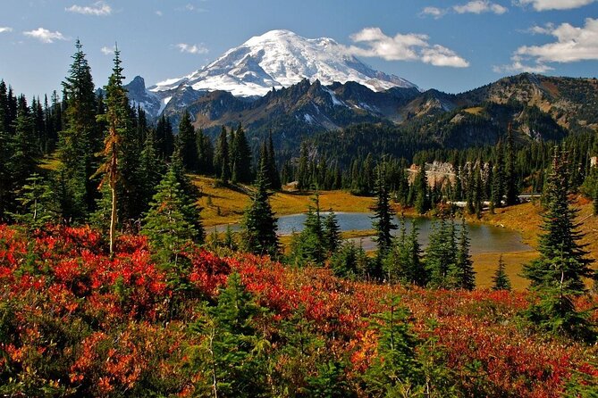
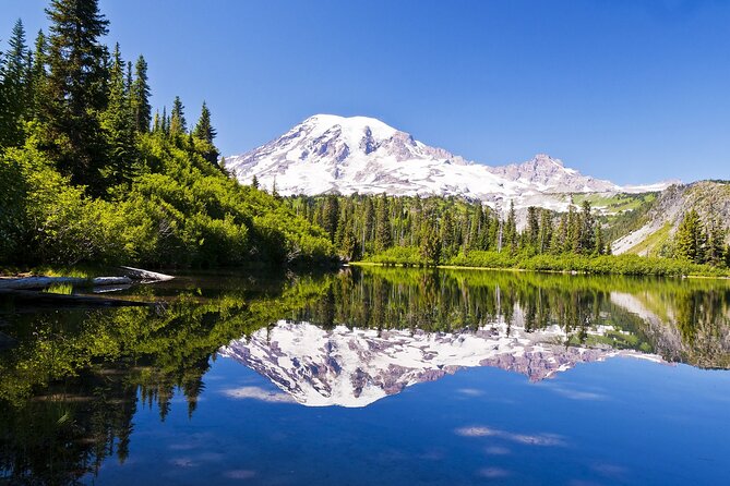
Inspiration Point comes soon after. It’s an accessible vista with impressive mountain scenery and a large parking lot, which makes it a smart stop even if you’re managing time. Then comes Reflection Lakes. This is the mirror moment: a glacial lake that shows Mount Rainier twice when conditions are calm, especially when there’s no wind.
The tour also points out Stevens Peak (6,560 feet) and notes its naming through Hazard Stevens, the first European man to summit Mount Rainier alongside P.B. Van Trump. That kind of name-and-number detail is exactly how you turn a quick photo stop into a memory you actually keep.
Pick your trail: Snow Lake, Box Canyon, Wonderland Trail, and Backbone Ridge
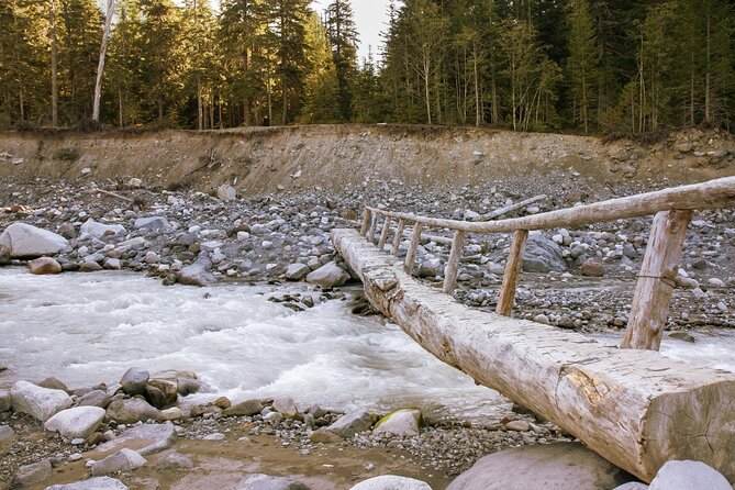
If you want more than short walks, this part is your menu. Snow Lake Trail is moderately challenging at 2.2 miles out and back, taking a little over an hour with some steep sections. The reward is two wilderness lakes, which is a good swap if Comet Falls felt too intense but you still want a real hike.
Picture Frame Falls comes next. It’s described as a no-name cascade that isn’t technically a real waterfall—more of a framed view—so think of it as a quick scene stop rather than a destination hike.
Then you hit Box Canyon. The tour calls out a half-mile paved loop with a view of a rift formed by shifting glaciers. It’s short, but the geology gives you a different kind of Mount Rainier story. Box Canyon Loop also connects to the Wonderland Trail, which the narration explains as a 93-mile circuit.
Wonderland Trail gets its origin story too. It began in 1907 due to a lack of fire roads, and the narration ties it to changing conditions and rangers needing access to remote areas. Then Backbone Ridge appears: a strenuous 6.6-mile round trip with about a 3-hour time commitment and rough terrain, focused on views over Tatoosh Wilderness.
Here’s the practical move: if your day has limited time, keep to the easy paved loops and one hike. If you’ve got legs and time, Backbone Ridge is a big final challenge before you shift to the more visitor-center friendly areas later.
Ohanapecosh and Tipsoo Lake: old forest fame, hot-springs naming, and lakeside pauses
The tour’s next stretch gives you variety again. Grove of the Patriarchs is next, but the narration notes it’s currently closed for maintenance. Still, it’s worth learning about: the park describes it as a 1-mile trail through huge old-growth trees, once the playground of Scottish botanist David Douglas, tied to his collecting work for the Royal Horticultural Society of London.
Ohanapecosh Visitor Center follows. The name is tied to the Taidnapam tribe, translating to standing at the edge, likely because it’s by the river. This is also where James Longmire discovered hot springs, which makes it feel more personal than a random stop.
Shriner Peak Trailhead is next. The tour labels it as one of the loneliest trails in the park, with a steep climb. It notes that it’s a no-go in summer months, but in autumn the difficult 8.5-mile hike (about six hours) is worth it. It also calls out that the peak has the oldest fire lookout in the park—useful if you like to connect views to how people have watched the woods for decades.
Tipsoo Lake ends this segment. The loop is described as a great place to pause and smell the flowers, and the narration says you might spot trout in the glassy surface. It also notes that the lakes didn’t originally host trout, so the wildlife story is partly about change over time.
White River to Owyhigh Lakes and Sunrise Rim: the drive’s calmer finale
The tour then tracks you along the White River. The narration includes a poetic warning—don’t step into the same river twice—plus the fact that its flow has been changed by elements and humans for centuries. It’s a good bridge between geology, ecosystems, and how parks still depend on human choices.
Owyhigh Lakes Trail comes next. This is longer—7 miles and about four hours—but the tour emphasizes level ground and plenty of shade, which is a big deal in a place where elevation and sun can add up. The name ties to Yakama Chief Owhi, connected to the 1858 Battle of the Spokane Plains, with an ongoing struggle between his people and a U.S. military unit.
Then you reach Sunrise Point. At 6,120 feet, it’s described as perhaps the best spot to watch sunrise. The Civilian Conservation Corps built the overlook, connecting it to the New Deal and park work tied to the Great Depression era.
Finally, Sunrise Rim Trail offers a one-mile option that can be a warm-up or wind-down. If you want a bigger push, the tour suggests skipping the rim and heading toward Wonderland on the Mount Fremont Trail, with 5.5 miles of uphill terrain and under three hours.
This ending is a smart match for the day’s pacing: if you did big hikes earlier, this gives you a lighter finish.
Should you book this Mount Rainier self-guided audio drive?
Book it if you want a car-based plan with real narration. This tour shines when you like stopping for a quick walk, learning what you’re looking at, and staying flexible. The per-car price (up to 4) is usually the deciding factor versus guided tours, especially if you’re traveling with friends or family.
Don’t book it (or adjust expectations) if you expect the tour to replace park entry or if you’re arriving without time to download offline content first. Also, if you’re starting late in the day, parking and road conditions can affect how much you can realistically do at Reflection Lakes, Inspiration Point, and other popular areas.
One smart way to choose: pick your hard hike ahead of time. Comet Falls and Backbone Ridge are the heavy hitters here. Then you can fill in the rest with short, easy walks like Twin Firs Loop, Box Canyon, and Nisqually Vista.
FAQ
Do I need a Mount Rainier park pass?
Yes. The tour does not include park passes. Mount Rainier National Park requires a standard entrance pass.
How long and how much driving is this?
It’s about 2–3 hours to complete and covers over 70 miles.
Does the tour work without cell service?
Yes, it’s designed for offline use after you download it. You must download the tour while you have strong Wi‑Fi/cellular first.
What language is the narration in?
The tour is offered in English.
Is this guided by a person?
No. It’s self-guided. No one meets you at the start, and the audio plays automatically as you approach each story point.
How do I get the audio in my car?
Connect your phone to your car stereo using Bluetooth, USB, or AUX. (You can also use headphones while walking.)