REVIEW · SANTA BARBARA
Ultimate Guide to Santa Barbara: A GPS Self-Guided Urban Stroll
Book on Viator →Operated by VoiceMap Audio Tours · Bookable on Viator
Santa Barbara has a way of feeling personal fast. This GPS self-guided stroll strings together key sights from the waterfront to downtown so you learn as you walk. You start with early roots, move through Spanish-era moments, then finish along the harbor with a story of rebuilding after the 1925 earthquake.
I especially like the value: $14.99 gets you lifetime access to the English audio and offline maps, so you can repeat the route at your own pace. I also like how the route mixes big-name landmarks like the Lobero Theatre and the Santa Barbara Museum of Art with smaller historical stops you might otherwise miss.
One drawback to plan for: the narration is English only, and you’ll need your own smartphone plus headphones. If you prefer Spanish audio, you may miss a few details unless you can comfortably listen in English.
In This Review
- Quick hits
- How This GPS Stroll Works in Real Life
- Price and Value: What $14.99 Really Buys
- Start Point: Alameda Park and Alice Keck Park Basics
- Trinity Episcopal and Our Lady of Sorrows: Street Churches With Context
- Downtown Anchors: Hotel Californian, Lobero Theatre, Hotel Santa Barbara, Museum of Art
- Chumash Roots and the 1500s Spanish Arrival
- El Presidio de Santa Bárbara State Historic Park: A Physical Takeaway
- Covarrubias Adobe: One of Santa Barbara’s Oldest Structures
- Moreton Bay Fig Tree and the Funk Zone Turn
- West Beach and the Urban-to-Waterfront Transition
- State Street to Stearns Wharf: The 1925 Earthquake and Preservation Push
- What You Can (and Can’t) Expect From This Tour
- Who This GPS Stroll Fits Best
- Should You Book This Santa Barbara GPS Stroll?
- FAQ
- What language is the audio available in?
- How long does the Santa Barbara GPS walk take?
- What’s included in the price?
- Do I need headphones or a smartphone?
- Is it a guided tour inside museums and attractions?
- Where does the tour start and end?
Quick hits
- Offline VoiceMap audio means you can keep going even with spotty cell service.
- Chumash to Spanish to modern downtown: the route puts major eras in order while you walk.
- Walkable downtown highlights include Hotel Californian, Hotel Santa Barbara, and Lobero Theatre.
- Presidio + Adobe stops give you real physical anchors, not just street-side descriptions.
- Final stretch to Stearns Wharf ties the urban story to the waterfront.
- No museum entry included, so you’ll decide in advance what (if anything) you want to pay to go inside.
How This GPS Stroll Works in Real Life
This is a private, GPS self-guided urban walk in Santa Barbara. The company behind it provides the audio through the VoiceMap app for Android and iOS, and you get offline access to the audio, maps, and geodata. That matters because Santa Barbara can be unpredictable with cell signal in pockets, and you don’t want your walk to depend on bars.
Timing is designed for a calm but steady pace: roughly 1 hour 15 minutes to 1 hour 30 minutes. You’ll be moving along downtown streets and then down toward the harbor, so plan on comfort shoes. The tour isn’t set up as a sit-down show; it’s built around getting your bearings fast and learning while you pass the important places.
The biggest practical question is gear. The tour includes the app and the offline content, but it does not include your smartphone or headphones. If you forget headphones, you’ll still be able to read locations, but you won’t get the story that makes the walk worth it.
You can also read our reviews of more tours and experiences in Santa Barbara.
Price and Value: What $14.99 Really Buys
At $14.99 per person, you’re paying for guided storytelling plus offline navigation content. That’s a strong deal if you like structure but don’t want to book a traditional guided group tour. You also get lifetime access, so if you revisit Santa Barbara later (or want to show a friend the route), you’re not buying it again.
The value is also in how the content is paced. Instead of forcing you into one long attraction after another, the tour gives you a sequence of street-level “stops” that keep your walk purposeful. That’s the key difference between walking downtown with a plan versus wandering without one.
The trade-off is that you need to supply your own phone and headphones, and the audio does not replace paid museum visits. If you want to go inside attractions along the way, you’ll need to pay separately.
Start Point: Alameda Park and Alice Keck Park Basics
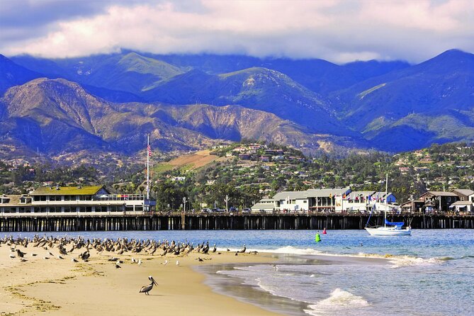
The walk starts at Alameda Park (1400 Santa Barbara St), near the corner of the Alice Keck Park Memorial Garden. This opening matters because it frames Santa Barbara as more than a pretty postcard. The narration begins by pointing you toward the city’s earliest roots, setting up what you’ll later see downtown.
When I think about good self-guided walking routes, I look for an easy first step—something you can find without stress. This start location is in the heart of things, which usually means less circling around. You also get a gentle ramp-in to the story, so you’re not hit with complicated context right after you start the app.
The only thing to watch: because you’re starting at a park corner, you may want to arrive a few minutes early so you can get the audio loaded and start listening before you begin moving.
Trinity Episcopal and Our Lady of Sorrows: Street Churches With Context
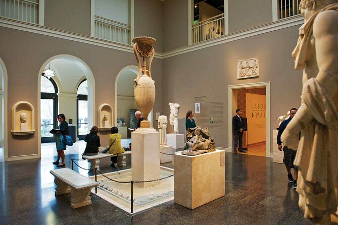
As you continue, the route passes Trinity Episcopal Church and then the Our Lady of Sorrows Roman Catholic Church. These stops are treated as part of a broader narrative rather than a quick photo-op.
That’s useful for you because churches in older American cities often mark waves of growth and shifting community life. Even if you don’t plan to enter, the audio helps you read the streets with more meaning. It also keeps the walk from feeling like a checklist of buildings.
A small consideration: the tour does not guarantee guided access into any place. If you decide you want to step inside a church or any other attraction, you’ll need to follow that site’s own rules and pay if required.
Downtown Anchors: Hotel Californian, Lobero Theatre, Hotel Santa Barbara, Museum of Art
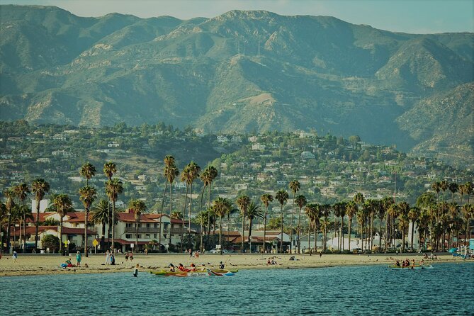
One of the most satisfying parts of the route is the stretch that lines up downtown landmarks you’ll recognize even if you’ve never visited before. The audio has you take in Hotel Californian, Lobero Theatre, Hotel Santa Barbara, and the Santa Barbara Museum of Art.
What I like here is the way the landmarks are used as anchors. You’re not just walking past them; you’re learning what changed and why the city became what it is. Downtown can feel like a blur if you’re only focused on where to park or what to grab for lunch. This section pulls you back into the story.
You’ll also enjoy this segment more if you slow down at each named stop for a few seconds. In a GPS walk, the temptation is to keep moving. But the payoff is that the narration is timed to what you’re seeing.
Possible drawback: since this is a GPS self-guided route, you won’t have someone physically standing with you to answer questions on the spot. If you’re the type who loves spontaneous clarifications, bring a little curiosity and read your way through what you see.
Chumash Roots and the 1500s Spanish Arrival
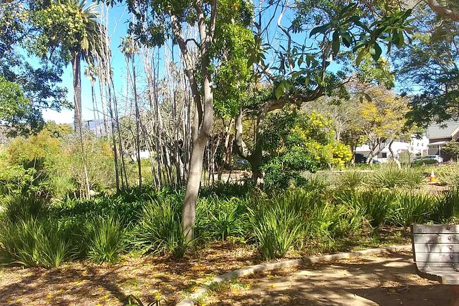
The tour’s center storyline moves through two major time layers. First, it focuses on the Chumash natives who lived here for more than 9,000 years. Then it shifts to Santa Barbara’s transformation when Spanish explorers Juan Cabrillo and Sebastian Vizcaino arrived in the 1500s.
This pairing is powerful because it keeps the city from feeling like it began in the Spanish era. You get a sense of long presence before the newcomers changed the direction of the region. It’s also helpful that the narrations come while you’re physically walking through downtown. That’s when history becomes less abstract.
If you’re short on attention span, this is where you should commit to listening closely. These are the big-picture segments, and once you grasp them, the later stops—especially the ones tied to preservation and rebuilding—make more sense.
El Presidio de Santa Bárbara State Historic Park: A Physical Takeaway
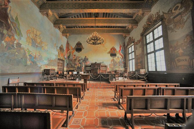
Next, the route points you to El Presidio de Santa Bárbara State Historic Park, described as one of the city’s important historical sites. This is the kind of stop that gives you a tactile feeling for time, even if you just pause outside.
Why this is valuable on a self-guided walk: it shifts the experience from “information while walking” into “place you can sit with.” Presidio-style sites tend to make you look around, not just forward. You might notice how the area feels different from the surrounding streets simply because of how the space is set up.
The tour does not guide you through museums or other attractions along the way, so if you want to enter buildings or paid areas within the park, you’ll need to plan that yourself.
Covarrubias Adobe: One of Santa Barbara’s Oldest Structures
The walk then heads you toward the Covarrubias Adobe, described as one of the city’s oldest structures. It’s located next to the Santa Barbara Historical Museum.
This stop is a great example of what I call street-level payoff. When you see an adobe, the city stops being a list of landmarks and becomes a real place with surviving material culture. Even if you don’t go into the nearby museum, the adobe gives you something concrete to anchor the story.
If you’re tempted to turn this walk into a full afternoon museum day, keep in mind the tour won’t handle admissions or entry. Use the audio to decide what you want to add on your own.
Moreton Bay Fig Tree and the Funk Zone Turn
Later, the route has you listen to the story of the 150-year-old Moreton Bay Fig Tree. Then it pivots toward the Funk Zone, with audio that connects it to the city’s Urban Wine Trail, covering over 20 wineries.
This portion is fun because it changes the pace from early history to the living present. Santa Barbara is one of those cities where people talk about food and wine as part of the culture, not just a tourist add-on. The audio makes that connection while you’re still in walking mode, so you’re not forced to choose between history and what’s happening now.
Practical tip: this part of town is where you may find yourself tempted to add detours for tastings or drinks. The tour ends later on Stearns Wharf, so if you want to follow the route as designed, treat these stops as inspiration for future visits unless you’re okay shortening the walk.
West Beach and the Urban-to-Waterfront Transition
The route also includes a moment to soak in the fresh wild air along West Beach. Even a short stretch of waterfront can reset your brain. It breaks up the density of downtown sidewalks and gives you a visual sense of Santa Barbara’s coastline.
In a time-boxed GPS walk, these breathing points matter. They prevent the experience from feeling like only narration and only street corners.
State Street to Stearns Wharf: The 1925 Earthquake and Preservation Push
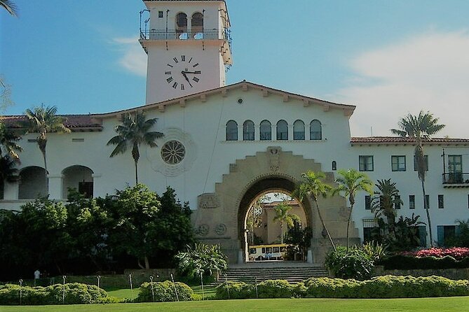
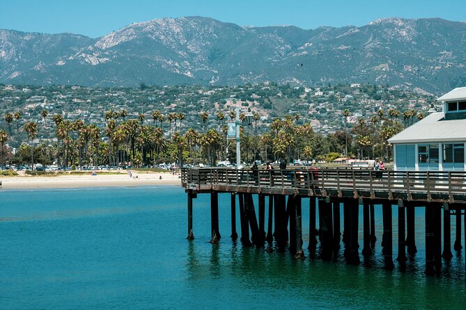
The tour concludes as you wind your way across State Street to Stearns Wharf. This ending comes with a story about the disastrous 1925 earthquake that destroyed the area, plus how influential activists put policies in place to help preserve the beauty of the historical downtown district.
I like endings like this because they explain why the city looks the way it does today. You’re not just seeing pretty streets; you’re learning about what was lost and what people fought to save. That gives your photos more meaning, too.
The finish at Stearns Wharf is also a smart choice because it’s a natural place to stop. You’ll have something to do next—walk the waterfront, grab a view, or simply stretch your legs after the audio route.
What You Can (and Can’t) Expect From This Tour
This is a GPS guided walking experience, not a museum or ticketed attraction tour. It includes the audio, offline maps, and the route structure, but it does not cover entrance fees, food, or transport.
So here’s the balance I’d recommend:
- If you want history and context while you walk, this works very well.
- If you want deep museum time inside buildings, you’ll need to add that separately.
- If you don’t want to handle headphones and your own phone, then it’s a mismatch.
Also note that it’s private in the sense that only your group participates. That can be a win if you’re traveling with friends or family and don’t want to deal with a large mixed group.
Who This GPS Stroll Fits Best
This tour is ideal if you:
- Want a guided route without booking a traditional group guide
- Enjoy learning while walking rather than sitting in one place
- Like downtown landmarks but want more meaning than a quick glance
- Prefer a short, doable itinerary instead of half-day planning
It may be less ideal if you:
- Need audio in Spanish (the narration language is English)
- Don’t want to use a phone or rely on headphones
- Expect the tour to enter museums or paid attractions for you
For a first-time visit, it’s also a good way to get your bearings across Santa Barbara without committing to too many stops. For a return trip, lifetime access makes it easy to revisit the route when you’re ready to connect the dots again.
Should You Book This Santa Barbara GPS Stroll?
I think you should book if you want a structured, low-cost way to see Santa Barbara’s highlights and understand how the city got shaped—from Chumash roots to Spanish arrivals, then to preservation after the 1925 earthquake. The offline VoiceMap setup is a real advantage, and the mix of named downtown landmarks plus the Presidio, Covarrubias Adobe, and Stearns Wharf ending makes the route feel like a complete walking arc.
Hold off if you need Spanish narration or if you’d rather have a live guide inside attractions. Since it’s self-guided, you’re responsible for the headphones-and-phone basics and for any museum entrances you decide to add.
If you’re comfortable listening in English and you like walking with a plan, this one is easy to recommend.
FAQ
What language is the audio available in?
The tour is offered in English.
How long does the Santa Barbara GPS walk take?
The duration is approximately 1 hour 15 minutes to 1 hour 30 minutes.
What’s included in the price?
You get lifetime access to the tour in English, the VoiceMap app (for Android and iOS), and offline access to audio, maps, and geodata.
Do I need headphones or a smartphone?
Yes. The tour does not include a smartphone or headphones, so you’ll need to bring your own.
Is it a guided tour inside museums and attractions?
No. You won’t be guided through museums or other attractions mentioned en route. If you choose to enter places, you’ll need to pay independently.
Where does the tour start and end?
It starts at Alameda Park, 1400 Santa Barbara St, Santa Barbara, CA 93101 and ends at 217 Stearns Wharf, Santa Barbara, CA 93101.