REVIEW · CALIFORNIA
Redwood National Park Self-Guided Audio Tour
Book on Viator →Operated by Shaka Guide Apps · Bookable on Viator
A Redwood road trip gets better when the car talks. This self-guided GPS audio tour strings together major stops in Jedediah Smith and Redwood country, with auto-playing narration and an offline map. I especially like the way it helps you find your bearings at each stop with turn-by-turn directions, and I also like that it’s built to work offline even when cell signal is spotty. One drawback to plan around: you’ll still need to cover parking and any entrance fees that apply, and the day is long enough that snack breaks matter.
This route also has a smart mix of quick lookouts and longer walks, so you can shape the pace to your group. Some stops involve beach hikes with tide timing, while others are short redwood loops or boardwalk-style canopy views, which is great if you’re mixing big views with manageable effort. The possible consideration here is logistics: you start on your own schedule, and the driving order is key to making the timing work for beaches, overlooks, and trailheads.
If you like road trips with built-in context, this one is a solid value. At $13.59 per group (up to 15), you’re paying for one narration experience per vehicle rather than per person. With a 13–14 hour route and offline support, it’s a good fit for families, couples, and small friend groups who want a guided feel without the cost of a traditional tour.
In This Review
- Key highlights before you hit the road
- What you’re actually getting for the $13.59 group price
- How the GPS audio tour works on a real Redwood road trip
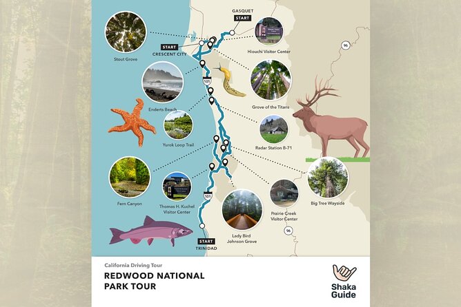
- Stop-by-stop: the route through Jedediah Smith Redwoods State Park
- Jedediah Smith Redwoods State Park: Stout Grove and Grove of the Titans
- Hiouchi Information Center: your quick reset
- Myrtle Beach: swim in jade-green water
- Crescents, overlooks, and the Enderts Beach scramble
- Coast-to-Klamath: redwood stops meet ocean viewpoints
- Trees of Mystery: a spendier roadside redwood experience
- Klamath River Overlook: height for whale spotting
- Yurok Country Visitor Center: cultural context on the route
- Old Douglas Memorial Bridge Site and whale-friendly Coastal Drive stops
- Corkscrew Tree and Big Tree Wayside: old growth, quick photos
- Prairie Creek Redwoods State Park and the “trail loop” strategy
- Karl Knapp area: loops that help you choose your effort
- Elk Meadow Picnic Area: wildlife odds, easy options
- Beaches and canyons: Gold Bluffs, Fern Canyon, and Lady Bird Johnson Grove
- Gold Bluffs Beach: sand with a story
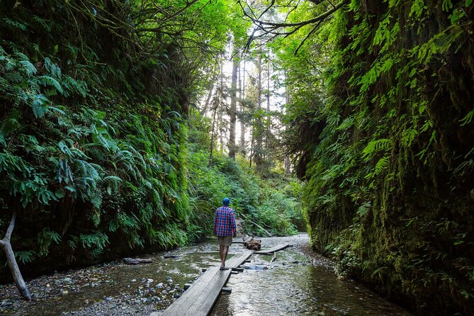
- Fern Canyon Trail: canyon walls and film vibes
- Lady Bird Johnson Grove and the Redwood Creek Overlook
- Thomas H. Kuchel Visitor Center: close the loop with whale chances
- What to skip, what to prioritize, and how to pace the 13–14 hour day
- Price, value, and where you may spend extra money
- Who this tour fits best
- Should you book this Redwood National Park self-guided audio tour?
- FAQ
- How long is the Redwood National Park self-guided audio tour?
- How much does the tour cost and who is it for?
- Does the tour work without cell service?
- Do I need Wi-Fi during the day?
- What kinds of stops are included?
- Are entrance fees included?
- Are parking fees included?
- Can I choose which stops to visit?
- Where does the tour start and end?
- Is the tour available year-round?
Key highlights before you hit the road
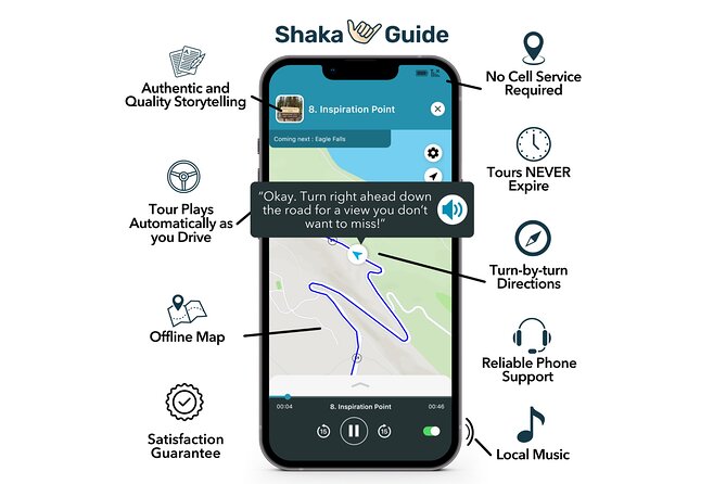
- Offline-first audio with an offline map, so you can keep going even when your signal fades
- GPS-triggered narration that plays automatically as you drive, which keeps you from constantly fiddling with your phone
- A tight grab-bag of redwood stops, from grove loops to elevated walkway views
- Beach and lookout variety, including tidepool terrain and multiple whale-watching viewpoints
- One ticket per vehicle, priced per group up to 15, which can be surprisingly budget-friendly
What you’re actually getting for the $13.59 group price
This is a self-guided mobile audio experience by Shaka Guide Apps. You pay $13.59 per group (up to 15), and the content is designed to run as you drive, so you’re effectively buying one vehicle-wide set of stories, travel tips, and music.
That “per group” pricing is where the value shows up. If you’ve got even a few people in your car, the cost per person drops quickly, especially compared with tours that price per traveler. And because the audio narration and GPS directions are included, you’re not just paying for facts—you’re paying for help turning the long Redwood National Park area into an organized route.
Also note the trade-off: this isn’t guided by a person sitting in the passenger seat. You’ll get story-and-direction support, but you’ll still be the one timing stops, finding parking, and making hike choices.
You can also read our reviews of more tours and experiences in California.
How the GPS audio tour works on a real Redwood road trip
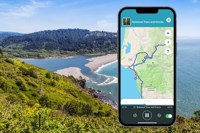
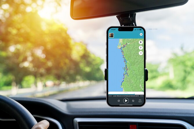
Your phone becomes the co-pilot. The tour includes an offline map, and the narration plays automatically as you drive using GPS activation, with turn-by-turn directions built in.
That offline design matters in this region. Cell coverage can be spotty, and the tour is meant for those moments—so you’re not stuck waiting for service before the next story cue. The practical move: download the tour using strong Wi‑Fi before you leave town, then keep your screen brightness reasonable so it’s easier to read when you park.
You’ll also want to plan around how long the route takes. The full run is about 13–14 hours, which is basically an all-day drive with frequent stops. If you try to treat every stop like a must-do hike, the day can stretch. If you pick a few signature walks and use the rest for quick redwood and ocean breaks, it feels smoother.
Stop-by-stop: the route through Jedediah Smith Redwoods State Park
Most people mentally separate the redwood world into “forest” and “ocean.” This route refuses to be that simple, and Jedediah Smith Redwoods State Park sets the tone with towering trees plus river and beach time.
Jedediah Smith Redwoods State Park: Stout Grove and Grove of the Titans
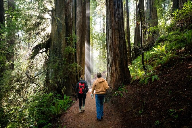
You start with Jedediah Smith Redwoods State Park, where the big theme is height and age. It’s home to some of the world’s tallest trees, and the park is threaded by Howland Hill Road, a narrow, unpaved road that provides trail access to Stout Grove and Grove of the Titans.
Two of the highlights are short enough to fit into a long day:
- Stout Grove: a half-mile easy loop through giant redwoods, with an optional trail down toward the Smith River. A respectful note here: staying on the designated trail matters, because the habitat is fragile.
- Grove of the Titans: this one is new to public access as of 2022, and the park service built a 1,500-foot elevated walkway. You get sky-level views without having to tramp off-path.
If you like a “walk under history” vibe, Stout Grove delivers. If you want “gaze up and feel small” energy with less trail strain, the Titans walkway is a strong choice.
Hiouchi Information Center: your quick reset
Next up is the Hiouchi Information Center. It’s a short stop—mostly for orientation—but it’s useful. You get exhibits, a park store, passport stamps, restrooms, and a picnic area, plus a ranger-led activity check-in. If you’re thinking about the Smith River and kayaking, this is the logical place to ask what’s running.
Myrtle Beach: swim in jade-green water
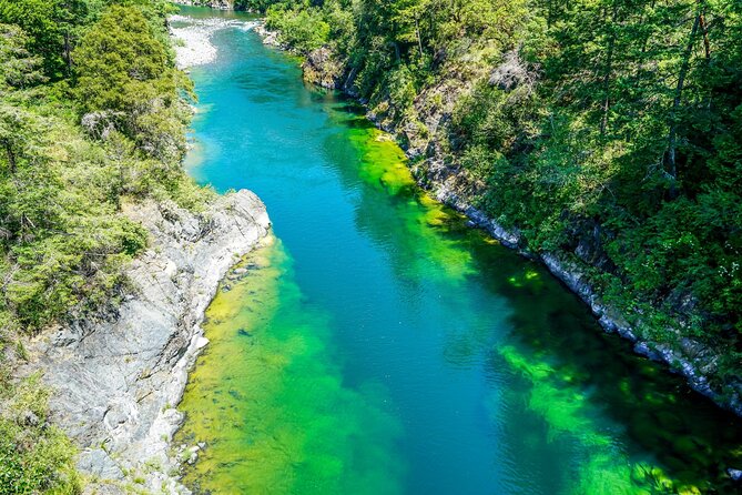
Then the route turns practical and fun with Myrtle Beach, one of the better swimming holes on the Smith River. The short trail is about a quarter-mile and steep, and there are pit toilets halfway down. From there, you can swim, sunbathe, fish, tube, and even consider cliff jumping if that’s your kind of chaos—just know it’s a spot where you need to be careful.
This is a good stop to schedule earlier in your day. It’s one of those places where time disappears fast, and you’ll want energy for later beach hikes.
Crescents, overlooks, and the Enderts Beach scramble
After Myrtle Beach, you move through the Crescent area:
- Crescent Beach: a three-mile stretch of sand with picnic areas and restrooms.
- Crescent Beach Overlook: a quick viewpoint at the end of Enderts Beach Road, with views toward Crescent City and Battery Point Lighthouse. It’s also a good place to watch for whales and catch sunset.
- Enderts Beach: one of the route’s most “choose your tide” stops. It’s a moderate 1.5-mile round trip with a scramble down a big boulder. At low tide you can see tidepools up close, but if the tide’s up, you’re better off saving it.
With Enderts Beach, the safety lesson is part of the experience: watch the rising tide and stay alert for dangerous sneaker waves.
Coast-to-Klamath: redwood stops meet ocean viewpoints
This part of the drive stretches your attention span in a good way. You go from redwood canopy and interpretive paths to ocean-adjacent drama and viewpoint math (height, distance, timing).
Trees of Mystery: a spendier roadside redwood experience
You’ll hit Trees of Mystery, a popular coast redwood attraction off Hwy 101. Expect interpretive trails, a museum of artifacts, skybridges in the canopy, and even a gondola-style ride above the treetops.
It’s called out as pricier than the rest, but if your group wants a structured, high-production “how redwoods work” moment, this is the place to spend a little extra. If you’re trying to keep your budget tight, treat it as optional.
Klamath River Overlook: height for whale spotting
Then comes Klamath River Overlook, set about 600 feet above sea level. You can also hike down about half a mile for a closer second viewpoint. Even if whales aren’t around when you visit, it’s still a great ocean-meets-river perspective.
Yurok Country Visitor Center: cultural context on the route
Next is the Yurok Country Visitor Center in Klamath. It’s a tribal interpretive center with information on Yurok history and culture, and it also has restrooms and souvenirs. It’s not just a “break stop”—it gives context, which makes the natural scenery feel more connected.
Old Douglas Memorial Bridge Site and whale-friendly Coastal Drive stops
You also see remnants of the old Douglas Memorial Bridge site, built in 1926 and destroyed in the Christmas Flood of 1964. What’s left are the iconic bear statues at each end, with replicas on the newer bridge over on Highway 101.
Then the route shifts to multiple coastline overlooks on Coastal Drive:
- High Bluff Overlook: interpretive signs, picnic tables, grills, pit toilets, and expansive views south. There’s also a short trail for even more perspective, plus a strong whale-watching and sunset angle.
- Radar Station B-71: a WWII Coast Guard observation station disguised as a farmhouse and barn. It’s an interesting reminder that humans built systems along this coast, and the buildings’ “farm disguise” is part of the story.
Corkscrew Tree and Big Tree Wayside: old growth, quick photos
Two rapid-hit nature icons close this stretch:
- Corkscrew Tree: a unique “fairy ring or cathedral tree,” with four redwoods twisting around each other from one parent tree into one sinuous trunk.
- Big Tree Wayside: a massive old-growth redwood estimated around 1,500 years old and over 300 feet tall, with interpretive signs and restrooms plus a short walking path.
If you’re short on time, these are great because they deliver big impact without requiring a long hike.
Prairie Creek Redwoods State Park and the “trail loop” strategy
This is where the route becomes truly walkable. In Prairie Creek Redwoods State Park, you get the Prairie Creek Visitor Center as a hub, with exhibits, bookstore, park info, restrooms, and picnic space. From there, you can pick trails based on how your feet feel.
Karl Knapp area: loops that help you choose your effort
The Karl Knapp Trail segment is designed like a choose-your-own-loop setup. Start at the visitor center and follow Prairie Creek north. After about a mile in, you take a spur trail on the right to reach Big Tree. Then you cross the parkway and follow the Foothill Trail south back to Big Tree Wayside, where you can choose:
- a shorter Foothill return, or
- a longer Cathedral Trees Trail return
The walking time is listed as 2 to 3 miles to complete the loop. That’s long enough to feel like you did something, but short enough to avoid a full-day leg blowout—especially if you plan the order right.
Elk Meadow Picnic Area: wildlife odds, easy options
At Elk Meadow Picnic Area, you get restrooms, picnic tables, and trails. If you spot elk, the key rule is simple: keep a safe distance (at least 50 yards). This stop also offers a nice easy option with the Trillium Falls hike: about a one-mile round trip to a small waterfall through old-growth forest.
It’s a smart “reset your brain” stop before you head to beaches and canyons later.
Beaches and canyons: Gold Bluffs, Fern Canyon, and Lady Bird Johnson Grove
This final stretch leans into the ocean and the “movie set” feeling of redwood-country scenery.
Gold Bluffs Beach: sand with a story
Gold Bluffs Beach got its name from gold found in the sand, discovered in 1850. People tried to mine it, but it proved costly and slow to extract because the gold was so fine. Even if you don’t care about the mining history, the story helps you understand why this coastline drew attention.
The listed time is about an hour, which is enough for a long enough walk without turning it into a marathon.
Fern Canyon Trail: canyon walls and film vibes
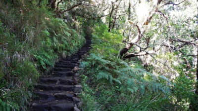
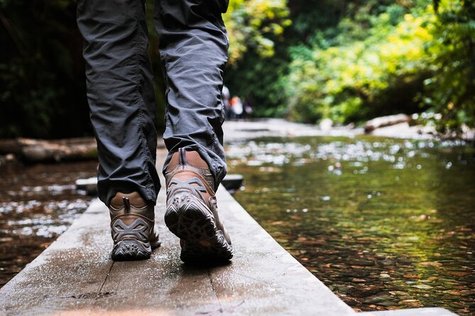
Then comes Fern Canyon Trail, a walk that feels like it belongs on screen. It’s about a mile either way depending on whether you do a loop through the canyon both ways. You can hike through the canyon and return through forest, or you can go out-and-back through the canyon.
The walking time is about an hour, and it’s another spot where the “you’re here, you’re seeing it” factor is high. If you want to keep it easy, consider walking at your own pace rather than trying to rush for every photo.
Lady Bird Johnson Grove and the Redwood Creek Overlook
Next is Lady Bird Johnson Grove, a family-friendly loop trail showing a mix of ferns, rhododendrons, and tall trees. The grove is named for Lady Bird Johnson, and the route includes the link to national park creation that helped lead to Redwood National Park.
After that is Redwood Creek Overlook in the Bald Hills, at about 2,100 feet above sea level. The views extend across redwood forests toward the Pacific, and it’s a strong sunset or stargazing type of stop.
If your group likes sky-and-stars views, this is the place to save your best “sit quietly for a few minutes” time.
Thomas H. Kuchel Visitor Center: close the loop with whale chances
Your route ends at Thomas H. Kuchel Visitor Center, the main visitor center for Redwood National Park. It has exhibits, park info, a park store, and restrooms. Behind it, trails lead to the beach, and the viewpoint angle here can be a great whale-watching or sunset endcap.
What to skip, what to prioritize, and how to pace the 13–14 hour day
Because the route is long, pacing is the secret sauce. If you try to do everything, you’ll rush the very parts you came for.
Here’s a practical way to prioritize:
- Pick one “big canopy moment”: either the Grove of the Titans elevated walkway or a shorter grove like Stout Grove
- Plan one water-focused stop: Myrtle Beach for swimming, or Enderts Beach if the tide is right for tidepools
- Choose one signature walking trail: either Karl Knapp loop or Fern Canyon
- Use the rest as quick redwood + viewpoint breaks, especially the overlooks and waysides
If you’re traveling with kids or anyone who tires fast, focus on the walkable stops with built-in infrastructure: visitor centers, short loops, elevated paths, and short overlooks.
If you’re a “park photographer” type, spend more time at the elevated canopy elements (Titans), the whale overlooks (High Bluff, Klamath River), and the big-tree photo zones (Big Tree Wayside and Big Tree along the Karl Knapp loop).
Price, value, and where you may spend extra money
The tour costs $13.59 per group and includes the audio narration, GPS directions, and offline map. That’s a good deal if you’ve got multiple people in the car, because it’s one narration stream per vehicle rather than per person.
What’s not included:
- Meals and refreshments
- Private transportation
- Entrance fees
- Parking fees
Even though many stops indicate admission is free, you can still run into parking costs depending on where you stop and how you access the trailheads. Also, a couple of attractions on the route can cost extra (like Trees of Mystery), so treat those as budget flex points.
If you’re trying to keep it cheap, you can still build a full day around free stops: groves, overlooks, visitor centers, and beach walks with your own food plan.
Who this tour fits best
This audio route fits you if:
- you want a hands-free drive with stories and directions that play automatically
- you’re comfortable driving and parking independently
- you like balancing short stops (overlooks, groves, visitor centers) with one or two longer walks
- your group wants flexibility to stop for photos, snacks, and tide timing
It may feel less ideal if you want a true live guide who manages timing, safety, and logistics. This is self-guided, so your success depends on your willingness to set your own pace and read the moment when the tide changes.
Should you book this Redwood National Park self-guided audio tour?
I’d book it if you want structure without rigidity. The combination of offline GPS directions, auto-playing narration, and a route that strings together the best-known redwood groves, beaches, and overlooks makes it a smart way to turn a long drive into something organized.
If your budget is tight, the per-group price is a clear win, and you can still build an excellent day using free stops. If your group loves one or two signature experiences (like the elevated Titans walkway or Fern Canyon), the audio adds value because it helps you understand what you’re looking at as you’re looking at it.
Go for it when you’re ready for a full-day rhythm. Bring snacks, plan around tides for Enderts Beach, and download the tour over Wi‑Fi before you lose cell service.
FAQ
How long is the Redwood National Park self-guided audio tour?
The route is listed as approximately 13 to 14 hours.
How much does the tour cost and who is it for?
It’s $13.59 per group, up to 15 people, and it’s offered in English.
Does the tour work without cell service?
Yes. It includes an offline map, and the narration is designed to work offline once downloaded.
Do I need Wi-Fi during the day?
You’ll want to download the tour using Wi‑Fi beforehand. During the drive, you don’t need continuous Wi‑Fi or data for the offline audio and map.
What kinds of stops are included?
The route includes redwood groves and trails (like Stout Grove and Grove of the Titans), visitor centers, river and ocean beaches (like Myrtle Beach and Enderts Beach), and coastal overlooks.
Are entrance fees included?
No. Entrance fees are listed as not included, even though many stops are marked free.
Are parking fees included?
No. Parking fees are listed as not included.
Can I choose which stops to visit?
Yes. The experience supports flexibility, and you can skip stops you don’t want.
Where does the tour start and end?
It ends back at the starting meeting point. There is an additional starting point listed in Trinidad, CA.
Is the tour available year-round?
The opening hours are listed for 09/27/2024 to 12/20/2026, Monday through Sunday, 12:00 AM to 11:30 PM.