REVIEW · MOAB
La Sal Mountain Loop Self-Guided Audio Tour
Book on Viator →Operated by Shaka Guide Apps · Bookable on Viator
That drive has a way of slowing you down.
This self-guided La Sal Mountain Loop GPS audio tour turns a long day of mountain scenery into an easy, hands-free route with stories, tips, and music. You pick your stops, pause when you want, and keep going at your own pace from one pullout to the next.
Two things I really like: the offline map/GPS setup (so you’re not trapped waiting for cell service), and the value for groups since it’s $15.99 per group up to 15 people. One drawback to consider: if parts of the loop are closed due to weather or road issues, you may not be able to complete the whole route.
In This Review
- Key things to know before you drive the La Sal Mountain Loop
- A hands-free way to explore Moab’s La Sal high country
- Price and value: $15.99 for up to 15 people
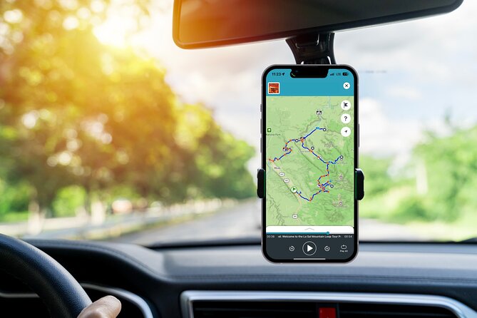
- Offline GPS audio: how it actually works in the car
- Your route through the La Sal Mountain Loop: 13 stops that range from easy to serious
- Stop 1: Ken’s Lake
- Stop 2: Brumley Arch
- Stop 3: Oowah Lake
- Stop 4: Warner Lake
- Stop 5: Castle Valley panoramic view
- Stop 6: Bull Canyon Overlook and dinosaur tracks
- Stop 7: Castleton Tower
- Stop 8: Parriott Mesa
- Stop 9: Fisher Towers
- Stop 10: Moab Giants museum at Red Cliffs Lodge
- Stop 11: Salt Wash (and a kayak idea)
- Stop 12: Takeout Beach for the river trips
- Stop 13: Courthouse Wash pictograph
- Timing your day: 4 to 6 hours means you still choose your pace
- Practical watch-outs: road closures and GPS hiccups
- Is this better than winging it in your own car?
- Should you book the La Sal Mountain Loop self-guided audio tour?
- FAQ
- How much does the La Sal Mountain Loop audio tour cost?
- How long does the tour take?
- Do I need data or Wi-Fi to use it?
- What language is the narration available in?
- Where does the tour start and end?
- Is the tour only available for certain days or times?
- Are admission fees included for the stops?
- Can I control when I drive and where I stop?
- Are service animals allowed?
Key things to know before you drive the La Sal Mountain Loop
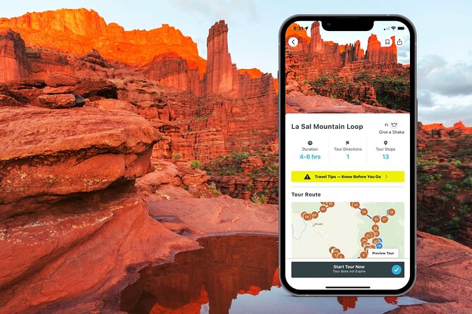
- Offline-first GPS and maps mean you can keep moving without data or Wi-Fi
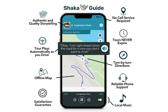
- Audio plays automatically as you drive, so you don’t have to tap at every stop
- Free stop ideas along the route, from lakes to sandstone formations to old rock art
- Stretches to match your energy, including short hikes and a few tougher options
- One price per vehicle/group (up to 15), not per person
A hands-free way to explore Moab’s La Sal high country
The La Sal Mountains add a totally different mood to Moab. Instead of staying in the valley, you climb into big views, higher elevations, and a string of stops that feel made for slow driving—windows down, engine purring, and your phone staying useful for once.
This tour works as a self-guided driving loop. You start at the North Hwy 191N area in Moab, follow GPS turn-by-turn directions, and get audio narration that kicks in while you’re rolling. You can skip stops you don’t feel like doing, and you can also stretch the day by picking what matters most to you.
You can also read our reviews of more tours and experiences in Moab.


Price and value: $15.99 for up to 15 people
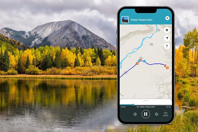
At $15.99 per group (up to 15), the math is friendly if you’re traveling with family or a crew of friends. You’re basically paying once for the car experience, not per head. That also makes it a good option if you want everyone in the vehicle to hear the same narration without sharing headphones.
You also get lifetime access to the app and data, plus tours never expire. That matters if you’re the type who wants to come back to Moab later or if you need to split the route across more than one day. And because it’s a “pick your stops” style tour, you can aim for shorter walks one day and hit the tougher hikes later.
Offline GPS audio: how it actually works in the car
Plan to treat setup like you’re packing a lunch. Do it once, do it right, and the rest is easy.
Here’s the practical flow:
- You book and receive confirmation by email.
- You download the Shaka Guide app.
- You redeem a code from your email to load the La Sal Mountain Loop GPS Audio Driving Tour.
- You start the tour from the route’s starting point and follow GPS instructions.
The big win is that the tour includes an offline map and the GPS audio can work without continuous Wi-Fi or data. Still, the tour suggests downloading the tour using strong Wi-Fi first—so I’d do that before you leave town. If you’re starting with spotty service, you might lose time before you even start driving.
Also note: the narration is designed to play automatically as you drive. That’s great for keeping your attention on the road, but it also means you should take a second to confirm you’ve launched the correct tour before you pull away.
Your route through the La Sal Mountain Loop: 13 stops that range from easy to serious
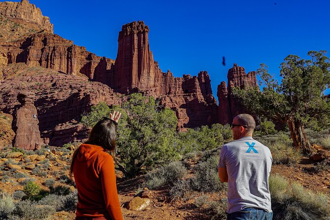
This loop is built around a sequence of viewpoints, lake pullouts, and hikes that fit the mountain mood. Most stops are described with a short time window for the stop itself, but hiking time can add up fast—especially at higher elevation.
A good strategy is to decide your “pain tolerance” early. If you’re feeling energetic, link two lakes. If you want photos without effort, focus on the overlooks and short walks.
Stop 1: Ken’s Lake
Ken’s Lake is a classic pullout-style stop: a campsite vibe with the La Sal Mountains showing off in the background. From there, you can take a short hike to a small waterfall, which is a nice payoff without committing to a big trail.
If you’re coming from lower elevations, you may feel the altitude more here. Take it slow and let your breath settle before you start walking.

Stop 2: Brumley Arch
Brumley Arch is only about a two-mile round trip, but it’s described as steep and strenuous. You’ll also drive on an optional gravel road to reach the trailhead, so expect some bumpy seconds before the hike starts.
This is a great stop when you want movement and you’re okay with uphill. If you’d rather keep it easy, you can still enjoy the area from the surrounding viewpoints, but this one is clearly built for hikers.
Stop 3: Oowah Lake
Oowah Lake is small, high, and pretty. It sits at about 8,800 feet (2,600 meters), and that elevation tends to make the scenery feel sharp and dramatic. It’s also popular for rainbow trout fishing, and the lake can reflect the La Sal Mountains when conditions are right.
This one works well if you want a calm break from driving. Just remember that higher elevation can make your “easy stroll” feel like a workout.
Stop 4: Warner Lake
Warner Lake is similar in vibe to Oowah—serene and known for rainbow trout fishing. The tour notes that crowds can show up during holidays or summer weekends, so if you dislike shoulder-to-shoulder parking, aim for earlier hours.
The most popular trail here connects Warner Lake to Oowah Lake for about a 1.6-mile round-trip. If you want maximum scenery for moderate effort, this is the best “do more with less” option on the whole route.
Stop 5: Castle Valley panoramic view
Castle Valley is where the drive turns into a viewpoint day. You get a sweeping look over the Colorado Plateau below La Sal, plus views that can include Porcupine Rim, Castle Valley itself, and even Arches and Canyonlands from the right angles.
This is an easy win if you want big photos without a big hike. It’s also a good place to pause and re-check where you are on the route before moving on.
Stop 6: Bull Canyon Overlook and dinosaur tracks
This stop is famous for dinosaur tracks left in the ground around 200 million years ago. The good news: you don’t need a hike. The tradeoff: you’ll likely need about 30 to 40 minutes for the detour.
This is the kind of stop that turns “just another overlook” into a story you can’t stop thinking about while you drive. If you’re traveling with kids or anyone who likes science facts, this is a must.
Stop 7: Castleton Tower
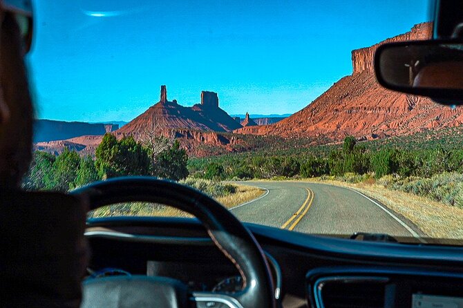
Castleton Tower brings the geology up close. You’re looking at a series of sandstone towers with names like Castleton Tower, the Rectory, and Sister Superior, rising as high as about 1,400 feet.
There’s no listed hike here, so this is mostly a “look, photograph, and enjoy the scale” stop. If you like learning what you’re seeing, this is where the narration can help you read the rock shapes faster.
Stop 8: Parriott Mesa
Parriott Mesa is the “more ambitious” stop on the loop. It’s over 6,000 feet, looks like a guard above Castle Valley, and stretches more than 1.5 miles long and about one-third of a mile wide.
There’s a three-mile round-trip hike option, described as challenging and requiring you to be very well-prepared. If you don’t have the fitness and gear for it, you can still enjoy the view from the area and keep the rest of your day lighter.
Stop 9: Fisher Towers
Fisher Towers is known for the kind of sandstone formations that make your brain keep finding faces and shapes. The route notes towers, spires, hoodoos, ravines, and terraces along a popular hiking trail.
If you’re doing only one “scenery hike” after lunch, this is the kind of place you’ll remember. Go early if you want quieter steps and cleaner photo angles.
Stop 10: Moab Giants museum at Red Cliffs Lodge
This is a calmer stop between outdoor blocks: the Moab Giants museum is part of the Red Cliffs Lodge. It focuses on the local film and pioneer story, including memorabilia and artifacts tied to early days and Hollywood productions shot in the region.
The tour notes lots of titles, like Wagon Master, Rio Grande, Taza Son of Cochise, City Slickers, Thelma & Louise, and more than a hundred TV commercials. Best of all: the museum entry is no charge (a nice change from paid attractions).
Stop 11: Salt Wash (and a kayak idea)
Salt Wash is where the Salt Wash River joins the Colorado River. If you have a kayak, the tour says you can follow Salt Wash upstream and eventually pop out near Delicate Arch inside Arches National Park.
Even if you don’t kayak, this stop is useful because it explains how the water systems shape the region. Think of it as a “how this place works” pause before the river comes back into play.
Stop 12: Takeout Beach for the river trips
Takeout Beach is where many kayaking and rafting trips end along the 13-mile Moab daily section of the Colorado River. If you’ve been seeing rafts on the water, this gives you the landing point context.
This stop also helps you understand that Moab isn’t just red rock and hikes. It’s also a river play hub, and this is part of the rhythm.
Stop 13: Courthouse Wash pictograph
Courthouse Wash is about old rock art. The pictograph was created by the Fremont people about 2,000 years ago, and the tour notes it requires a short hike of roughly 500 feet from the parking area.
This is a good final stop because it adds human history without turning your day into a long museum visit. It’s also a reminder to stay respectful around fragile sites and stick to allowed areas.
Timing your day: 4 to 6 hours means you still choose your pace
The tour is estimated at 4 to 6 hours. That’s enough time to do several short stops and at least one more serious hike, but it won’t magically cover everything if you get slowed down by views and photo breaks.
I’d plan your day around two variables:
- Hike choice: Brumley Arch and Parriott Mesa are the “earned it” hikes here, while lakes and overlooks can be quick.
- Elevation: Oowah Lake is at about 8,800 feet, and altitude can change how fast you move.
If you’re doing the Warner Lake-to-Oowah Lake connection, you can string together a satisfying walking plan without it becoming an all-day slog. If you want maximum flexibility, keep your “big hike” to just one major choice.
Practical watch-outs: road closures and GPS hiccups
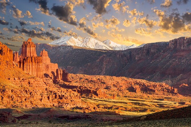
The biggest real-world risk isn’t the audio tour. It’s the road itself. The route depends on getting through the La Sal Mountain Loop, and road closures can prevent completing the loop.
So do this before you set off: check current road conditions for the area. If there’s a closure, don’t force it—adapt by focusing on the stops you can still access and skip the rest.
Another consideration: any GPS-based experience can occasionally misroute or have audio cut in and out. I recommend you keep an eye on the map screen and be ready to use your own common sense if the instructions feel off. If it happens, you can still fall back to your own navigation and continue reaching the next planned sights.
Is this better than winging it in your own car?
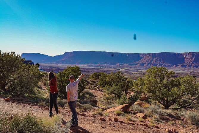
Winging it can work if you already know the roads and you’re fine guessing at where the good pullouts are. But this tour gives you something practical: turn-by-turn GPS directions plus stop-specific stories and tips.
What you’re really buying is less time figuring out what’s worth stopping for, and more time actually stopping. You also get offline support, which is a big deal in remote areas.
If you want a road trip where you can park for lakes, see dinosaur tracks, and finish with rock art—without planning every minute—this style of audio tour is a smart middle ground.
Should you book the La Sal Mountain Loop self-guided audio tour?
Book it if you:
- Want offline GPS audio that keeps your day moving without constant phone hunting
- Like the idea of a private, no-pressure route you control stop by stop
- Have a group (up to 15) and want one simple price for everyone
- Plan to do a mix of quick overlooks and at least one hike
Skip it or be cautious if you:
- Can’t handle a plan that depends on the road staying open
- Prefer fully guided, live human narration (this is self-guided)
- Don’t want to do any hiking at all, since some of the best stops include trails and short detours
If your goal is an efficient, flexible Moab drive with high-elevation rewards, I think this tour earns its place. Just download it first, check road status, and let the narration handle the mental load while you focus on the views.
FAQ
How much does the La Sal Mountain Loop audio tour cost?
It costs $15.99 per group (up to 15 people).
How long does the tour take?
It’s estimated at about 4 to 6 hours.
Do I need data or Wi-Fi to use it?
No. The tour includes an offline map, and audio/GPS work offline without continuous Wi-Fi or data.
What language is the narration available in?
The tour is offered in English.
Where does the tour start and end?
It starts at North Highway 191N Hwy 191, Moab, UT 84532, USA, and ends back at the same meeting point.
Is the tour only available for certain days or times?
It’s available daily, Monday through Sunday, from 12:00 AM to 11:30 PM within the listed date range (04/01/2022 – 12/20/2026).
Are admission fees included for the stops?
The named stops are listed with admission ticket free, but meals and entrance fees are not included if any additional fees apply beyond what’s described.
Can I control when I drive and where I stop?
Yes. It’s self-guided, so you can start, pause, and resume, and pick the stops you want or skip ones you don’t.
Are service animals allowed?
Yes, service animals are allowed.