REVIEW · PAGE
Horseshoe Bend and Lake Powell Self-Guided Tour
Book on Viator →Operated by Shaka Guide Apps · Bookable on Viator
Page can feel like a magic postcard when you time it right. This self-guided audio tour uses GPS to play stories as you drive, guiding you to the big-name views around Page, Arizona and nearby Utah. I like that you get both the scenery and the context, and I like the flexibility to linger at overlooks or skip stops. The main thing to plan for is tech and logistics: the experience depends on getting the app and GPS working, and Horseshoe Bend parking gets tight at peak hours.
What makes it practical is the structure. You’re not stuck on a fixed schedule, and the route covers a lot of ground without forcing long hikes at every stop. You also pay per vehicle/group (up to 15), which can be a strong deal if you’re traveling with family or friends.
One more consideration: several stops have real-world constraints like parking fees, limited lot space, and attraction hours. It’s not a live guided tour, so if you want a person to handle every detail, you’ll need to be a little more hands-on yourself—download, check settings, and arrive prepared.
In This Review
- Key highlights you’ll feel while driving
- How the self-guided audio tour works in your car
- Price and logistics: where the value comes from (and what costs extra)
- Route overview: the Page-to-Lake-Powell driving circuit
- Antelope Pass Vista and Vermillion Cliffs: your first big wow
- Horseshoe Bend: the Colorado River loop and the crowd math
- Antelope Canyon: stunning slots, but reservations are non-negotiable
- Powell Museum & Archives: adding context before you move on
- Glen Canyon Dam Overlook: dam views with a built-in rest stop
- Potato Hill Overlook and the Rim Trail: short walks you can actually finish
- Grandview Overlook and Navajo Mountain Viewpoint: calm panoramas
- The Chains slickrock hike: amazing views, serious water caution
- Hanging Gardens Trail: small distance, unusual scenery
- Carl Hayden Visitor Center and the dam connection
- Wahweap Marina and Recreation Area: shoreline time on Lake Powell
- Wahweap Overlook: the ride’s final posture
- Optional add-ons: Stud Horse Point, Skyline Arch, Lone Rock Beach, Big Water Visitor Center
- Crowd and timing tips that keep this experience enjoyable
- Should you book this self-guided Shaka Guide tour?
- FAQ
- What is included in the tour price?
- Do I need Wi-Fi to use the tour?
- How long is the tour?
- Is the tour offered in English?
- Is there reserved entry for Antelope Canyon?
- What parking fees should I expect?
- Where does the tour start and end?
- Are service animals allowed?
Key highlights you’ll feel while driving
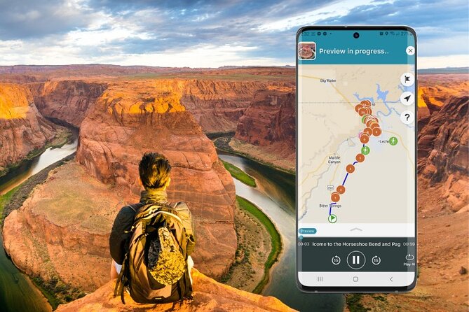
- Offline audio with GPS that plays automatically as you move
- One-price-per-vehicle style value for groups up to 15
- Prime Page viewpoints plus short walks like Potato Hill and Grandview
- Real hike variety from slickrock sand to a vertical rock garden
- Clear Horseshoe Bend crowd math (timing and parking rules)
- Museum + dam stops so you’re not just staring at photos
How the self-guided audio tour works in your car
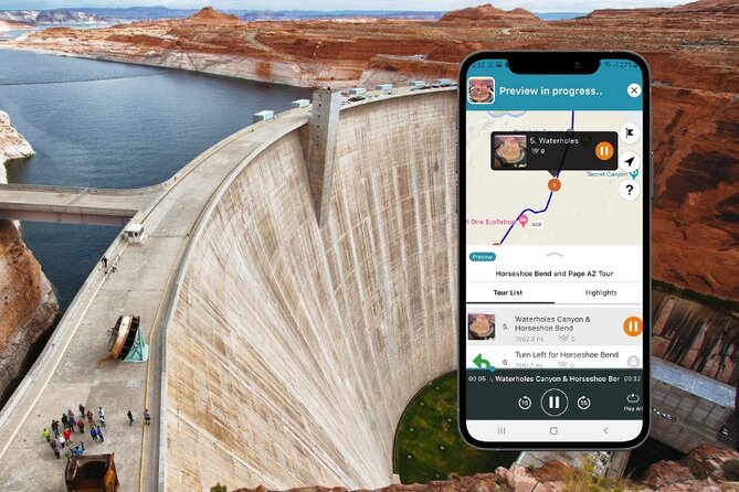
This is a mobile audio tour built for your own driving pace. After you book, you download the Shaka Guide app, redeem the tour using the code sent by email, and then launch it from the My Stuff tab. The narration plays automatically as you drive, with turn-by-turn directions using GPS and an offline map, so you’re not stuck hunting for cell service.
The tour is designed to be flexible. You can pause, resume, and skip stops you don’t want. That matters around Page because sometimes you’ll want to hang at a viewpoint for photos or shade, while other times you’ll want to keep moving.
It also helps that the tour never expires. You’re not racing a single-day window. If you can’t make it on the exact date, you still can use it later—as long as you can access the download in the app.
Price and logistics: where the value comes from (and what costs extra)
The price is $11.99 per group (up to 15 people). For a driving tour where most stops are free, that’s the big value driver. Even better, the tour is described as costing one tour for the entire vehicle rather than per person, which is ideal if you’re traveling with kids, a multigenerational crew, or friends in one car.
Now for what’s not included. Parking fees are listed separately for Horseshoe Bend ($10 for car or RV) and Wahweap Recreation Area ($30 per car). Also listed as not included are possible entrance fees like John Wesley Powell Museum ($8 per booking) and Glen Canyon National Recreation Area ($15 per person). Some nearby stops are marked free, but fees can still show up based on what you decide to do or how the area is managed that day.
Plan your budget like this: pay for the tour, then expect a couple of small parking hits plus any attraction fees you choose to add.
Route overview: the Page-to-Lake-Powell driving circuit
This tour is built around Page, with a mix of viewpoints, short walks, and a few trail options. The suggested flow starts near Bitter Springs, then hits Antelope Pass Vista, Horseshoe Bend, and the key Lake Powell viewpoints.
You’ll also get a museum-and-dam context stop, plus a set of hikes that range from easy out-and-back to easy-moderate slickrock walking. Toward the end, you’ll reach the Wahweap area on Lake Powell, where you can mix shoreline time with viewpoints and local visitor centers.
If you have limited time, you don’t have to do everything. The route is ideal for a half-day visit if you focus on the signature stops (Horseshoe Bend, Lake Powell overlooks, and one or two short walks). If you’ve got a full day, it really comes alive with trails like Hanging Gardens and The Chains.
Antelope Pass Vista and Vermillion Cliffs: your first big wow
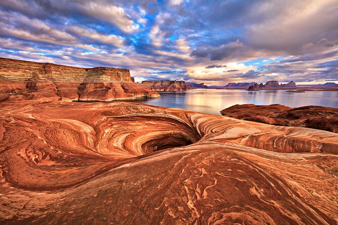
Antelope Pass Vista is your early “set the scene” stop. You’ll be looking across to Vermillion Cliffs National Monument, a huge geological area just under the Utah state line. The payoff here is scale: it’s one of those places where you realize the region isn’t just a lake and a river—it’s massive, layered rock history.
Timing note: this stop is quick (about 15 minutes on the tour), so treat it as a warm-up. If you’re sensitive to crowds later, arriving early for Antelope Pass Vista helps you start the day calm.
What to do: park, take a few minutes to orient yourself, then move on. This is a “see it once, really look” type of stop, not a long wandering opportunity.
Horseshoe Bend: the Colorado River loop and the crowd math
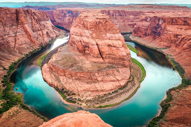
Horseshoe Bend is the star. You’ll see the Colorado River curve around a sandstone formation from a 1,000-foot-tall cliff. There’s a parking lot with restrooms, a viewing area, and an approximate 1.5-mile hike from the area if you want to stretch your legs.
Here’s the practical part: it gets very crowded. The busiest times listed are 9–11 a.m. and 4:30–6:30 p.m. During those windows, the parking lot can fill up, and no parking is allowed on Highway 89. If the highway gets used for parking, vehicles can be ticketed and towed. The safe strategy is simple: arrive before the rush or be ready to circle back later.
Parking costs $10 for car or RV. That fee is part of why this stop works well for most self-guided visitors—it’s built for quick access, not rough improvisation.
For photos: if you’re going for the classic angle, give yourself buffer time. Crowds make waits happen fast. For hiking: wear shoes with solid grip. The view is worth the effort, but it’s still a real walk.
Antelope Canyon: stunning slots, but reservations are non-negotiable
Antelope Canyon is a slot canyon known for narrow, winding passages and colorful walls shaped by erosion from flash floods. The tour points you toward the right idea, but with one key condition: you need prior reservations to visit.
The canyon has two main sections. Upper Antelope Canyon is typically accessible by guided tours, while Lower Antelope Canyon requires a hike. Because the tour is self-guided audio, it can help you understand what you’re seeing, but it can’t replace the reservation requirement.
My advice: if you want Antelope Canyon, lock in your time before you arrive in Page. Slots fill up, and this is one of those experiences where flexibility gets punished.
Powell Museum & Archives: adding context before you move on
The Powell Museum & Archives stop gives you quick background on the region. It’s located at 6 N Lake Powell Blvd in Page, inside the museum, and it’s listed as free on the tour.
The museum’s name ties to a one-armed explorer: John Wesley Powell, described as the first European American to cross the Colorado River. You’ll see exhibits focused on geology, archaeology, dam history, paleontology, and culture.
Why this matters: without context, Lake Powell and the Glen Canyon Dam can feel like scenery with no story. This stop adds the “why” behind the water, the geology, and the engineering.
Time plan: it’s a short stop on the tour (about 30 minutes). Use it to orient yourself, not to cram a full museum visit.
Glen Canyon Dam Overlook: dam views with a built-in rest stop
The Glen Canyon Dam Overlook is an easy win. You get a northward view of the dam and the Colorado River, and it’s centrally located in Page off Scenic View Road. Access is easy: a walk listed as less than 1,000 feet, plus picnic tables and a pavilion where you can pause.
This stop works even if you’re tired. It’s scenic, but it’s also functional—somewhere to sit while your brain catches up after the big driving day.
If the day is hot or windy, this is one of those places where you’ll appreciate the simple comfort setup.
Potato Hill Overlook and the Rim Trail: short walks you can actually finish
Potato Hill Overlook is a great “stretch your legs” moment. You’ll do an easy roughly one-mile round-trip walk to get views over Lake Powell and Antelope Island. The tour also notes that the Page Rimview Trail is accessed from there.
The Rim Trail itself loops around Page and is just over 10 miles (about 16 km) long. It’s mentioned as a spot for birding and biking, so it’s a natural fit if you’re the type who likes low-stress exploring.
For most visitors, Potato Hill is the sweet spot: short enough to keep momentum, scenic enough to feel like a real add-on.
Grandview Overlook and Navajo Mountain Viewpoint: calm panoramas
Grandview Overlook is another quick pause with panoramic views of Lake Powell and Navajo Mountain. This is a good “slow down” stop after a busier stretch.
Then you’ve got Navajo Mountain Viewpoint, which is described as sacred to the Navajo people. It’s also noted as being about the height of seven Empire State Buildings, which helps you get your sense of scale quickly.
Just past that is Wahweap Viewpoint, also called out for great Lake Powell views. If you’re the kind of traveler who wants one longer look per major area, plan to spend a little more time here and less time at pull-offs that feel too similar.
The Chains slickrock hike: amazing views, serious water caution
The Chains is listed as an easy to moderate hike with slickrock sand formations. You explore canyon walls and you may see views toward the Glen Canyon Dam. Lakeshore access is possible depending on current lake elevations, so what you see can change with water levels.
The most important detail is safety. The tour stresses extreme caution by the water because it can be very deep at this location.
If you want to do this hike, bring sturdy footwear and take your time near the edges. This isn’t a stroll where you can casually wander right up to the waterline.
Trailhead directions are specific: take the first right on the gravel road after Ridge Way heading toward Glen Canyon Dam before the Glen Canyon Bridge, then left at the end past Hanging Gardens trailhead, and keep going to the parking area at the dead end. Follow that carefully so you don’t end up on the wrong road in a slickrock area.
Hanging Gardens Trail: small distance, unusual scenery
Hanging Gardens Trail is a 1.2-mile out-and-back (about 2 km). The draw is in the name: plants actually grow on vertical rock surfaces.
This one is a solid option if you want a hike that feels different without eating most of the day. It’s short, scenic, and the “wow” factor comes from the unusual growth pattern rather than from massive elevation.
Wear shoes with grip, since rock and sand surfaces can get slick depending on conditions.
Carl Hayden Visitor Center and the dam connection
The Carl Hayden Visitor Center is located about two miles north of Page across the Glen Canyon Bridge, and the building is attached to Glen Canyon Dam. It’s listed as free and open daily with seasonal hours:
- Summer: 8 a.m.–6 p.m. MST
- Winter: 8 a.m.–4 p.m. MST
- Spring & Fall: 8 a.m.–5 p.m. MST
- Closed Thanksgiving, Christmas Eve, Christmas, and New Year’s Day
This stop is worth it because it’s not just an overlook. It’s a place to reset—get your bearings, ask questions if staff are available, and connect the visuals of the dam to the broader story of the region.
If your timing is tight, treat it like a “check it for context, then move” kind of stop.
Wahweap Marina and Recreation Area: shoreline time on Lake Powell
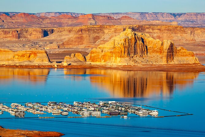
Wahweap Marina is your chance to get out of the car and explore the shoreline of Lake Powell. The tour notes that Lake Powell Resort is located there too, with restaurants and shops open to non-hotel guests.
This is a good point in the day to stop treating everything like a drive-by photo. Walk the shoreline area, look for a quiet spot, and take in the water scale.
Then comes Wahweap Recreation Area. You drive through an entrance station into the area. You’ll get great views across the lake toward Utah, plus restrooms centrally located near the group area. The tour lists restrooms in multiple buildings, and it notes the area is about a quarter mile from the shore.
Parking at Wahweap Recreation Area is listed as $30 per car and not included. Budget for it, and if you’re visiting during peak season, arriving earlier can help you avoid stress.
Wahweap Overlook: the ride’s final posture
Wahweap Overlook is the tour’s last named overlook. The idea here is simple: take a breather, look back at what you’ve already seen, and decide what to do next.
If the tour has you running on autopilot, this is the moment to zoom out. You’ve seen river curves, canyon cuts, slickrock trails, and dam views. Now you let the whole region “click” as one connected place.
Optional add-ons: Stud Horse Point, Skyline Arch, Lone Rock Beach, Big Water Visitor Center
The tour also includes a few extra areas that feel like they fit naturally if you want more hiking or time off the main path.
- Stud Horse Point Trailhead: about 1.5 miles long, moderate difficulty, with some elevation gain. Expect lake and sandstone cliff views along the way.
- Skyline Arch Trailhead: also about 1.5 miles, moderate with elevation gain, ending at a spectacular view of Skyline Arch.
- Lone Rock Beach: described as offering stunning views of Lake Powell and Lone Rock. It’s a place for sandy beach camping, swimming, kayaking, and off-roading.
- Big Water Visitor Center: a stop for fossil and geology-style exhibits, with dinosaurs, geology exhibits, and adventure tips.
These are the kinds of add-ons that can turn a standard day into a story you remember. Just watch your time and choose based on weather and your walking comfort.
Crowd and timing tips that keep this experience enjoyable
A self-guided tour rewards planning. Here are the big timing and safety points you should use:
- Horseshoe Bend timing: plan around the busiest windows (9–11 a.m. and 4:30–6:30 p.m.). If you’re flexible, arrive earlier to avoid full parking stress.
- Parking rules at Horseshoe Bend: if the lot is full, don’t improvise by parking on Highway 89. The tour explicitly warns that cars can be ticketed and towed.
- Lake and hike safety: if you’re doing The Chains, keep distance from the waterline. Depth and conditions are the concern.
- Visitor center hours: Carl Hayden Visitor Center has seasonal hours and holiday closures. Check what day you’re going so you don’t arrive when it’s closed.
- Antelope Canyon reservations: if Antelope Canyon is on your must-do list, reserve ahead. Upper and Lower have different access requirements, and this is not a walk-up plan.
And one more tech tip, based on the real-world experience people report: download and launch the app on solid Wi-Fi before you leave, then keep GPS permissions on.
Should you book this self-guided Shaka Guide tour?
Book it if you want a smart way to cover the Page highlights without paying per person for a guided bus tour. The offline GPS audio, the hands-free narration, and the mix of overlooks plus short hikes make it a strong value, especially for groups up to 15 in one vehicle.
Skip or think twice if you know you’re likely to struggle with app setup or GPS reliability. Some people report start-point trouble or the tour stopping working mid-route. If you’re the type who hates dealing with phone settings while traveling, consider whether you’d rather pay for a live guide.
My balanced take: this is a great match for travelers who like autonomy and are happy to drive and park carefully. If you time Horseshoe Bend right and download the tour properly ahead of your trip, you’ll get a smooth, story-rich day around Lake Powell.
FAQ
What is included in the tour price?
The tour includes an offline audio guided experience through the Shaka Guide app, with narration that plays automatically as you drive, turn-by-turn GPS directions, an offline map, and the ability to pick and skip stops. Parking and some possible entrance fees are not included.
Do I need Wi-Fi to use the tour?
No. The tour is described as working offline with an offline map and GPS-based narration. You should download the tour using strong Wi-Fi before you go.
How long is the tour?
The duration is listed as 1 to 8 hours, depending on how many stops you choose and how long you spend at each location.
Is the tour offered in English?
Yes. The tour is offered in English.
Is there reserved entry for Antelope Canyon?
Yes. Visiting Antelope Canyon requires prior reservations, and the tour notes that Upper Antelope Canyon is accessible by guided tours while Lower Antelope Canyon requires a hike.
What parking fees should I expect?
Horseshoe Bend parking is listed as $10 for car or RV. Wahweap Recreation Area parking is listed as $30 per car. Parking at those locations is not included in the tour price.
Where does the tour start and end?
The tour starts at Bitter Springs, AZ, USA and ends back at the same meeting point.
Are service animals allowed?
Yes. Service animals are allowed.