REVIEW · PAGE
Grand Canyon North Rim Full-Day Self-Guided Tour
Book on Viator →Operated by Shaka Guide Apps · Bookable on Viator
Plug in and let the rim narrate.
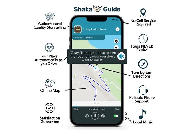
This full-day self-guided route strings together big views and small history stops, with GPS-activated audio that plays as you drive. I like the offline map and narration setup because it keeps you moving even when signal is spotty on the road to the North Rim.
I also like the freedom built into the plan. You can treat this like a choose-your-own-day itinerary—hit the overlooks and short walks you want, skip what you don’t, and keep the pacing calm. It’s set up for a private group (up to 15), so you’re not stuck with someone else’s timetable.
One drawback to plan around: the parks you’re visiting can add big-ticket entry fees on top of the $15.99 tour price. And since it’s phone-based, if your device struggles with GPS/audio, you may need a backup phone or tech help.
In This Review
- Key highlights worth aiming for
- The real vibe: a self-guided North Rim day with a story behind every mile
- Price and logistics: where you get the value, and what can surprise you
- Marble Canyon start: how to make the tour work well in the real world
- Historic Navajo Bridge: a long walk over the Colorado River
- Cliff dwellers and an old expedition route: quick history hits
- Vermilion Cliffs National Monument: the drive turns rugged
- House Rock Valley Overlook: the quick “take a breath” moment
- Pipe Spring National Monument: water, cultures, and a real place to slow down
- Kanab Visitor Center: geology and archaeology stop-over
- Le Fevre Overlook and Jacob Lake Inn: two practical breaks
- The Civilian Conservation Corps fire lookout tower: a relic still open
- Border Store: stock up before the rim
- Point Imperial: the highest point on the North Rim
- Vista Encantada Picnic Area and Roosevelt Point: two wins on Cape Royal Drive
- Cape Final Trail: the easy walk that often wins people over
- Walhalla Ruins and Walhalla Overlook: Pueblo-era rooms plus a big view
- Angel’s Window viewpoint: an easy photo stop with a clear parking tip
- Cape Royal Road: where the best overlooks cluster
- Point Sublime and the longer North Rim trails: pick your challenge level
- North Rim Visitor Center: information, exhibits, and the best restrooms
- Who this tour fits best (and who might want a different plan)
- Should you book Grand Canyon North Rim Full-Day Self-Guided Tour?
- FAQ
- How long is this tour?
- Is this a guided group tour?
- Does it work offline?
- What does the $15.99 tour price include?
- What extra fees should I budget for?
- Can I cancel and get a full refund?
Key highlights worth aiming for
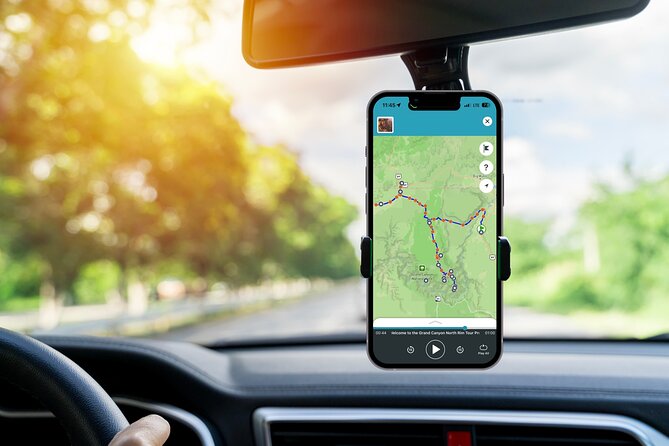
- Hands-free narration while you drive, plus turn-by-turn GPS directions
- Offline map and offline audio, so you’re not chained to cell service
- A smart mix of short stops and a few real hikes (Cape Final, Cape Royal Road, Point Sublime, Bright Angel Point)
- North Rim viewpoints without rushing: Vista Encantada, Roosevelt Point, Cape Final Overlook, Walhalla Ruins/Overlook
- Value for the vehicle: one group price up to 15 people, not per person
- Great “drive-first” itinerary if you want history + overlooks in one day
The real vibe: a self-guided North Rim day with a story behind every mile
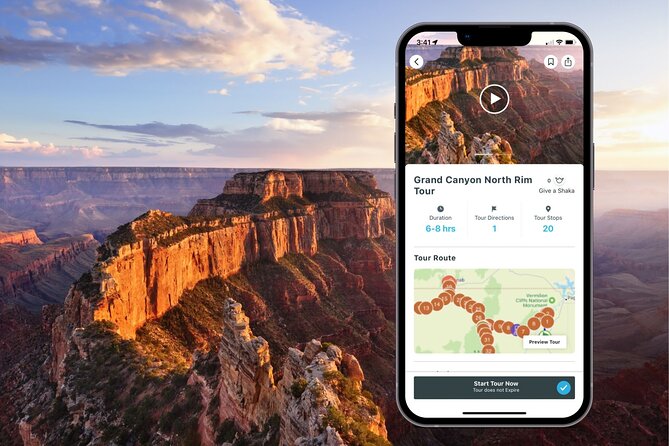
This tour is built for people who want the Grand Canyon experience without doing the whole thing the hard way. The big advantage is that the driving parts come with narration and directions, so you spend less time staring at your phone and more time actually watching the terrain change.
It’s also designed to be practical. The route includes a sequence of checkpoints—historic bridges, monument stops, roadside overlooks, and then North Rim highlights—each timed so you can get out, look, and get back in the car without it turning into a slog. The tour duration is listed as 1 to 16 hours depending on how many stops and walks you choose.
Cost-wise, the $15.99 price is for your group (up to 15 people). That’s where the value sits—especially if you’re splitting the price across family or friends. The catch is that park entry fees are not included, and those can be the main expense of the day.
You can also read our reviews of more tours and experiences in Page.
Price and logistics: where you get the value, and what can surprise you
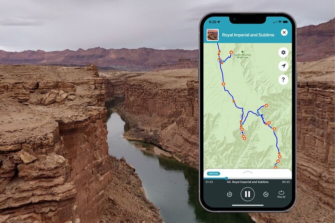
Here’s how to think about the money. You pay $15.99 per group for the audio tour, which can be used for your vehicle. Then you pay separately for major park entry:
- Grand Canyon North Rim entrance fee: $35.00 per person
- Pipe Spring National Monument entrance fee: $10.00 per person
- Parking fees: not included
That means this tour works best when you already plan to enter the parks anyway. If you’re doing a quick roadside pass-through, the tour price alone might feel less worth it. But if you’re planning a real North Rim day with multiple stops, the audio guidance can make the driving part smoother and the sightseeing part faster to organize.
Also note the tour runs with mobile ticketing and an app workflow. You’ll download using strong Wi‑Fi ahead of time, redeem a code from your email, then launch in the Shaka Guide app. Once you start, the audio narration and GPS guidance are meant to work offline.
Marble Canyon start: how to make the tour work well in the real world
The tour starts and ends back at the meeting point in Marble Canyon, AZ 86036. It’s offered daily, with a long window from 12:00 AM to 11:30 PM (service hours are listed across multiple years).
Before you leave Marble Canyon, do two things that make the day easier:
- Download the tour ahead of time on Wi‑Fi, so you don’t lose directions later.
- Take a quick moment at the start to confirm your audio is working and your GPS is locking in.
The reviews you shared include both a smooth success story and a hard failure case. One person got stuck when their phone wouldn’t play the tour, and tech support helped after they switched to another phone. So if you have any doubt, bring a backup device or at least ensure the phone you’ll use has GPS enabled and speaker volume up.
Historic Navajo Bridge: a long walk over the Colorado River
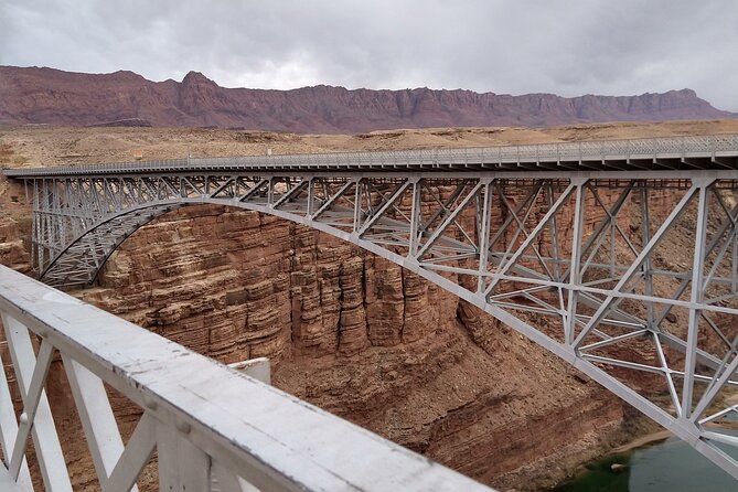
Stop 1 is Historic Navajo Bridge, constructed in 1927. The bridge originally made travel and trade easier across the Colorado River between Utah and Arizona, and now it’s a historic landmark you can walk across.
This is a good early stop because it’s simple: park, stretch, and enjoy the river below. The tour lists an hour here, which is enough time to cross slowly, take photos, and still keep the day moving.
What I like about starting here is the “setting the stage” effect. You’re not yet at the canyon viewpoints, but you’re already seeing the scale of the river system that shaped the region.
Cliff dwellers and an old expedition route: quick history hits
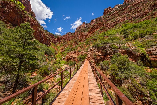
Stop 2 is Cliff Dwellers Stone House, a roadside attraction with roots in 1927. It was built by Betsy and Bill Russel and started as a makeshift shelter that became a traveler lodge.
Stop 3 is the Dominguez–Escalante Historic Trail, specifically the San Bartolomé Camp. In 1776, Spanish priests Francisco Dominguez and Silvestre Escalante explored the area looking for a possible trade route from Mexico to California. This area is suggested as an early European look at the Arizona Strip during that expedition.
Both stops are short (about 15 minutes each), which matters if your goal is to keep the day fun rather than museum-like. You’ll get enough context to make the region feel connected, without losing half your morning.
Vermilion Cliffs National Monument: the drive turns rugged
Next up is Vermilion Cliffs National Monument. The tour notes that many drivers continue on toward the North Rim, but this is where you start to see the area’s rougher side—along with the beginning of rugged 4-wheel drive routes tied to attractions like Wire Pass day hikes and the Condor Viewing Site.
You won’t be taking a 4×4 on this self-guided route as described, but you will get the shift in scenery. It’s a reminder that the North Rim day is part of a bigger system, not just a single viewpoint.
House Rock Valley Overlook: the quick “take a breath” moment
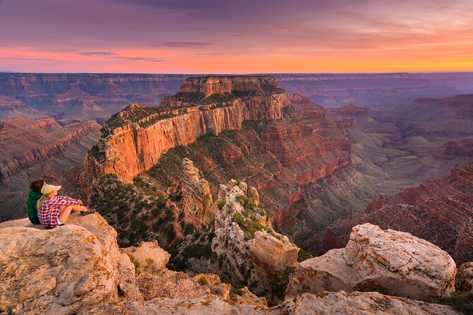
Stop 4 is House Rock Valley Overlook. You’re looking at a final broad view of the Vermilion Cliffs and the House Rock Wildlife Area, then the route transitions toward Kaibab National Forest with a noticeable elevation and environment change.
This stop is only about 10 minutes, but it’s the kind of stop I love on a self-guided plan: it doesn’t eat time, yet it helps your brain adjust to what’s coming next.
Pipe Spring National Monument: water, cultures, and a real place to slow down
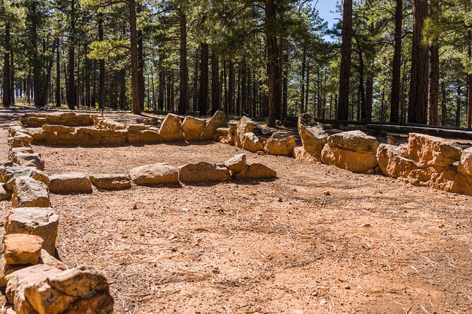
Stop 5 is Pipe Spring National Monument. The tour highlights the way history and water come alive as you explore the museum, historic fort, cabins, and gardens. It also points to traditions of the Kaibab Paiute and Mormon settlers, with opportunities for living history demonstrations and ranch animals.
The tour lists about 30 minutes here. That’s not “tour the whole monument in depth” time, but it’s enough for an efficient introduction—especially if you pick the parts that match your style. You’ll also be able to hike the Ridge Trail (the tour mentions it as a way to enjoy geologic wonders, plants, and wildlife).
Pipe Spring is also one of the only places on this route where you should mentally budget extra money: the entrance fee is listed as $10.00 per person. If you’re counting costs, this is the stop to decide if it’s worth the ticket for your group.
Kanab Visitor Center: geology and archaeology stop-over
After Pipe Spring, the route includes a stop at the Kanab Visitor Center, described as one of four visitor centers within Grand Staircase Escalante National Monument. This one focuses on geology and archaeology.
This is a nice “brain reset” after you’ve been outside. Even if you don’t plan a long indoor visit, a visitor center helps you understand what you’re about to see—especially for places with layered rock stories and long timelines.
Le Fevre Overlook and Jacob Lake Inn: two practical breaks
Stop 6 is Le Fevre Overlook, a roadside viewpoint before Jacob’s Lake. The tour notes binoculars are available so you can admire the red-orange Grand Staircase Escalante staircase from a closer angle.
Stop 7 is Jacob Lake Inn, a place to stretch your legs and grab a bite. The tour notes breakfast, lunch, and dinner plus an on-site bakery known for giant cookies. Plan about 30 minutes here so you don’t arrive at North Rim activities hungry or rushed.
This pair of stops works well because it balances “look at something” with “take care of you.” If you’ve ever driven for hours and arrived cranky, you’ll appreciate the built-in break.
The Civilian Conservation Corps fire lookout tower: a relic still open
Next is the 80′ Aermotor steel tower with a 7′ x 7′ metal cab. Built by the Civilian Conservation Corps in 1934, it was used by wildland firefighters and rangers to spot far-off wild fires. It was decommissioned in the 1970s but remains open to visitors.
You’ll get about enough time for a short visit and photos (the exact time isn’t clearly listed, but it’s slotted as an important stop after Jacob Lake Inn). If you like seeing how people used to manage wildlands—long before modern monitoring—that’s the payoff here.
Border Store: stock up before the rim
Stop 8 is the Border Store Country Store. This is an easy, practical stop to load up on supplies, snacks, and gas before heading out to trails and longer drives.
I treat stops like this as part of the sightseeing plan. If you do it right, you won’t spend half your North Rim day searching for a vending machine during your best viewing window.
Point Imperial: the highest point on the North Rim
Stop 9 is Point Imperial, noted as the highest point on the North Rim at 8,803 feet above sea level. The tour points out you can see Boundary Ridge and Saddle Mountain to the North, with the Nankoweap Trail running across the lower ridge. From the upper part, views of Mount Hayden, Hancock Butte, and Alsap Butte are possible.
The tour allows about an hour, which gives you time to settle in, take in the far sightlines, and move at your pace. At high elevation, that pacing matters—short walks and slow breathing beat sprinting from viewpoint to viewpoint.
Vista Encantada Picnic Area and Roosevelt Point: two wins on Cape Royal Drive
Stop 10 is Vista Encantada Picnic Area along Cape Royal Drive. It’s a quiet viewpoint blanketed with wildflowers and offering views of Nankoweap. On clear days, you may even spot the Painted Desert to the east.
Stop 11 is Roosevelt Point, accessed through a very short walk and with resting benches. The tour notes you can see far north scenery and the Grand Canyon stretch where the Colorado River forms an unbranched gorge about a mile or so across, cutting into the flat desert plain between the Vermilion and Echo Cliffs.
Both are short stops (about 15 minutes each). That’s ideal for self-guided travel because you’re constantly refreshing your view without eating daylight.
Cape Final Trail: the easy walk that often wins people over
Stop 12 is Cape Final Trail, a 4-mile out-and-back. It’s rated easy, which in North Rim terms usually means it’s more “walkable and shaded” than “true stroll.” The first part goes through ponderosa pine forest until you reach the Cape Final Overlook with expansive North Rim views.
The tour suggests about an hour. I like this hike because it’s long enough to feel like you earned the view, but not so long that it becomes an all-day commitment.
Walhalla Ruins and Walhalla Overlook: Pueblo-era rooms plus a big view
Stop 13 is Walhalla Ruins, also known as Walhalla Glades. This was a summer home of Basketmakers during the Pueblo period. The tour says you can tour 10 rooms left behind, plus attend ranger-led talks and tours through artifacts.
Stop 14 is Walhalla Overlook across the road. Here you get views of the Echo Cliffs, Painted Desert, and the Little Colorado River Gorge.
These two stops together work well as a contrast: scale down with the rooms, then scale up with the canyon country view. Both are quick (around 10 to 15 minutes), which keeps your day flowing.
Angel’s Window viewpoint: an easy photo stop with a clear parking tip
Stop 15 is Angel’s Window Viewpoint. It’s highlighted for getting a wide-angle photo of the stone arch. The tour also gives a practical parking tip: park in the pullover on your left.
This is the kind of stop that feels small but helps your photo set—and gives you another signature shape in the day’s memory.
Cape Royal Road: where the best overlooks cluster
Stop 16 is Cape Royal Road, a nine-and-a-half mile paved road full of spectacular overlooks. The tour lists about an hour, which is enough time to sample a few key pullouts without feeling like you’re racing down the road.
If you only have one section of the route where you want to linger, Cape Royal Drive is where to do it. The road format makes it easy to stop and restart, which fits the audio-tour rhythm.
Point Sublime and the longer North Rim trails: pick your challenge level
Stop 17 is Point Sublime, described as a moderately challenging 32.5 mile out-and-back hike. That distance is long enough that it should set off a serious planning alarm. Even if you’re strong, this is not a casual stop. If you’re not committing to a full long hike, consider choosing shorter rim options instead.
Then there’s another trail described as named for artist Gunnar Widforss: it’s long but relatively flat, at 10 miles, following a sequence that includes a slightly uphill forest start, then following the canyon rim, then dropping down into a valley and ending on a final plateau for best views.
Next is the Uncle Jim Trail, a moderate 4.7-mile out-and-back to the Uncle Jim Trail Overlook. The tour notes there are uneven points and that it’s popular for guided mule rides, so you’ll want careful footing and situational awareness.
Finally, the tour includes Bright Angel Point, described as the most visited viewpoint on the North Rim. It’s accessed behind the Lodge on the Transept Trail and is reached via a half-mile paved path.
Here’s the honest way to use this section: decide your hiking style before you get tired. If your legs feel good, pick one of the bigger trail options. If you want maximum views with minimal risk, stick to the shorter rim paths like Bright Angel Point and keep your day relaxed.
North Rim Visitor Center: information, exhibits, and the best restrooms
Stop after the trail/viewpoints is the North Rim Visitor Center. The tour calls out plenty of parking, educational programs, interactive exhibits both indoor and outdoor, a large gift shop, ranger information stations, and—importantly—restrooms.
Plan about 30 minutes. Even if you’re not staying long, this is a useful place to confirm what’s changed in the area (weather, conditions, ranger focus) and to get context for the last big stretch of your day.
Who this tour fits best (and who might want a different plan)
This tour is a strong match if you like:
- Driving scenic roads with history and viewpoint stops
- A day that mixes short walks with real time to take photos
- Planning flexibility (you choose stops, not the other way around)
- Offline navigation and auto-play narration so you can keep your eyes on the road
It may feel less ideal if:
- You want guided, in-person interpretation throughout
- You dislike paying separate park entrance fees
- You rely on a phone that’s prone to GPS/audio glitches (bring a backup option)
Should you book Grand Canyon North Rim Full-Day Self-Guided Tour?
If you’re going to the North Rim anyway, I think this is worth booking. The $15.99 group price can be a bargain once you split it, and the best part is that the day doesn’t depend on service bars. The audio and GPS approach helps you move confidently, and the stop sequence keeps the day full without forcing you into one rigid schedule.
My advice: commit to at least the major overlooks and one short hike (Cape Final Trail is a smart pick), then leave room for the Visitor Center. And before you roll out, test your phone audio and GPS at the start so you’re not scrambling later.
FAQ
How long is this tour?
The duration is listed as approximately 1 to 16 hours, depending on which stops you choose and how long you stay at each one.
Is this a guided group tour?
No. This is self-guided and private, meaning only your group participates.
Does it work offline?
Yes. The tour includes an offline map and offline narration that’s designed to work without continuous Wi‑Fi or data.
What does the $15.99 tour price include?
It includes the offline audio guided tour, GPS turn-by-turn directions, and the ability to start, pause, and resume at your pace. Meals and refreshments are not included.
What extra fees should I budget for?
Grand Canyon North Rim entrance is listed as $35.00 per person, Pipe Spring National Monument is $10.00 per person, and parking fees are not included.
Can I cancel and get a full refund?
You can cancel up to 24 hours in advance for a full refund.