REVIEW · SAN FRANCISCO
Highway 1 Pacific Coast Highway Self-Guided Driving Tour Bundle
Book on Viator →Operated by Drive with Action · Bookable on Viator
Highway 1 gets better with a good narrator. This self-guided, location-triggered audio tour turns the road trip into a string of explain-it-to-me moments, from whale season to World War II bunkers. I especially like that it’s valid for a full year and works offline after download, so you can do this drive once or revisit parts without re-buying.
My second favorite thing is how hands-free the experience is: the stories play automatically based on where you are, so you’re not stuck reading your phone every few seconds. For the money, it’s also hard to beat since it’s priced per group (up to 4), not per person.
The main drawback to plan for is that audio is great, but navigation guidance is lighter than a full GPS route turn-by-turn. If you wander off the suggested road rhythm, you may miss some audio cues or lose the timing.
In This Review
- Key highlights worth knowing before you go
- Price and timing: what you’re really paying for
- Setting up Action’s Tour Guide App without stress
- Starting in San Francisco: from Lakeshore to Pacifica
- Pacifica to Half Moon Bay: beaches, bunkers, and whale season
- Pigeon Point to Davenport: lighthouses, redwoods, and elephant seals
- Santa Cruz and Monterey: food towns with big ocean stories
- Big Sur: the road that earns the camera roll
- Garrapata, bridges, and purple sand: why this stretch feels different
- Central Coast detours: Hearst Castle, monarchs, and dunes
- Santa Barbara to Santa Monica: surf legends and postcard beach towns
- The “should I book it” decision
- FAQ
- How much does the Highway 1 self-guided audio tour cost?
- Does the audio tour work offline?
- How long is the drive from start to finish?
- What’s included and what’s not?
- Where does the tour start and end?
- Do I need to download anything before I arrive?
Key highlights worth knowing before you go
- One-year validity for a per-car price: buy once, then use it on return trips within the next 12 months.
- Offline GPS audio: download ahead on strong Wi‑Fi/cellular, then rely on GPS playback without signal.
- Hands-free storytelling tied to your location: audio starts on-site and moves as you drive, which keeps the trip calmer.
- Wildlife timing built into the stories: gray whales in Dec–Jan, elephant seals best Dec–Apr, and monarch butterflies in Oct–Feb.
- Roadside stops chosen for real-world payoff: lighthouses, bridges, pocket coves, and ocean views designed for quick photo breaks.
- Audio timing is not the same as a GPS copilot: keep your phone handy and pay attention to the tour route and speed limits so cues stay aligned.
Price and timing: what you’re really paying for
This bundle costs $29.99 per group (up to 4), and once purchased, it stays valid for one year. That matters because Highway 1 is not a “one-day and done” kind of drive. Even if you do the big sweep in a single stretch, you’ll probably want to come back for a better sunset, calmer traffic, or a specific trail you skim past the first time.
The driving time you should expect depends on how often you stop. The tour is designed around Highway 1 essentials along a 555-mile run, described as about 5–7 hours for the core experience. Another detail says the overall drive duration can come out around 10–11 hours, which makes sense if you add extra beach time, longer photo stops, or brief hikes.
You can also read our reviews of more tours and experiences in San Francisco.

Setting up Action’s Tour Guide App without stress
After booking, you get an email/text with setup instructions and a password. The key point is that you must download the tour while you’re on strong Wi‑Fi/cellular. After that, it works offline.
When you’re ready, you start touring by opening the Action’s Tour Guide App at the starting area. There’s no guide meeting you; you simply begin at the designated start point and the audio cues should start automatically based on your chosen tour direction.
One practical tip that keeps this smooth: get your phone set up before you’re driving. A car mount helps, and if you have the option, connect your phone to the car stereo for truly hands-free listening. It also helps if you do a quick sound check before you roll out, since audio quality depends on your phone settings and volume.
Starting in San Francisco: from Lakeshore to Pacifica
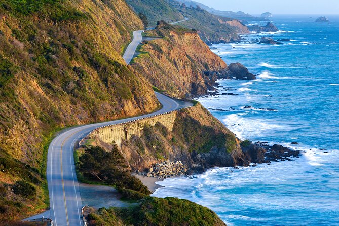
Your ride begins near PG6H+8F San Francisco Lakeshore, and your tour ends at Santa Monica Pier. You’ll be moving along California’s Highway 1, a route that’s described here as the longest state route in California at just over 656 miles.
In the first stretch, the audio sets a tone you’ll keep hearing: this road isn’t just scenic. It’s packed with odd names, old ambitions, and people trying to survive on the edge of the ocean.
In Pacifica, you’ll learn how the town ties into the wider story of San Francisco Bay and how Gaspar de Portolá helped put the region on the map. The narration also covers the unusual path to how Pacifica got its name, which is a fun warm-up if you’re the type who likes facts that feel like gossip.
Then you’re quickly into coastal stop energy, with the kind of short breaks that fit a driving tour: pull off, look, listen, go.
Pacifica to Half Moon Bay: beaches, bunkers, and whale season
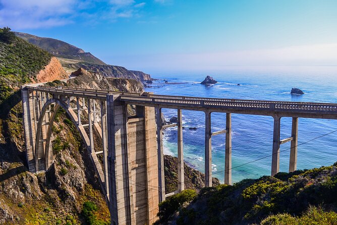
This part of the drive focuses on quick stops where the view does the heavy lifting, while the audio supplies the why.
At Pedro Point, the ocean views are the payoff—and the detail that matters is access. The point used to have a road, but it’s now reachable only by footpath, and only at low tide. If you plan for this one, check timing so you’re not standing at the wrong edge of the water.
Devil’s Slide Trail shifts the mood from pure scenery to military history. The bunker here dates to World War II, originally built to watch for a possible Japanese invasion. Today, the same structure is a local canvas for graffiti artists and youths. It’s an example of how the same concrete can hold two completely different eras.
For wildlife lovers, Gray Whale Cove State Beach is the big seasonal cue. The narration points out that gray whales migrate south past this shore in December and January, and they’re sometimes close enough to see with the naked eye. If you’re traveling in those months, I’d treat this like a priority stop rather than a casual stretch break.
Montara adds small-town character, with the town’s existence tied to an older lighthouse. Then Half Moon Bay brings a darker thread: mob activity earned the area a reputation as the most corrupt county in California at one time. It gives contrast to the “storybook coastline” feeling you get from the cliffs and calm stops.
Pigeon Point to Davenport: lighthouses, redwoods, and elephant seals
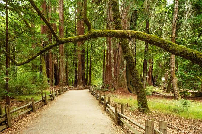
This stretch is built around a classic theme: the Pacific coastline looks dramatic, but California also packs in serious ecosystems.
At Pigeon Point Lighthouse, the facts are the hook: it’s 115 feet tall, described here as the tallest lighthouse on the west coast and also one of the oldest. This is one of the stops where your camera doesn’t feel like a chore; you just set it up and let the ocean do the posing.
Then you pass through redwoods territory—huge trees that you can’t properly appreciate from a speeding car, but you’ll still feel the scale. The guide also specifically names Big Basin Redwoods State Park as a place you’ll drive past, with old-growth trees and a chance of wildlife sightings if you’re moving in the morning.
A highlight for animal watching is the Elephant seals tip. The narration says the best time to view them is between December and April, during their breeding season. If you’re visiting outside that window, you might still see them, but don’t build your whole schedule on it.
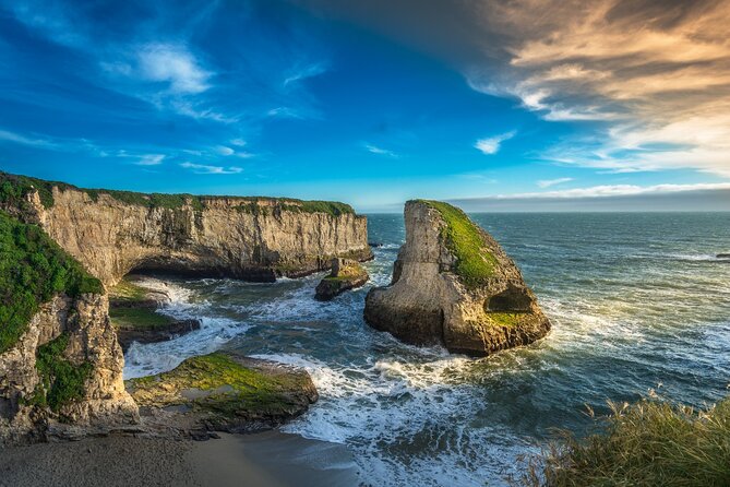
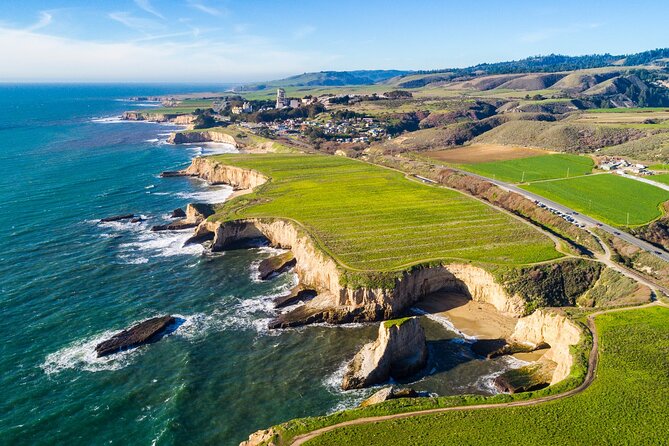
In Davenport, the town is tiny, but the coastline is strong. You’ll get the story behind the Davenport Crack, where water carved a deep tunnel through a cliff so it looks like the land split in two. Nearby, there’s another “names look scarier than reality” moment with the shark fin rock formation at the ominously named cove—no need to worry about actual sharks based on what’s stated here.
If you want quiet time, this part includes the idea of pocket beaches: small, secluded spots reached by scrambling where fewer people go, so you can actually hear yourself think.

Santa Cruz and Monterey: food towns with big ocean stories
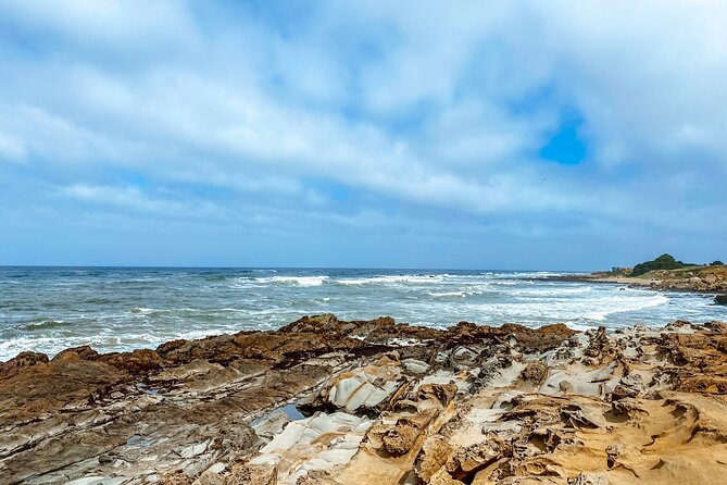
Santa Cruz is presented as one of the must-see stops, and the details support it: founded in 1791, known for architecture, food, and quirky shops. If you’re building your own plan, treat Santa Cruz as a place where you can turn the audio drive into a real half-day break.
The Santa Cruz Wharf is described as the main hotspot, busy with seafood restaurants and with a fully functional wooden roller coaster. That’s a reminder that this part of the coast isn’t all nature and no fun.
There’s also a mention of The Mystery Spot, opened in 1939 by George Prather, where the experience plays with gravity-defying effects. Even if you don’t stop, it adds a different kind of roadside curiosity—perfect for families or anyone who likes odd stops that feel very California.
From there, you’re pushed toward wildlife and water again with Elkhorn Slough Reserve, a wetland where salt water meets fresh water. The guide says more than 700 species of terrestrial and marine animals live there, so even a short pass can be a good “look for something moving” moment.
In Monterey, you’ll hear the sardine-packing history and how Cannery Row became a strip of restaurants, gift shops, and bars in converted factories. The narration also calls out the Monterey Bay Aquarium, with thousands of marine animals and interactive displays—again, a stop that can turn a driving tour into a longer day if you care about marine life.
Big Sur: the road that earns the camera roll
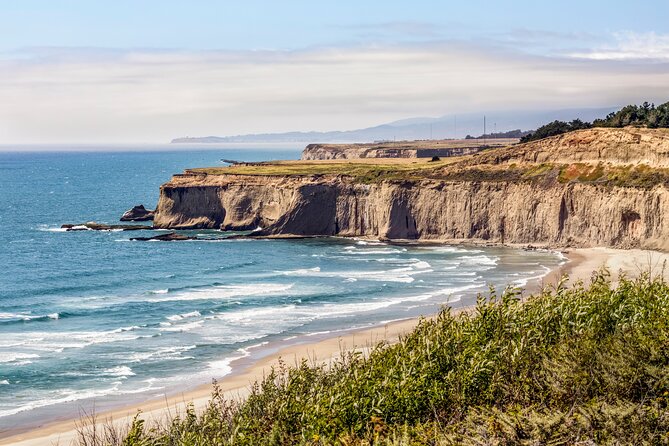
Big Sur is treated like the crown jewel for a reason: the description here is dramatic and physical—bluffs hundreds of feet above crashing waves, lush greenery, and rocky hiking options.
A useful detour option is the 17-Mile Drive through Pebble Beach and Pacific Grove. It’s described as passing lavish estates on one side and delivering unbeatable ocean views on the other. If you’re short on time, this gives you a controlled, scenic hit without hunting for every pull-off yourself.
Then Carmel-by-the-Sea brings the fairytale vibe: fairytale cottages, eccentric residents, and an unusually large number of art galleries for such a small town. If you like art strolls and walking-friendly streets, this is where you can swap “pull over for photos” for “park and wander.”
You’ll also hear about Point Sur and the lighthouse story: a mountainous island that used to be a nightmare for ships at night, now on the National Register of Historic Places. The guide adds that former owners forbade most development along this coastline, leaving a more untouched wilderness feel.
Garrapata, bridges, and purple sand: why this stretch feels different
Garrapata State Park is one of the places where the road trip turns into actual choices. The narration points out hiking trails that lead toward the coast, plus other routes through lilies and redwood groves. Admission is noted here as not included, so you’re not locked into a single entrance fee, but you should still expect that some stops require your own planning.
Then you hit the most photo-friendly engineering on the route:
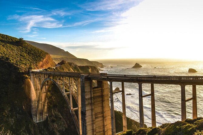
- Bixby Creek Bridge, described as one of California’s most photographed bridges, with lush green bluffs and ocean views that make every stop look like a postcard.
- Big Creek Bridge, described as 589 feet long, with turnouts at each end so you can pull over and photograph without feeling like you’re sprinting.
Along the way, there are also smaller but memorable moments: Pfeiffer Beach with purple sand, tied here to manganese garnet washing down from nearby bluffs. That kind of detail makes a quick stop feel purposeful.
For animal watching, you get another elephant seal cue with Seal Beach Overlook, where seals lounge on the rocks. The guide also notes an accessible walkway at Elephant Seal Vista Point, giving you a better shot at seeing them without a scramble.
If you like geology oddities, Partington Cove is a quieter pause, described as sheltered and secluded, plus a rumor about prohibition-era moonshiners as a fun historical side note. Nearby, there’s also the waterfall story: it used to cascade straight into the Pacific, but mudslides changed the landscape. You get the visual impression even if the original shape is gone.
Central Coast detours: Hearst Castle, monarchs, and dunes
Once you’re past the core Big Sur spine, the tour keeps the pace but adds fresh styles of stops.
Near San Simeon, the guide includes Hearst Castle, a National Historic Landmark and California Historical Landmark. It’s described as conceived by William Randolph Hearst and architect Julia Morgan, built between 1919 and 1947. If you’re a history person, this is the kind of landmark that can justify pulling off for a longer visit, even though entry tickets aren’t included.
Then the coast shifts into something very seasonal. The narration mentions monarch butterflies sheltering in eucalyptus trees between October and February, describing a count of around 25,000 butterflies at one point. If you visit during those months, treat this like a timed stop, not an afterthought.
For pure scale and ocean views, Guadalupe’s dunes are described as the tallest on the entire west coast, reaching up to 500 feet. Standing on top is framed here as an unbelievable panorama moment, so plan for it as a lookout stop with time to breathe.
In Lompoc, the guide emphasizes flowers and public art. It describes tens of thousands of flowers every year, murals across town (40 total), and a Lompoc Wine Ghetto with a world-class collection of wineries and tasting rooms. If wine tasting is your thing, this is where the audio tour can lead you into a full afternoon plan.
There’s also an optional crowd-averse detour to Jalama Beach, described as a quiet alternative when you want a calmer shoreline.
Santa Barbara to Santa Monica: surf legends and postcard beach towns
The late stretch keeps layering small-town charm with big coastline hits.
Santa Barbara gets framed as one of the prettiest towns on the route, with a Spanish mission background and a focus on artists, top-tier restaurants, and beaches. Even a short stop can help reset your trip energy before Los Angeles traffic.
You’ll also get Thousand Steps Beach, with a correction built into the description: there are 218 steps, not a thousand. It’s a good reminder that this tour tends to give practical reality, not just dramatic numbers.
Then come several beach stops with clear “why people love it” cues:
- Carpinteria State Beach: a favorite for swimming and camping, plus a harbor seal detail where you might spot seals on the sand.
- Rincon Beach: a famous surfing destination and host of the Rincon Classic.
- Faria Beach: another surfing spot around Las Pitas Point, with limited sand space—great for privacy, less ideal for casual beach lounging.
- Point Mugu Rock: ancient volcanic rock that created problems for early highway construction, now a great pull-over for views.
For rock-formation photographers, El Matador State Beach is described as a visual playground of weird rock formations, with sunset framed as the absolute best time to visit.
As you get closer to Los Angeles, the guide includes Point Dume and Zuma Beach, both framed as beloved beach getaways. Planet of the Apes fans get a specific filming-location detail at Point Dume: the Charlton Heston shot involving the destroyed Statue of Liberty.
Finally, Malibu is described as the SoCal beach definition, with surfing opportunities and a parade of celebrity home names listed in the narration. The tour ends at Santa Monica Pier, where you get the beach-and-boardwalk payoff next to Los Angeles glitz.
The “should I book it” decision
I’d book this if you want a high-value audio companion for one of America’s best-known drives. The strongest reasons are the one-year validity, the offline GPS audio, and the fact that the stories point you toward places with payoff—wildlife cues, lighthouses, bridges, and short breaks where a few minutes can turn into a memory.
I’d hesitate if you rely on heavy turn-by-turn navigation. This experience works best when you stay on the tour route and keep your phone oriented, because the cues are tied to your location and the route rhythm. It’s also smart to plan extra time for stops, since some sections can feel like long stretches between moments if you’re expecting constant action.
If you’re doing Highway 1 for the first time, or you want to keep the drive from turning into “just driving,” this is a solid way to make the road trip feel guided without hiring a person.
FAQ
How much does the Highway 1 self-guided audio tour cost?
It costs $29.99 per group for up to 4 people.
Does the audio tour work offline?
Yes. After you download it using strong Wi‑Fi/cellular, the GPS and audio are designed to work offline.
How long is the drive from start to finish?
The tour is described as about 10 to 11 hours, with the essential 555-mile section mentioned as about 5 to 7 hours depending on how you use stops.
What’s included and what’s not?
Included are the audio narration, offline GPS support, and hands-free location-based playback. Not included are attraction passes, entry tickets, or reservations.
Where does the tour start and end?
It starts near PG6H+8F San Francisco (Lakeshore, San Francisco, CA, USA) and ends at 108 Santa Monica Pier, Santa Monica, CA 90401, USA.
Do I need to download anything before I arrive?
Yes. After booking, you’ll receive setup instructions and a password. You must download the tour while you have strong Wi‑Fi/cellular, and it will work offline afterward.