REVIEW · WYOMING
Self-Guided Audio Driving Tour in Black Hills and Mt Rushmore
Book on Viator →Operated by GuideAlong (GyPSy Guide) · Bookable on Viator
Mount Rushmore sounds better with your own guide. This self-guided road trip uses GPS location-based audio so the stories and driving prompts play as you move. I especially like the mix of big-name icons with smaller side stops you might skip on your own, and the fact it works offline using your phone’s GPS.
The best part is pace. You decide when to pull over, when to skip a stop, and how long to linger at the scenic viewpoints or trailheads. It feels like you’re borrowing a friendly guide for the drive, without being locked into a schedule.
One thing to think about: you’ll only get the smooth experience if you plan for the app setup and download before you hit spotty areas, plus bring a car charger so your battery lasts through long drives.
In This Review
- Key highlights worth planning around
- Price and value: $29.99 per group that feels practical
- How the GPS audio tour really works on the road
- Getting the app ready for the Black Hills (so it doesn’t break your day)
- Stop-by-stop: what each area gives you (and what to watch for)
- Stop 1: The Black Hills start area (and making your own plan)
- Stop 2: Mount Rushmore National Memorial (give it real time)
- Stop 3: Custer State Park (slow roads, long wildlife potential)
- Stop 4: Devils Tower National Monument (short stop, big meaning)
- Stop 5: Badlands National Park (the main act, with multiple bite-size options)
- Stop 6: Crazy Horse Memorial (worth it, even if it’s not the same vibe)
- Stop 7: Keystone (your practical break)
- Stop 8: Rapid City (base camp energy)
- Stop 9: Sylvan Lake (easy walk, photo-friendly granite)
- Stop 10: Iron Mountain Road (tunnels, curves, and that Rushmore peek)
- Stop 11: Bridal Veil Falls (quick pullout, easy shot)
- Stop 12: Deadwood (2 hours for the full vibe)
- Stops 13–14: Roughlock Falls State Nature Area and Spearfish Canyon Scenic Byway
- Stops 15–19: Badlands Wall, Door Trail, Fossil Exhibit Trail, Minuteman Missile, Yellow Mounds
- Stop 18’s side trip idea: Wind Cave National Park (only if you have time)
- Iron Mountain Road, Needles Highway, and RV reality (tunnel height limits)
- Timing: how to build 1, 2, or 3 days without stress
- What I think you’ll enjoy most
- Possible weak spots to plan around
- Should you book this self-guided driving tour?
- FAQ
- How much does the tour cost?
- How long does the tour take?
- Does the audio tour work offline?
- Do I need to pay park entrance fees?
- Where does the tour start and end?
- Can I start the tour at any time of day?
- How do I access the tour after booking?
- What if I have a large RV?
- Can I cancel and get a refund?
- How often can I use the tour?
Key highlights worth planning around
- GPS autoplay audio means the narration cues up right when you’re near each stop.
- Offline operation lets you keep going even when cell service disappears.
- Group value: one purchase covers everyone in your vehicle (up to 8).
- Drive-friendly pacing: you can stop, resume, and create your own version of the route.
- Three major loop styles let you string the sites together over 1, 2, or 3+ days.
- Good road-trip icons plus side roads give you both scale and variety, from Needles Highway to the Badlands trails.
Price and value: $29.99 per group that feels practical
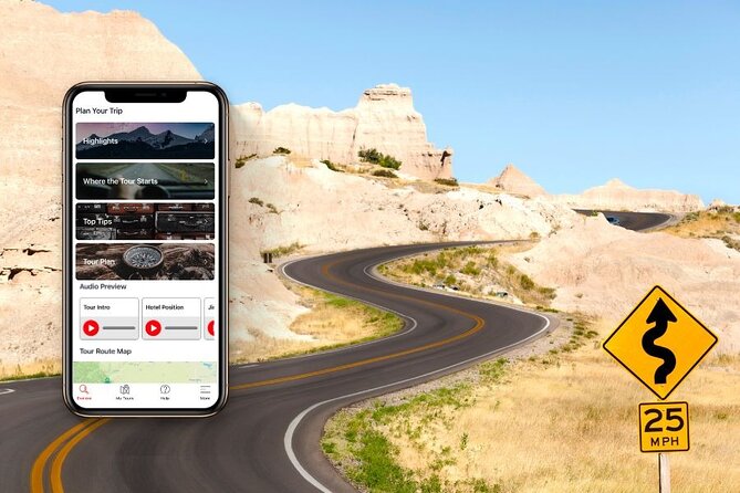
At $29.99 per group (up to 8 people), this tour is priced like a road-trip accessory, not a formal excursion. If you’re traveling as a family or with friends, the cost per person drops fast. You’re paying for two things that are hard to replace on your own: (1) context for what you’re seeing, and (2) turn-by-turn guidance for when you’re busy parking, crossing pullouts, or checking trailheads.
Also, you get to use it as many times as you want during the trip timeframe you choose because it’s a buy once, use forever style purchase with free updates. That matters in the Black Hills and Badlands area, where you may go back for sunrise light, a second trail, or a viewpoint you didn’t have time for the first day.
How the GPS audio tour really works on the road
This tour is location-triggered, not a simple play-at-will playlist. As you drive, the narration plays based on where your phone thinks you are, and it includes driving directions and tips leading into the next stop. In practice, that means you don’t have to keep checking maps every time you want to find the right turnout.
A couple of practical points I’d treat as rules of the road:
- Keep the app running so audio continues normally when you stop and resume.
- Make sure your phone stays charged, ideally with a USB/C car charger.
- If you go off route, you may need to navigate back to where the tour picks up again.
One more reality check: GPS doesn’t care about your plans. If you double back or drive the same route segment again, the audio for that segment may repeat.
Getting the app ready for the Black Hills (so it doesn’t break your day)
The tour uses the GuideAlong app (provided by GuideAlong / GyPSy Guide) and it requires a download step ahead of time. The tour is designed to run offline after you download, which is exactly what you want in rural South Dakota where cell coverage can be spotty.
What you should do before you leave Wi‑Fi:
- Redeem your voucher code using the link sent by email and text.
- Download the GuideAlong app.
- In the app, download the specific tour under My Tours.
- Charge your phone fully, then top up with a car charger once you start driving.
If you skip the download step or your phone runs low on battery, you’ll lose narration at the worst times—usually right when the canyon roads or park drives get interesting.
Stop-by-stop: what each area gives you (and what to watch for)
This route is built around several “icon + scenery” blocks. You don’t have to see everything in one go, and you’ll get more out of it if you pick a loop and then add side stops when time allows.
Stop 1: The Black Hills start area (and making your own plan)
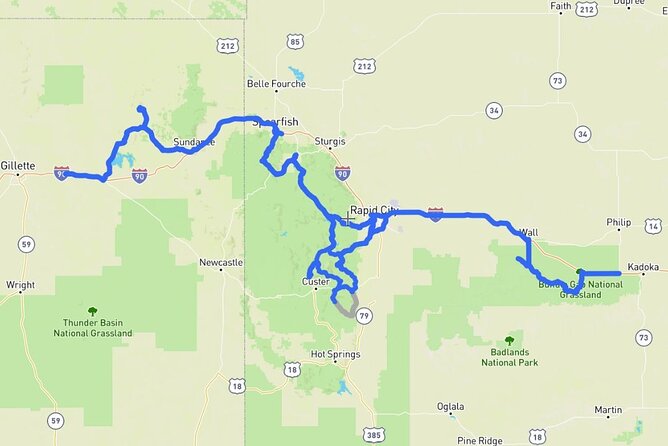
You can effectively begin anywhere along the route, with the listed start in Moorcroft, WY (82721). The tour uses GPS location cues, so the key benefit here is flexibility: you can build your day around your interests and schedule instead of treating it like a rigid checklist.
What I like about starting this way: you can choose your best direction and timing for views, wildlife spotting, and photo light. What I’d watch: don’t expect perfect timing between stops. Some legs are more about driving and scenery, while others have short pulls plus longer trail options.
Stop 2: Mount Rushmore National Memorial (give it real time)
Mount Rushmore is only about a 15-minute stop in the guide structure, but you’ll feel the scale most if you stretch that a bit. The memorial is famous for a reason: seeing it in person is one of those rare travel moments where the photos don’t fully prepare you for the depth and how much stone is involved.
What you should expect:
- A quick arrival-and-observe rhythm.
- Strong visual impact even if you don’t do every extra activity on site.
One consideration: some people want more depth here, and the narration can feel lighter at this specific stop compared to the rest of the drive.
Stop 3: Custer State Park (slow roads, long wildlife potential)
Custer State Park is where the tour becomes more about the drive than the “one landmark moment.” You’ll be rolling through wide natural habitat with prairie hills and open grasslands mixed with pine forest.
The main drive is listed as 18 miles, but plan for at least an hour, and if you like wildlife spotting, it’s easy to spend 3 hours or more on this section alone. The tour encourages side roads off the main route, which is where you’ll find more chances to stop without feeling like you’re rushing.
Trade-off: if you’re trying to compress everything into one day, Custer is the first place you’ll feel time pressure.
Stop 4: Devils Tower National Monument (short stop, big meaning)
Devils Tower has a deep mix of Native American spiritual importance and mainstream pop culture from the 1970s sci-fi classic Close Encounters of the Third Kind. The tour frames it as a place of intrigue dating back across generations.
It’s listed as a 25-minute stop, which fits the reality of Devils Tower: you can absorb the big shape, look around, and move on without needing a long hike—unless you choose to add one on your own.
Stop 5: Badlands National Park (the main act, with multiple bite-size options)
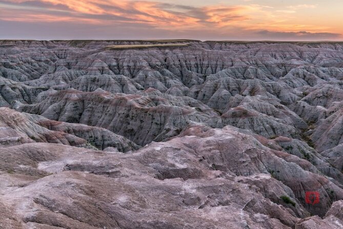
Badlands National Park is where the route really gives you choices. You get huge rock formations, a mix of prairie grassland and striking erosion patterns, plus several stop types: overlooks, boardwalk trails, and an active fossil exhibit area.
The tour times here are “how long you might spend” markers, not strict requirements. You can keep it to a few short walks and viewpoints, or add more time for trails.
Stop 6: Crazy Horse Memorial (worth it, even if it’s not the same vibe)
Crazy Horse Memorial is a significant work honoring Sioux and other Northern Plains native groups. It has context tied to sculptor Henry Standing Bear and the later construction direction on Thunderhead Mountain.
Listed around 20 minutes. The advantage of keeping it short: you can get back on the road and let your day flow naturally toward the Badlands.
Stop 7: Keystone (your practical break)
Keystone is the nearest community to Mount Rushmore and it’s built for logistics: hotels, restaurants, cafes, and souvenir shopping. Listed as a free 10-minute stop.
Use it as a reset. Grab water, quick snacks, and postcards. This is also where you’ll feel less “park outpost” and more “real town with services.”
Stop 8: Rapid City (base camp energy)
Rapid City is the hub for scenic drives in this part of South Dakota. It’s a good place to base accommodations and explore the town itself.
The tour lists a 20-minute stop. If you’re staying overnight, I’d treat Rapid City as your planning brain: laundromat, supplies, and a last check of daylight and route timing.
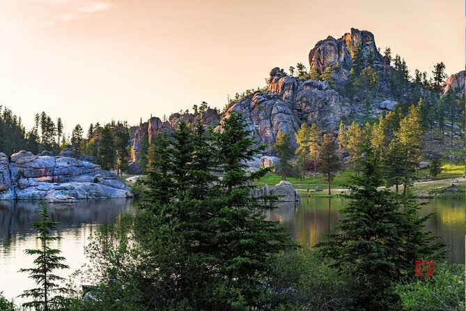
Stop 9: Sylvan Lake (easy walk, photo-friendly granite)
Sylvan Lake is described as the Jewel of Custer State Park. The tour suggests you might want about 45 minutes for the relatively easy 1.1-mile loop around the lake.
It’s a great “active break” between longer drives. If you’re more ambitious, the Black Elk Peak trail starts here as a 7-mile loop with about 1,100 feet of elevation gain to South Dakota’s highest point—but that’s outside the basic tour timing.
Stop 10: Iron Mountain Road (tunnels, curves, and that Rushmore peek)
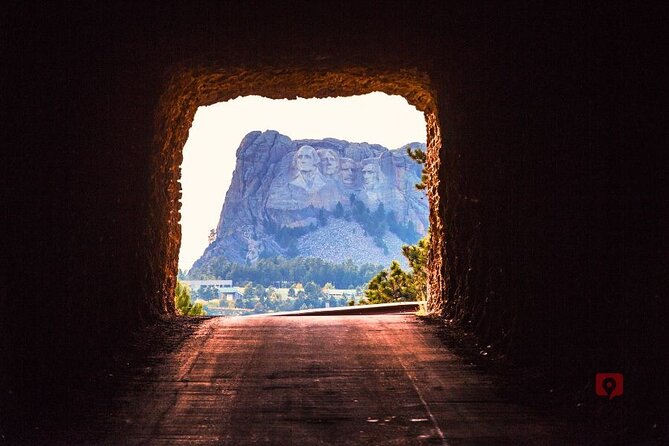
Iron Mountain Road is the kind of drive you don’t want to rush. The route notes tunnels, pigtail bridges, lookouts, and 314 curves, with a final magical moment through Scovel Tunnel where the presidential faces greet you like a postcard view.
The tour lists this as a 45-minute approach, which is consistent with how long it feels when you’re actually stopping for views.
Stop 11: Bridal Veil Falls (quick pullout, easy shot)
Bridal Veil Falls is a 60-foot narrow waterfall right beside the road in Spearfish Canyon. You can get a photo right from the viewing platform.
If your schedule is tight, this is a “pause and go” stop that still gives you a satisfying payoff.
Stop 12: Deadwood (2 hours for the full vibe)
Deadwood is the famous wild-west town tied to the gold rush era and a cast of characters you’ll recognize from stories and pop culture.
The tour lists about 2 hours, which makes sense because Deadwood rewards time. If you’re only passing through, you might focus on a couple key streets plus a quick look around.
Stops 13–14: Roughlock Falls State Nature Area and Spearfish Canyon Scenic Byway
Roughlock Falls is reached from the ex-sawmill town of Savoy and is accessible via boardwalk. The tour suggests an easy visit, plus you can extend with a stream-side walking trail to the falls.
Then Spearfish Canyon Scenic Byway is a 19-mile stretch of road with waterfalls and towering limestone walls. It connects Spearfish with Savoy and Cheyenne Crossing along Spearfish Creek.
These two stops work well as a “water + canyon walls” block. The drawback is simple: both can steal time from your next stop if you’re the type who stops every time you see a new viewpoint.
Stops 15–19: Badlands Wall, Door Trail, Fossil Exhibit Trail, Minuteman Missile, Yellow Mounds
This is your Badlands toolkit.
- Badlands Wall (Lower and Upper Prairie barrier): gives you a sense of elevation change and erosion over time.
- Door Trail: the popular 3/4-mile boardwalk route to the Door rock formation. If you prefer less walking, the Window Trail is shorter.
- Fossil Exhibit Trail: a short 0.25-mile boardwalk focused on fossils found in the park area.
- Minuteman Missile National Historic Site: a major theme shift from geology to Cold War history. You can visit a visitor center plus decommissioned nuclear missile silos and control centers.
- Yellow Mounds Overlook: one of the best vistas in the park, with banded colors from yellow and beige to pink, tied to how the mud changed over time.
Here’s the key planning tip: this block is where you decide whether you want your day to be “walk and learn” or “drive and view.” You can do a lot quickly, but you’ll feel rushed if you try to hit every single trail and museum.
Stop 18’s side trip idea: Wind Cave National Park (only if you have time)
Wind Cave is listed as a cave system worth adding if your itinerary allows. The tour notes that it requires driving on side trips off the Black Hills Loop tour route, and that the commentary includes guidance on where to turn off and how to return to the tour route.
Same with anything like this: it’s fantastic if you have flexibility. If you’re on a strict timeline, keep it optional.
Iron Mountain Road, Needles Highway, and RV reality (tunnel height limits)
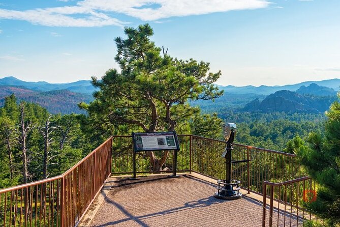
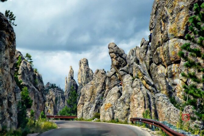
If you’re traveling in a larger RV, pay attention. The tour notes height restrictions along the Black Hills Loop Drive because large RVs can’t fit through tunnels on Needles Highway and Iron Mountain Road. If you have a trailer, the guide suggests detaching and leaving it behind when possible.
This is worth checking early so you don’t get trapped by a route you assumed was open.
Timing: how to build 1, 2, or 3 days without stress
The route is effectively organized into three major loops:
- A Deadwood to Devils Tower style day
- A Black Hills / Mount Rushmore / Crazy Horse / Custer style day
- A Badlands focused day
If you have only 1 day and a half, you’ll likely skip some of the lesser attractions and you may not reach the more time-consuming hikes you want. If you really want a satisfying pace, planning for about one day per loop is the easiest way to avoid “drive, park, sprint” fatigue.
What I think you’ll enjoy most
The strongest upside is that the audio feels like it’s guiding the drive, not just describing it. The GPS cues help you avoid that constant map-checking. The narration also adds enough background that you understand what you’re looking at, instead of treating each stop as a checkbox.
In the reviews you’ll see recurring praise for the same things: automatic narration, directions that trigger early enough to help you decide turns, and stories that mix history with humor. You can also control your pace, which is a big deal on roads where viewpoints and trailheads are frequent.
Possible weak spots to plan around
No tool is perfect, and this one has a few limitations you should know:
- The app setup and download process can be confusing if you don’t follow steps carefully.
- Some spots may have audio gaps if GPS signal behaves oddly, even though the tour is offline once downloaded.
- Fast-forward options are limited, which can make repeated starts feel annoying if you frequently stop and restart the tour.
- Some people feel the Mount Rushmore commentary is lighter than they expected.
Should you book this self-guided driving tour?
Book it if you want a budget-friendly, flexible way to cover major South Dakota icons with real context in the car. It’s especially good for groups in one vehicle, since the price is per group and up to 8 people share the same purchase.
Skip it (or approach with extra patience) if you hate app-based logistics, or if you’re relying on quick phone control while driving and stopping constantly. Also, if Mount Rushmore is your only priority and you want deep, on-site-style storytelling, you might feel you want more there than what fits into a typical driving stop.
If you go in with the right expectations—download the tour in advance, keep your phone charged, and plan for at least one longer day—you’ll end up with a road trip that feels guided without feeling scheduled.
FAQ
How much does the tour cost?
It’s $29.99 per group (up to 8 people).
How long does the tour take?
The duration is 4 to 12 hours (approx.), depending on how many stops you make and how long you spend at each.
Does the audio tour work offline?
Yes. Once you download the tour in the GuideAlong app, it works offline and does not require cell service.
Do I need to pay park entrance fees?
No. Entrance fees and national park passes are not included.
Where does the tour start and end?
The start is listed as Moorcroft, WY 82721, and the end is the Black Hills, United States. You can also start and end anywhere along the route.
Can I start the tour at any time of day?
The tour is listed as open 12:00 AM to 11:59 PM (Monday–Sunday) for the overall period shown.
How do I access the tour after booking?
You receive an email and text with instructions to download and redeem your voucher code in the GuideAlong app.
What if I have a large RV?
Height restrictions apply on the Black Hills Loop Drive, including tunnels on Needles Highway and Iron Mountain Road, so large RVs may not fit.
Can I cancel and get a refund?
Yes. You can cancel up to 24 hours in advance for a full refund. If you cancel less than 24 hours before the start time, the amount paid is not refunded.
How often can I use the tour?
It’s a one-time purchase with no expiry, and it includes free updates.