REVIEW · NEVADA
Lake Tahoe Self-Guided Audio Tour
Book on Viator →Operated by Shaka Guide Apps · Bookable on Viator
Lake Tahoe by car can feel like a blur of pull-offs and parking lots. This self-guided audio tour turns that drive into a clean, story-led route with turn-by-turn GPS. You get a long loop packed with iconic viewpoints, beaches, trails, and quick nature stops around both Nevada and California sides.
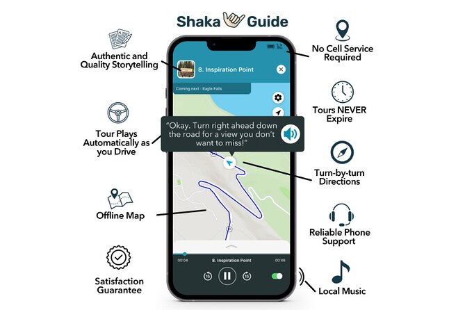
I especially like the hands-free setup: the narration and directions play automatically as you drive, and the offline map keeps working with no data needed. I also like that it’s private per group (up to 15 people) and priced like a budget-friendly add-on rather than a pricey guide. One drawback to plan for: you’re relying on your phone screen and GPS, so if your app view is hard to follow while driving, you’ll want to be extra careful at each pull-off.
In This Review
- Key Takeaways Before You Start
- Lake Tahoe by Car, Guided by GPS Audio
- Price and Value: What $13.59 Per Group Really Buys You
- Getting the Offline Audio to Work Smoothly
- Memorial Point to Sand Harbor: East Shore Trail Starts the Day
- Cave Rock and Zephyr Cove: Shoreline Wonders in Different Moods
- Nevada Beach and Heavenly Village: Easy Walks and Big-Name Tahoe Energy
- Tallac Historic Site and Taylor Creek: Forest Walks With a Seasonal Twist
- Inspiration Point to Emerald Bay State Park: The Overlook Run
- D.L. Bliss and the Rubicon Trail: Short Hikes for Big Views
- Sugar Pine Point, the Hellman Ehrman Estate, and a Final Forest-to-View Rhythm
- Tahoe Dam, Watson Cabin Museum, and the North Shore Loop
- Historic Stateline Fire Lookout and the Incline Village Finish
- Timing Tips: How to Avoid a 12–15 Hour Day Melting Into Chaos
- Who This Audio Tour Works Best For
- Should You Book This Lake Tahoe Self-Guided Audio Tour?
- FAQ
- Is the Lake Tahoe audio tour in English?
- Do I need Wi-Fi or data to use the tour?
- How long does the tour take?
- What does the tour price include?
- Are parking fees and entrance fees included?
- Does the tour expire?
Key Takeaways Before You Start
- GPS-activated audio: narration, music, and directions play as you drive
- Offline map + offline tour access: download ahead, then go without data
- Private group format: one tour per vehicle/group, up to 15 people
- Flexible pacing: pause, skip, or linger at stops based on your day
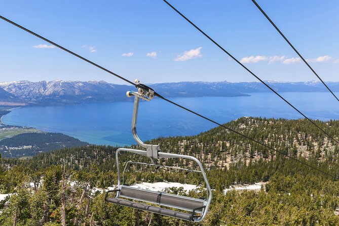
- A full Tahoe loop: beaches, overlooks, state parks, and a few short hike options
Lake Tahoe by Car, Guided by GPS Audio
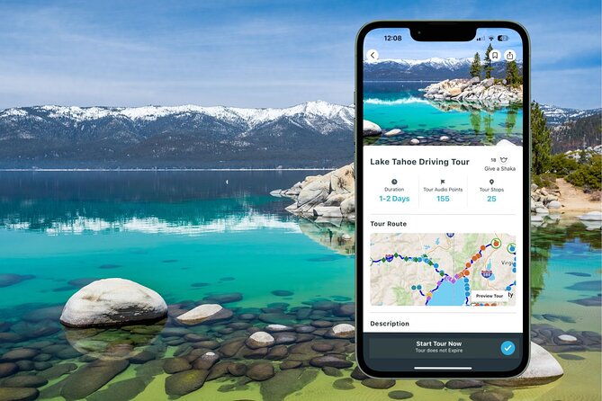
This tour is built for a road trip mindset. You follow the suggested route by GPS, and your car ride becomes a guided experience through the best-known Tahoe moments, with stories and practical pointers layered on top.
The key is the automation. Your audio narration and directions are designed to start when you’re near the next stop, so you’re not constantly hunting through menus. It also includes music, which sounds small, but it helps keep the drive from feeling like a chore.
Since you’re self-guiding, you control the tone of the day. If you want quick stops for photos and views, you can. If you want to stretch a beach walk or do a short trail loop, you can do that too.
You can also read our reviews of more tours and experiences in Nevada.
Price and Value: What $13.59 Per Group Really Buys You
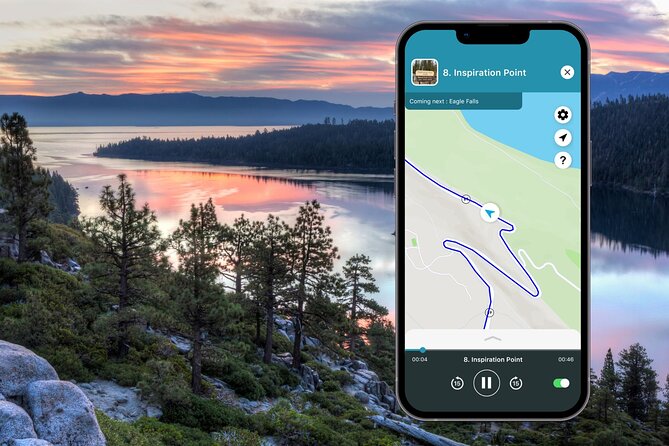
At $13.59 per group (up to 15), the price is the easiest part. This isn’t priced like a per-person tour where one extra traveler suddenly changes the math.
What you’re really paying for is structure. Lake Tahoe can be tough to “plan” because the best bits are scattered and you’ll often be repeating the same types of lookouts unless you know the stops. This audio route strings together those highlights into a route that makes sense for a long driving day.
You should still expect a few extra costs outside the tour price. The tour itself does not include parking fees or entrance fees, even though many of the listed stops show “admission ticket free” in the experience notes. Translation: you may save money on tickets, then still pay for parking depending on where you stop.
Getting the Offline Audio to Work Smoothly
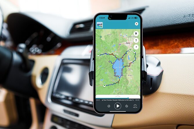
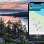
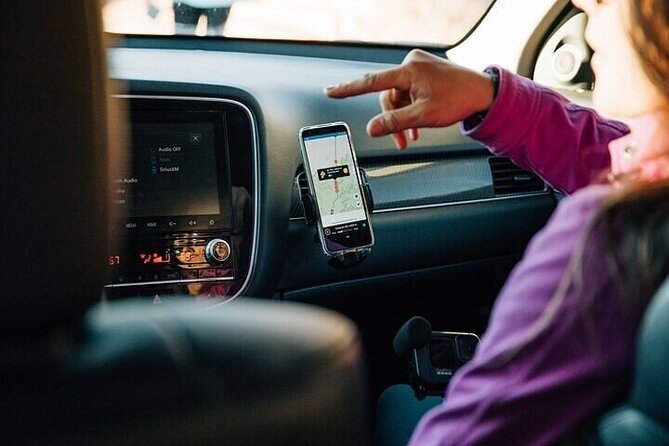
The setup is straightforward, but it matters. Download the tour using strong Wi‑Fi before you start your driving day, then use the app on your phone with GPS turned on so the narration can cue itself as you drive.
Here are the practical things I’d do to avoid the most common self-guided frustration:
- Charge your phone fully before leaving your lodging.
- Pick a safe place to check the next stop before you roll to it.
- If your car has poor signal inside tunnels or heavy tree cover, keep an eye on the GPS route line.
One thing the tour promises is that your audio and offline map do not require continuous internet. So once you’re out there, you’re not stuck hoping cell service will come back before you reach the next viewpoint.
Memorial Point to Sand Harbor: East Shore Trail Starts the Day

The tour kicks off at Memorial Point Scenic Overlook, and the timing of that matters. This start is where you begin the east-side drive on the Nevada side heading south along Highway 28, with big views in multiple directions.
From here, you’re in prime “Tahoe wow” territory: lake views, Sierra Nevada mountains across the water, and the Carson Range off to your left. If you’re doing more than just one day around Tahoe, I’d treat this stretch as a preview of the kind of walking you can come back for, especially with the East Shore Trail running alongside.
Then you move into Sand Harbor, which is the beach stop that feels like a whole park of its own. It has three distinct beachfront areas with different looks, plus a nature boardwalk that’s described as an absolute must-do for spotting wildlife and getting water views for miles.
At Sand Harbor, you’ll also notice a smart mix of easy and rewarding choices:
- The visitor center zone includes a cafe and a place to sit outside with lake views.
- The far-south area is described as great for stand-up paddleboarding because of shallow water extending out.
- The north-side sections have huge boulders that are fun for kids climbing on them, and they also give photos that instant “Tahoe character.”
You can pay the entrance fee and park inside, but the tour notes say you should park wherever you can once you’re in. So don’t plan on a perfect parking spot; plan on a short walk once you park.
Cave Rock and Zephyr Cove: Shoreline Wonders in Different Moods
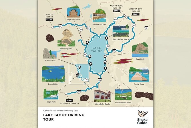
After Sand Harbor, the route keeps pushing you into quick-hit scenery. One of the most memorable entries is Cave Rock, approached via a drive that includes a short tunnel. The payoff is shoreline-level viewing where you look straight up at the formation and cave.
This is one of those stops where the “I’m just getting out for a minute” plan often turns into “okay, I’ll stay a bit.” The formation is close, and you can take your time looking for angles that show how the cave relates to the rock face.
Next up is Zephyr Cove, which works two ways. If you’d rather not pay another entrance fee, the tour suggests you can pull in, park near the restaurant and general store, and still see the beach and forest surroundings.
If you do pay and linger, Zephyr Cove adds more options: volleyball, water activity rentals, and even a paddlewheeler boat ride (the M.S. Dixie Paddlewheeler is mentioned). This is a good stop when you want to shift from “views through the windshield” to “Tahoe day mode.”
Nevada Beach and Heavenly Village: Easy Walks and Big-Name Tahoe Energy
Nevada Beach is described as stunning, and the direction details help here. You’ll see a wooden fence along the road, and the tour suggests you can turn around and find parking along the fenceline if you’d rather not park in a lot.
From there, it’s a walk down a path to the shoreline. The best part, according to the route notes, is the view outward across mountains with tall trees lining the water, creating a different kind of Tahoe photo than the more famous boulder-and-peninsula spots.
Then the route heads into Heavenly Village Way. This stop is less about hiking and more about choices. The tour points you to buy gondola tickets at the Heavenly hotel lobby if you want elevated lake views, which is useful when the weather clears and you want the “from above” perspective.
Tallac Historic Site and Taylor Creek: Forest Walks With a Seasonal Twist
At Tallac Historic Site, you get a change of pace. Instead of just looking out over the water, you walk through old summer estates in a forest setting, which makes the lake feel closer because you’re moving at human speed.
Some cabins are tourable if the Baldwin Museum is open, and the tour notes encourage you to explore the old log cabin mansions along the water. Even if you don’t do a full inside tour, simply walking the paths can feel like a “Tahoe lived-in” experience rather than a postcard loop.
The next stop is Taylor Creek Visitor Center, and the route calls it optional if you’re short on time. The main reason to care is salmon spawning season, when you can follow the creek along the Rainbow Trail and watch orange salmon swimming upstream.
So this is a stop you choose based on month. If you’re visiting outside that season window, you might treat it like a quick nature break rather than a highlight.
Inspiration Point to Emerald Bay State Park: The Overlook Run
Once you leave Taylor Creek, the route climbs again until you’re around 8,000 feet. The tour is blunt about safety here: there are no guardrails at the overlook points, so keep your eyes on the road and only look when you’re stopped and parked safely.
The reward is Inspiration Point Vista, with a jaw-dropping view of Emerald Bay. The tour specifically calls out Fannette Island as the only island in all of Lake Tahoe, sitting in the middle of Emerald Bay. That kind of fact is exactly why audio tours are worth it; it turns a view into something you can remember.
Next comes Eagle Falls Trail. This stop depends on when you’re going. In spring or early summer, you may get a stronger waterfall because of snowmelt. Later in summer or fall, it may trickle or even be quiet, and at that point you’d skip it unless you just want an easy forest hike.
Then you enter Emerald Bay State Park, where the photo opportunities are described as spectacular: the emerald-green bay, shoreline, tiny island, and the castle setting. The hike is described as pretty nice too, with pocket waterfalls and rugged cliff views along a wide, well-worn path.
D.L. Bliss and the Rubicon Trail: Short Hikes for Big Views
The D.L. Bliss State Park portion is one of the best “choose your effort” areas in the whole loop. The tour suggests stopping inside a visitor center for maps, souvenirs, and to talk with a ranger or volunteer about conditions around things like the Rubicon Trail and where to park for Balancing Rock.
Then you hit Balancing Rock Nature Trail, a short path to a formation that looks like it could topple. If you like a quick photo moment, this is ideal because it’s relatively compact and you get a unique Tahoe-shaped photo out of it.
After that, you can walk Lester Beach among Tahoe’s iconic boulder formations. The route says it’s not a priority if you’re short on time or parking is tight, which tells you something important about pacing: this section can add time quickly if you keep saying yes to every beach.
Then comes Rubicon Trail. It’s described as popular and super long, but you don’t need the full thing. The recommendation is to take about ten minutes out and back to see the lake view high along the cliffs. You should stick to the path, and the tour also mentions an abandoned lighthouse trail that can be more time-consuming and challenging.
If you’re feeling energetic and really want the long version, the notes say the trail can lead all the way to Emerald Bay and Vikingsholm Castle.
Sugar Pine Point, the Hellman Ehrman Estate, and a Final Forest-to-View Rhythm
At Sugar Pine Point State Park, the standout is the shoreline walk that leads to a photo spot where railroad tracks head into the lake. The tour notes say you can see the tracks almost to the bottom of the lake floor, thanks to water clarity.
After that, you reach a nature center stop and then an estate area where you can tour the Hellman Ehrman mansion or walk the grounds. The tour guide language suggests stepping onto the back porch for a lake view, then walking down across a big lawn to a pier.
Then the route shifts into a valley view with ski slopes above that hosted the Olympics. The tour notes that in summer or fall, when the area is green and lush, the view can feel like a different world. If the gondola is open, you can ride it to a top exhibit with an Olympic museum display and Washoe tribe displays.
This valley section works well when you want a break from beaches and you don’t mind a little “drive, park, short walk, view” rhythm.
Tahoe Dam, Watson Cabin Museum, and the North Shore Loop
Back on the northwest shore, you reach Lake Tahoe Dam, described as an engineering marvel in charge of regulating water levels as part of the Tahoe Regional Water System. It’s only a quick stop, but it gives you a different kind of Tahoe story beyond scenery.
Next up: Commons Beach in Tahoe City. This is described as a sandy public park with picnic areas and a playground, which makes it a good rest stop if you’re traveling with kids or you just want to stretch without committing to a long hike.
Then you stop at Watson Cabin Museum for the Watson log cabin and Penny Bear. The notes also mention that you can walk out on a public pier from there and see across toward Heavenly Mountain.
You’ll also pass Carnelian Bay, with a suggestion to stop quickly for a photo if the view pulls you in. Then the route continues to Kings Beach, but the tour puts it in perspective: it’s popular, but if you already did Sand Harbor, it’s not necessary. The water gets warmer and shallower longer at both places, but the tour says Sand Harbor wins for that “mesmerizing” vibe.
Historic Stateline Fire Lookout and the Incline Village Finish
For one of the best unique viewpoints, the route includes Historic Stateline Fire Lookout. It’s a semi-paved path to an old fire lookout above 7,000 feet, and you get a view over Lake Tahoe you won’t find anywhere else, according to the route notes.
The final stretch includes an overlook along a hairpin turn out of Incline Village for one last Lake Tahoe look down. Then you finish at the Tahoe Meadows Ophir Creek Trailhead, where you can walk a scenic path through meadows and forests.
The tour describes this as gentle terrain with wildlife viewing opportunities, and a chance to connect with the unspoiled beauty of the area without needing a long, intense hike.
Timing Tips: How to Avoid a 12–15 Hour Day Melting Into Chaos
The tour estimates 12 to 15 hours total, which is a full day in the car. Your stop durations range from 5–30 minutes at many overlooks to longer blocks like Rubicon Trail and the potential multi-step Emerald Bay hike.
If you want a calmer pace, don’t treat every “free admission” stop as equally important. Pick a few must-dos for walking and hiking, then use the others for quick photos, shoreline peeks, and short viewpoint moments.
Also remember: this is a self-guided driving route. You’ll still need to build in the real-world time for parking, walking to each pull-off, and getting back to the car. The GPS audio helps, but it doesn’t replace the time it takes to park and unload.
Who This Audio Tour Works Best For
This is a great fit if you want structure without a schedule. You’ll like it if you’re comfortable driving and you’re okay mixing short walks with scenic pull-offs.
It’s also a strong choice if you’re traveling as a group in one car. Since the pricing is per group up to 15 and the tour experience is private, it can be a smart option for families or friends who want one shared guide-style experience.
If you’re the type who hates tech while driving, you might find the experience frustrating. One lower rating mentioned difficulty following the app and not being able to see attractions described, and that’s a reminder: your phone setup matters, and you should check the next stop safely when parked.
Should You Book This Lake Tahoe Self-Guided Audio Tour?
Book it if you want a full-day Lake Tahoe drive that includes real information, clear GPS guidance, and the freedom to skip what doesn’t fit your mood. At $13.59 per group, the value is strong, especially if you’re using the offline features and staying organized enough to catch the audio cues.
Skip it or think twice if your phone experience in the car is unreliable, your screen is hard to read, or you don’t want to handle app-based directions at all. If that’s you, a traditional guided tour might feel easier.
If you do book, plan your day around your hiking comfort. Pick your top walking priorities like Sand Harbor boardwalk time, Emerald Bay State Park, and a short Rubicon Trail out-and-back, then let the rest be quick hits. That approach makes the whole loop feel like a Tahoe greatest-hits day instead of a checklist.
FAQ
Is the Lake Tahoe audio tour in English?
Yes. The tour is offered in English.
Do I need Wi-Fi or data to use the tour?
No. The audio and offline map are designed to work offline. You do need strong Wi‑Fi to download the tour before you go.
How long does the tour take?
It’s listed as approximately 12 to 15 hours.
What does the tour price include?
It includes an offline audio guided tour with automatic narration while you drive, GPS turn-by-turn directions, an offline map, and the ability to explore at your own pace. It is private for your group.
Are parking fees and entrance fees included?
No. Parking fees and entrance fees are not included in the tour price.
Does the tour expire?
No. Tours never expire, so you can download and choose the day that works for you.