REVIEW · BANFF
Self-Guided Audio Tours for the Canadian Rockies
Book on Viator →Operated by GuideAlong (GyPSy Guide) · Bookable on Viator
The Rockies are better when the car talks back. This self-guided audio route stitches together Banff, Lake Louise, Yoho, Icefields Parkway, and Jasper with GPS-triggered stories and practical stop notes.
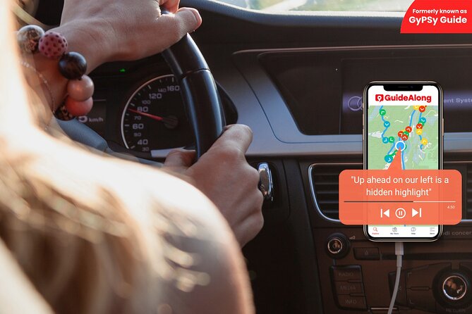
I really like the location-based autoplay setup. As you drive, the narration starts when you reach each point, so you get history, wildlife hints, and what to look for right as you need it.
One thing to consider: a few big-name stops cost extra on top of the tour, and you’ll want to plan for National Park Passes plus attraction tickets like Banff Gondola and hot springs.
In This Review
- Key Points You’ll Care About on the Road
- Price and Tech: What the $39.99 Gets You (and What It Doesn’t)
- Banff Gondola, Bow Falls, and Surprise Corner: Icon Views Without Waiting for a Tour Group
- Cave and Basin to Upper Hot Springs: Thermal Springs, a Tiny Snail, and Real Banff Character
- Minnewanka, Hoodoos, and Vermilion Lakes: Easy Time in Nature That Doesn’t Require Big Fitness
- Banff-to-Lake Louise by 1A: The Slower Route, the Big Photos, and Johnston Canyon’s Catwalks
- Lake Louise and the Weeping Wall: Turquoise Photos and a Frozen-Melt Mystery
- Icefields Parkway: Where the Audio Helps You Catch What You’d Miss
- Athabasca Glacier and the Columbia Icefield: The Spots You Need the Most Planning for
- Yoho National Park and Kicking Horse: Takakkaw Falls to Emerald Lake Without Overthinking
- Jasper SkyTram, Maligne Canyon, and Maligne Lake: Views, Walks, and a Cruise You Should Prebook
- Mt. Edith Cavell and Miette Hot Springs: Two Ways to End a Big Driving Day
- Should You Book This Self-Guided Rockies Audio Tour?
- FAQ
- Is this tour self-guided or do I meet someone?
- How much does it cost and how many people can use one purchase?
- Does the audio work offline in the Canadian Rockies?
- What language is available for the audio?
- Do I need tickets or a park pass for the stops?
- How does the audio know when to play at each stop?
- Can I start and end at different points along the route?
Key Points You’ll Care About on the Road
- GPS-triggered autoplay: you don’t have to press play at every turn
- One group purchase up to 8 people: group savings are real for a private vehicle day
- 520 audio points: lots of short stops, not just a few headline sites
- Download and go offline: no cell signal needed once you’ve saved the tour
- Some ticketed attractions cost extra: hot springs and select sites may add fees
Price and Tech: What the $39.99 Gets You (and What It Doesn’t)
This is a self-guided audio tour sold per group for $39.99, good for up to 8 people in your vehicle. That pricing model matters in the Rockies, where a “drive-it-yourself” day can get expensive fast if you book multiple paid activities for each person.
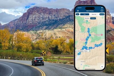
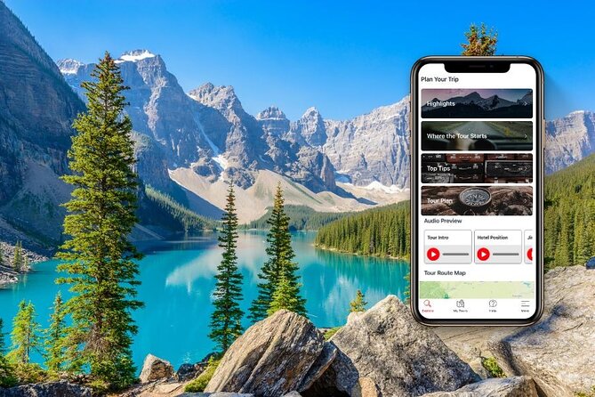
The real value is the app. GuideAlong (GyPSy Guide) delivers 520 GPS points, with stories, tips, and directions that autoplay based on your phone’s location. You can also use trip planners (in-app, web, and PDF), plus flexible routing—either follow suggested routes or create your own.
You’ll love the offline design. Download the tour before you leave (over WiFi or cellular data), then you can tour without internet once it’s saved to your phone. That’s a big deal along mountain roads where signal can be spotty.
What’s not included is the money you’ll spend at the gates and ticket windows:
- National Park Passes (not included)
- Attraction tickets vary, including Banff Gondola, Cave and Basin, and Banff Upper Hot Springs
- The tour lists set add-on costs for some stops: Banff Upper Hot Springs $17.50 per booking and Cave and Basin National Historic Site $9.00 per booking
If you’re the kind of traveler who wants freedom but also doesn’t want to “wing it” every turn, this is a strong match. It’s also a private activity—only your group participates—so you’re not negotiating schedules with strangers.
Banff Gondola, Bow Falls, and Surprise Corner: Icon Views Without Waiting for a Tour Group
Your Banff start is built around three quick, high-impact stops—perfect for a first taste of the town’s mountain power.
Banff Gondola (Sulphur Mountain) is the classic for a reason: you ride up to Sulphur Mountain for 360-degree mountaintop views across six ranges. Then you can follow the boardwalks toward the Cosmic Ray Station. If you’re lucky, you might even spot bighorn sheep along the boardwalks. When the light turns softer, the top area makes room for lingering—bistro and coffee options, plus market-style dining—so sunset can be part of the plan. Ticket timing matters because the gondola admission isn’t included.
Bow Falls is a calmer counterpoint. It sits on the Bow River near the Banff Springs Hotel, just before the Spray River joins in. One practical note: water levels change a lot through the year, especially during spring thaw. A small parking area and trail lead you to a higher viewing spot, which helps when you want a cleaner angle.
Then come Surprise Corner, famous for the layered view: Bow Falls below, the Banff Springs Hotel in the middle distance, and Sulphur and Rundle Mountains as the backdrop. It’s close and easy to access, with a small carpark and viewing platform across the road. The one caution here is obvious but important: it’s a blind corner, so keep your head up for traffic.
If you do Banff as your warm-up day, aim for a morning start for Gondola. You’ll get better photo light and less rushed energy.
Cave and Basin to Upper Hot Springs: Thermal Springs, a Tiny Snail, and Real Banff Character
Banff doesn’t just do views. It also does steam and story.
Cave and Basin National Historic Site explains why Banff became what it is. The area was known and used by First Nations people, and in 1883 three railway workers discovered the cave and its thermal mineral springs. That discovery kicked off major attention that ultimately helped lead to Canada’s first national park. On site, you can visit the Interpretive Centre and walk boardwalks to see the original underground cave and the endangered Banff Springs snail.
This stop is a good fit for people who like understanding how a place got its reputation—not just seeing it. It’s also timed well: the walk approach is straightforward, and you’ll spend enough time there to feel you learned something, not just passed through.
Next door in spirit is Banff Upper Hot Springs, where the old mountain-health retreat idea comes alive. The minerals listed for the soaking water include sulphate, calcium, bicarbonate, magnesium, and sodium. The water runs about 37–40C / 98–104F, and it’s described as the only hot springs where you can bathe inside Banff National Park.
These hot springs sit above the gondola base station, so the pairing works well if you’re already in the Sulphur Mountain area. Just plan for the extra admission cost: $17.50 per booking.
Minnewanka, Hoodoos, and Vermilion Lakes: Easy Time in Nature That Doesn’t Require Big Fitness
After Banff’s big hitters, the tour shifts into spots that feel “low effort, high payoff.”
Lake Minnewanka is a glacial lake with added structure—three small dams expanded it over time. The name connects to Nakoda language (meaning water of the spirits). If you want a relaxing wildlife-focused plan, look into cruise options on the lake (the route is 21 km / 13 miles). Shoreline animals can show up, and you’ll also hear about Aboriginal artifacts discovered there with roots around 10,000 years.
If you’d rather stretch your legs, the Stewart Canyon hike is described as easy and rewarding: 6.4 km / 4 miles return. Locals and travelers enjoy the area with ice cream or BBQ style downtime once you’re done.
Then you switch to something that looks unreal: Hoodoos Trail. Hoodoos—fairy chimneys or goblins in other places—are rock spires shaped by rain, wind, and ice erosion. The trail is easy and flat to a viewpoint that frames the Bow River and Rundle Mountain.
Finally, Vermilion Lakes bring wildlife potential close to town. These shallow wetland lakes are great for birds, and there’s occasional chance of coyotes, and sometimes even bear and moose. The walk or bike access from downtown makes it simple to fit in, and canoe access can be possible from the Bow River when water levels spill into Echo Creek.
All three are usually short stops on a driving day, which is ideal if you want more “outdoor time” without burning daylight.
Banff-to-Lake Louise by 1A: The Slower Route, the Big Photos, and Johnston Canyon’s Catwalks
Instead of taking the fast highway, this route encourages you to use the old Trans Canada Highway 1A between Banff and Lake Louise. It’s a quieter way to experience the same dramatic peaks, plus there are more scenic pull-offs.
Two iconic photo spots get attention here: Castle Mountain and Morant’s Curve, where you can try to recreate the famous historic train marketing photograph.
For wildlife viewing, the Bow Valley Parkway is another useful stretch. You’re likely to spot animals if you’re patient and keep an eye on the roadside.
The biggest practical stop on this leg is Johnston Canyon. It’s one of Banff National Park’s most popular natural attractions. The hike is relatively short: 1.1 km / 1 mile along the trail and steel catwalks built into the canyon walls to reach the Lower Falls. There’s an optional crouch tunnel through a short opening to a final platform.
If you’ve got more energy, continue to Upper Falls—the grade increases. In summer, the canyon can feel like natural air-conditioning because of the cool mist. In winter, expect a completely different scene: frozen waterfalls and snow-covered trees.
Then comes Moraine Lake, the “Canadian $20 bill” icon, framed as the Valley of the Ten Peaks. Here, you can enjoy canoeing, walk to viewpoints like Rockpile, or head toward Consolation Lake. There’s also Moraine Lake Lodge for a meal plan if you want a more sit-down approach.
Moraine Lake is typically thawed June to October, so timing matters.
Lake Louise and the Weeping Wall: Turquoise Photos and a Frozen-Melt Mystery

Lake Louise is described as turquoise and framed by towering peaks and Victoria Glacier. You can get great photos from the lakeshore, and if you want a hike, the route lists two well-known options: the Plain of Six Glaciers area and the Lake Agnes Tea House trails.
One detail that’s very practical: bring cash for the teahouses after your hike. The data notes there’s no debit or credit payment available onsite. If you’d rather go slower, you can rent a canoe or take the Lake Louise Sightseeing Gondola.
Then there’s the short stop called the Weeping Wall. You drive under an impressive cliff where snowmelt oozes through rock, trickling down through winter too. In colder months, it becomes great for ice climbers, since it turns into frozen falls.
Even if you don’t climb, it’s a reminder that the Rockies aren’t only about summer. They’re a year-round engineering system for water, ice, and rock.
Icefields Parkway: Where the Audio Helps You Catch What You’d Miss
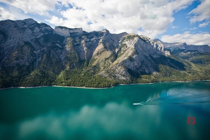
The Icefields Parkway is the spine of the whole experience. It’s described as the World’s Most Beautiful Mountain Drive, and your audio guide is set up to point out must-do stops and optional side explorations along the way.
The way it’s framed matters: the narration isn’t just repeating big facts. It’s timed to the drive, so you get context when you’re actually seeing the mountains, brightly colored lakes, glaciers, and waterfalls. Wildlife odds are also called out as good on this route, which encourages you to stay observant while you drive.
Some of the most memorable stops on this stretch include:
Parker Ridge Trail near the Icefield Centre: short but steep, with a reward view over the Saskatchewan Glacier. Elevation is flagged—about 6,000 feet—so if you’re not used to altitude, pace yourself. Snow can appear on the trail year-round. Most people spend about 1.5 to 2 hours for it.
Crowfoot Glacier: a hanging glacier alongside Bow Lake. It’s named for the way the glacier used to form three toes shaped like a crow’s foot, but as the glacier shrinks, it now has two “toes.” It’s a good “read the shape” kind of stop.
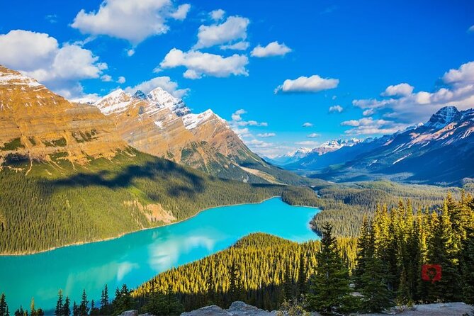
Peyto Lake: located at Bow Summit, which is the highest point on the Icefields Parkway. It’s described as glacier-fed and likely among the most superbly colored mountain lakes you’ll see, especially when the sun is out—more sunshine usually means brighter color.
Bow Lake rounds out the glacier-and-lake theme, fed by the Bow Glacier. It also connects to the Bow River system that runs through Banff National Park toward Calgary. A nearby historic lodge, Num Ti Jah, is built by early guide Jimmy Simpson. The building’s hexagonal log design is explained as a practical solution when only small trees were available, and it’s described as having been the largest log building in the world at one time.
One ticket caution: Bow Lake is marked with admission not included on the tour description, so if there’s any paid component nearby, budget for that.
Athabasca Glacier and the Columbia Icefield: The Spots You Need the Most Planning for
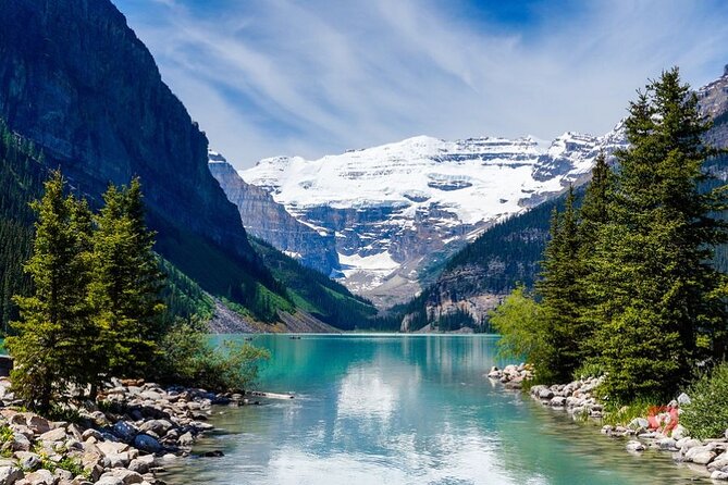
If you want the Rockies’ glacier scale in a way that’s accessible, the Athabasca Glacier area is the core. It’s called one of the most accessible glaciers in the world. You can view from the Columbia Icefield Discovery Centre, or you can book a larger on-ice experience.
The Columbia Icefield Discovery Centre is where the logistics come together. You can drive right to the toe of the glacier and watch markers showing how far it has retreated over more than a century. If you book the Columbia Icefield Adventure Tour, you’ll go up onto the glacier on an Ice Explorer vehicle. That combined experience also includes a separate bus to the SkyWalk, described as a glass-bottomed viewpoint out over a canyon.
Give yourself time. The tour notes you should allow at least 3 hours for the combined experience. If you’re short on hours, the SkyWalk can be booked on its own.
Then keep moving to Sunwapta Falls and Canyon. Great viewpoints are accessed within about a minute of the parking area. If you want a loop walk, there’s a 3 km loop trail that can be done in about an hour.
This whole glacier section is where the audio truly pays off. When you hear what you’re looking at while you’re standing in front of it, it changes how you notice details.
Yoho National Park and Kicking Horse: Takakkaw Falls to Emerald Lake Without Overthinking
Once you swing west of Lake Louise, Yoho National Park is set up as a two-hour stretch with a few big stops plus short extras.
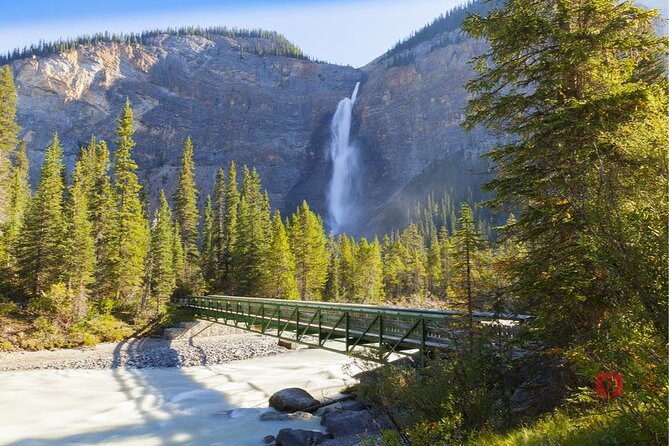
Takakkaw Falls is the headline. It’s described as the biggest of the region’s waterfalls. You’ll feel the mist from this glacier-fed cascade. The road to the falls may not open until June due to avalanche hazards, so plan your dates accordingly. It’s also flagged as a good wildlife area, especially with the drive through Yoho Valley and short scenic stops.
Next is Emerald Lake, an alpine lake with standout color and mountain peaks around it. There’s an option for a flat hike around the perimeter or a canoe on the blue water. If you want food without packing a full picnic, the lakeside lodge is named as a good lunch option, from casual to more gourmet.
A bonus stop is Natural Bridge on the access road.
To add a history break from water and rock, you’ll reach the Lower Spiral Tunnels Viewpoint. It’s tied to the nation-building story of completing a rail route connecting Atlantic and Pacific oceans. The tunnels show engineering ingenuity for steep grades, and from the viewpoint, trains appear to pass over the top of themselves as they climb and descend through Kicking Horse Pass.
Jasper SkyTram, Maligne Canyon, and Maligne Lake: Views, Walks, and a Cruise You Should Prebook
As you head further into Jasper-area scenery, the tour keeps mixing big views with short-to-moderate walks.
Jasper SkyTram is one of the easiest ways to get high views. It’s at Whistlers Mountain near Jasper (different from the Whistler ski resort). The tram glides to 2,200 m / 7,200 ft, and at the top you can hike higher into the alpine to viewpoints above treeline, or enjoy mountaintop dining. Admission isn’t included, so treat it as an add-on if you want the tram portion.
Then shift to classic Jasper nature:
Pyramid and Patricia Lakes: an iconic view across Pyramid Lake to Pyramid Mountain. A small footbridge lets you access a photo angle that includes an island. The tour also notes a secret WWII project tested on nearby Patricia Lake.
Maligne Canyon: limestone carving made it deep and narrow. It’s close—only a minute walk from the main parking area to canyon views. If you want more, you can start from the 5th Bridge location and follow trails that run the canyon length.
Maligne Lake: you arrive after passing Maligne Canyon and Medicine Lake. Shore access is straightforward, and the big signature activity is the cruise to photograph the iconic Spirit Lake scene. The tour strongly notes you should prebook your cruise time if you plan to do it.
If you’re chasing waterfall energy next, add Athabasca Falls near the Jasper end of the Icefields Parkway. In spring thaw, snowmelt delivers a big water show through a narrow canyon.
For big-scenery photos with some wildlife chance, Old Fort Point Loop Trail is a short stair climb and loop. Big horn sheep are common around here.
Mt. Edith Cavell and Miette Hot Springs: Two Ways to End a Big Driving Day
To finish strong, you’ve got two very different “relax and reset” options.
Mt. Edith Cavell is a sidetrip that needs time. It’s described as requiring a minimum of 2 hours. Two hikes branch from the viewpoint and carpark:
- Path of the Glacier: 1.6 km / 1 mile with about 70 m / 230 ft elevation change to Cavell Pond. You may see icebergs floating from above Cavell Glacier.
- Cavell Meadows Trail: 7 km / 4.3 miles with about 500 m / 1,640 ft elevation change. Mid-summer is recommended, with wildflowers plus views of Angel Glacier, and you might hear squeaking mountain pikas and see ground squirrels.
Snow can appear year-round on parts of this region, so take it slow and plan for changing conditions.
Then there’s the pure soak option: Miette Hot Springs. These are described as the hottest thermal pools in the Rockies. You get scenic views while soaking, and it’s described as relaxing after long sightseeing. Drive time from Jasper is about 50 minutes (as listed), and the road follows the Athabasca River with wildlife viewing opportunities, plus short viewpoint stops.
Should You Book This Self-Guided Rockies Audio Tour?
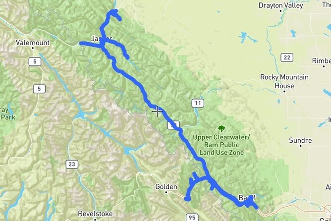
I’d book this if you want maximum freedom and you’re comfortable driving a long day through iconic parks. The GPS-triggered audio is the key advantage: you don’t just get facts, you get guidance at the moment you’re standing on the roadside.
It’s also a smart pick for groups because the tour is priced per group up to 8 people, and the app can be used with one phone per vehicle setup. If you love to mix big attractions with quick walks—Gondola views in Banff, catwalk hikes like Johnston Canyon, glacier scale stops on the Icefields Parkway, and then Jasper trails—you’ll find plenty to do without feeling stuck.
Skip it (or at least plan carefully) if you hate optional add-on admissions. Several major experiences cost extra, and you’ll still need National Park Passes. Also, this is driving-first travel, so you’ll want a vehicle-friendly itinerary mindset.
If you’re the type who likes your day to flex with weather, crowds, and detours, this audio tour is built for that. Download ahead, charge your phone, pack earbuds for the walks, and let the car guide your eyes.
FAQ
Is this tour self-guided or do I meet someone?
It’s self-guided with an audio guide that plays automatically based on GPS location. The activity is private, and only your group will participate.
How much does it cost and how many people can use one purchase?
The price is $39.99 per group, up to 8 people in your vehicle.
Does the audio work offline in the Canadian Rockies?
Yes. You can download the tour to the GuideAlong app before you go, and it’s designed to work offline once downloaded.
What language is available for the audio?
The audio tour is offered in English.
Do I need tickets or a park pass for the stops?
National Park Passes are not included. Some attractions have separate admission fees, including Banff Gondola, Cave and Basin, and Banff Upper Hot Springs.
How does the audio know when to play at each stop?
Commentary plays automatically as you drive using your phone’s GPS chip, based on your location.
Can I start and end at different points along the route?
Yes. The audio is based on your GPS location, so you can start and end anywhere along the tour route. The start and end locations listed are in Banff National Park and Jasper National Park.