REVIEW · OUTER BANKS
Outer Banks Self-Guided Driving Audio Tour
Book on Viator →Operated by Travel with Action · Bookable on Viator
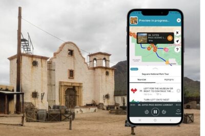
The Outer Banks sound better in the car. This self-guided drive pairs hands-free GPS audio with offline maps, so you can keep rolling even when cell service gets sketchy. I also love how the stories focus on specific places, not vague facts, which makes the coast feel personal instead of random.
You’ll get a long stretch of scenery—about 40+ miles and 35+ audio stories in roughly 2 to 3 hours—without the pressure of a group schedule. My favorite part is the freedom: you can start and pause whenever you want, then pick back up later. One drawback to plan for: the experience relies on your phone triggering at the right spots, so if you start anywhere else, audio may not play smoothly.
If you’re the type who likes to drive, make a few photo stops, and learn at the same time, this is a smart way to see both the coast and the background stories. If you’re not into tech, give yourself time to get the audio downloaded before you drive, because offline setup matters here.
In This Review
- Key highlights you’ll feel on the road
- GPS audio through the Outer Banks: what this format does right
- Price and time: deciding if it fits your Outer Banks plan
- Start where the route makes sense: Cape Hatteras National Park Road
- Whalebone Junction to Bodie Island: shipwreck stories in real sand country
- What you should do at this early stretch
- Oregon Inlet and the rescue history you can actually see
- A tip that improves the experience
- Pea Island National Wildlife Refuge: birds meet barrier-island life
- Jughandle Bridge and Chicamacomico: the Coast Guard era, before the modern era
- Roanoke Island’s Mother Vine: a living time capsule
- Kite Point and the modern wind: when water turns into a sport
- Cape Hatteras Lighthouse and Cape Point: two different ways to read the coast
- Hatteras village and Teach’s Lair: Blackbeard as a way to navigate local place names
- WWII British Sailor Cemetery: a quieter, heavier stop
- Jockey’s Ridge State Park: when the dunes explain the whole barrier-island puzzle
- Wright Brothers National Memorial: hands-on science in big open space
- Avalon Pier: a simple add-on if you want food and ocean views
- Kitty Hawk, Kill Devil Hills, and the garage origin story
- Duck and Corolla: small-town stops plus wild-watersport energy
- Currituck Beach Lighthouse and Whalehead Club: big engineering and big money
- Practical tech tips so the audio behaves
- Who this driving audio tour is best for (and who should skip)
- Should you book the Outer Banks Self-Guided Driving Audio Tour?
- FAQ
- How much does this Outer Banks self-guided driving tour cost?
- How long will it take to complete?
- Is the tour available in English?
- Does it work offline without cellular service?
- Do I need tickets or attraction passes to enjoy the stops?
- Where does the tour start and end?
- Can I pause the tour and start again later?
- What if I need to cancel?
- Does it play audio automatically based on location?
Key highlights you’ll feel on the road
- Auto-play GPS audio: stories start on their own as you stay within the route and speed limit
- Offline maps and offline use: no signal is less of a problem after you download
- Per-car value: $24.99 per group (up to 4) is often cheaper than guided touring for the same drive
- A route packed with real places: lighthouses, life-saving stations, dunes, piers, and memorials
- Mostly free on-site stops: many stops list free admission, so you can spend money on food instead of tickets
- Great drive length for a half-day: about 2 to 3 hours without rushing, even with short pulls over
GPS audio through the Outer Banks: what this format does right
This is not a guided bus tour. It’s a do-it-yourself drive that still feels guided, because your phone handles the story timing. After you download the tour on strong Wi‑Fi/cellular, the app works offline, and the audio plays based on location cues. That means you can keep your eyes on the coast and your hands on the wheel, instead of constantly tapping buttons.
The practical win is the pacing. You’re looking at a barrier-island route with long, straight stretches where it would be easy to get bored. Audio changes that. You’ll hear shipwreck details, lighthouse engineering, rescue history, and local traditions right when you pass the real landmarks.
I also like that the tour is priced per group, up to 4. If you’re traveling with friends or family, this can be a strong value compared with per-person tours. For solo travelers, it’s still reasonable if you’ll actually use the 35+ story stops.
You can also read our reviews of more tours and experiences in Outer Banks.


Price and time: deciding if it fits your Outer Banks plan
At $24.99 per group and about 2 to 3 hours, the tour is built for a “drive day.” You’re not signing up for a full-day itinerary, and you’re not committing to timed entry tickets. Many stops note free admission tickets, so the cost mostly covers storytelling and navigation—not entrance fees.
How to decide if it’s for you:
- If you want one efficient, informative route and like to stop only when you choose, it fits well.
- If you want lots of deep museum time, you might end up wishing for longer stops at a few locations. This tour is more about getting the big picture while driving.
Also, because it’s app-based and GPS-triggered, you’ll have the best experience starting at the correct launch point and then sticking close to the speed limit and route guidance.
Start where the route makes sense: Cape Hatteras National Park Road

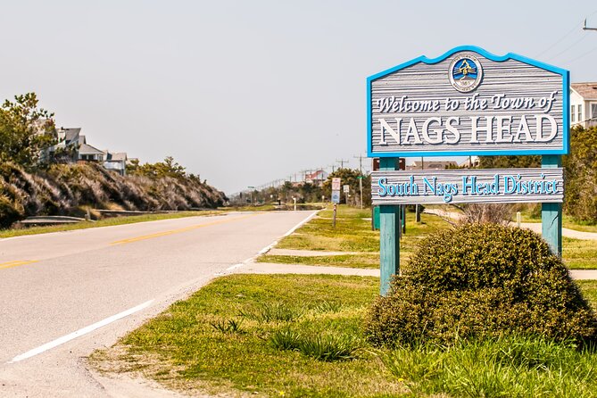
Your tour starts at Cape Hatteras National Park Rd, Nags Head, NC 27959. No staff meets you there. The idea is simple: arrive on-site, open Action’s Tour Guide App, enter the password you received by email/text after booking, and let the first story trigger automatically.
This matters because one complaint people have is getting the audio to behave. The tour should start on its own once you’re at the designated starting point, but if you begin elsewhere, it can feel like the app isn’t “finding” the route. I recommend giving yourself a little buffer time right before you plan to go. Download on strong Wi‑Fi, enter the passcode, and test audio before you hit the long stretch of driving.
Whalebone Junction to Bodie Island: shipwreck stories in real sand country

The first stop is Whalebone Junction Information Center at the Outer Banks Visitors Bureau. It’s a helpful way to set the tone—lost colonists, shifting sands, and the Outer Banks reputation for rough water and sudden disaster. This is where you learn what kind of stories the coast will feed you.
Then you move to Bodie Island Lighthouse. The audio focuses on the 1921 schooner Laura Barnes—foggy weather, a fatal miss of the shore, and a ship that survivors saved from sinking, while wreck remnants still sit lodged in sand today. The practical takeaway: when you look at this shoreline, don’t just see a pretty view. Think of how fog and wind can erase distances in seconds.
What you should do at this early stretch
- Take a couple minutes to orient yourself with the coastline view.
- If the weather is clear, use that moment to get your bearings for later dunes and inlet vistas.
Oregon Inlet and the rescue history you can actually see
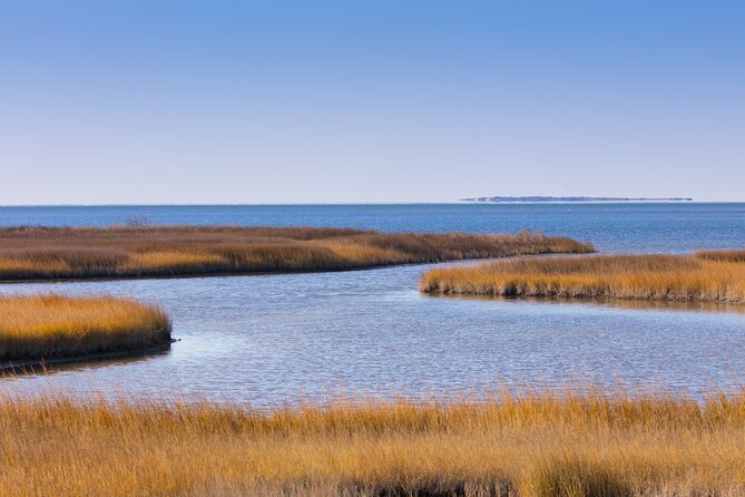
Next comes Oregon Inlet, where your audio explains how the inlet connects Pamlico Sound with the Atlantic Ocean, and how storms shaped the area’s geography. The story about the 1846 hurricane and a ship named Oregon ending up safely on a sandbar gives you a human scale for the forces at work here.
Then you’ll cross Herbert C. Bonner Bridge, and your audio turns to the bigger system behind the scenery: Pamlico Sound is described as about 80 miles long and roughly 18 miles wide, shallow enough to support productive fishing. You also learn why this region is so tied to water—commercial fishing focuses on crabs, oysters, and clams.
Right after, you’ll pass the Oregon Inlet Life-Saving Station (1874). This is one of the core Outer Banks themes: people building systems to survive a coast where navigation used to be far harder than it is now. The audio stresses what it meant to sail without radar, GPS, or sonar, and why shipwrecks became common enough to earn the Outer Banks nickname The Graveyard of the Atlantic.
A tip that improves the experience
Since you’ll pass multiple life-saving sites and museums, keep your expectations flexible. This tour is designed for short stops. If you want to linger, do it at the places that pull you in—otherwise you’ll feel rushed for the rest of the drive.
Pea Island National Wildlife Refuge: birds meet barrier-island life
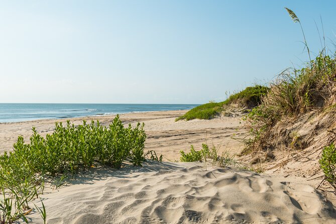
You’ll drive through Pea Island National Wildlife Refuge, covering 13 miles of preserve from the Oregon Inlet area down toward the community of Rodanthe. The story connects it to the Atlantic Flyway, describing the coast as a kind of travel corridor for migratory birds.
At Pea Island Beach, the audio reminds you that the beaches here are enormous—so you can still find a calm stretch even when the area is popular. Even if you skip swimming, a sit on the sand can break up the drive and reset your eyes for what’s next.
Jughandle Bridge and Chicamacomico: the Coast Guard era, before the modern era
Jughandle Bridge gets a quick “why is this even here?” moment. It’s a good example of how the tour doesn’t just list facts; it gives you reasons that make local geography make sense.
Later you’ll come to Chicamacomico Life-Saving Station Historic Site and Museum. The story parallels Oregon Inlet’s rescue role, including training and observation along the coast. It even mentions a particular rescue device known as a beach apparatus—an idea that makes you appreciate how much ingenuity went into saving lives when conditions were brutal.
Roanoke Island’s Mother Vine: a living time capsule

When you reach The Mother Vine on Roanoke Island, the audio shifts to something unusual: this is the oldest grapevine on the continent still producing grapes. It’s described as about 400 years old, though the exact origin date isn’t known.
This is the kind of stop that breaks the shipwreck-and-lighthouse pattern. It also makes a subtle point: while the Outer Banks is famous for storms and sea history, the land still grows things that outlast disasters.
Kite Point and the modern wind: when water turns into a sport
At Kite Point, you’ll hear how locals treat it like a hub for kitesurfing, and how the beaches around here have been popular with windsurfers since the 1970s. For me, this is an important contrast point: the Outer Banks is not only about wrecks. It’s also about using the wind and surf to create new traditions.
If you’re traveling in a windy season, this is one of the spots where you might actually see the sport in action without planning anything.
Cape Hatteras Lighthouse and Cape Point: two different ways to read the coast
The tour then moves to Cape Hatteras Lighthouse, replacing the earlier lighthouse with the big one. The audio notes early troubles with building and references the contrast with Bodie Island’s lean, making it easier to understand lighthouse engineering as a real battle with time, salt air, and sand.
Next is Cape Point, described as where nature and history meet through ever-changing sands and maritime stories. You’ll feel the tone shift again: instead of one specific event, the coast itself becomes the actor.
Hatteras village and Teach’s Lair: Blackbeard as a way to navigate local place names
Entering Hatteras, the audio talks fishing and the small-town scale. Then you’ll spot Teach’s Lair Marina, named for Edward Teach, also known as Blackbeard. You’ll also pass the Hatteras Ferry Terminal, where the audio points you to ferry service over to Ocracoke Island.
Here’s the practical part you can use right away: ferries depart three or four times a day depending on season, and you can walk or take your car on the ferry. Even if you don’t take the crossing, it’s useful to know the option exists.
WWII British Sailor Cemetery: a quieter, heavier stop
The WWII British Sailor Cemetery stop is a somber one. The audio references the U-boat threat off the Outer Banks and the Allied forces brought over from Europe. It’s a reminder that this coastline still mattered in more modern conflicts, not just the age of sails and schooners.
If you tend to get emotional at memorials, plan a slower moment here. This is one of those stops where “just a quick listen” doesn’t feel right.
Jockey’s Ridge State Park: when the dunes explain the whole barrier-island puzzle
Now comes Jockey’s Ridge State Park, known as the tallest sand dune system in the Eastern United States. The audio tackles the question you might already be thinking: why are there dunes in the middle of the island when the island is made of sand?
The answer is basically wind and storms moving sand over time, with inland storms and opposing wind patterns. It’s a neat moment where the geology becomes a story you can visualize.
Wright Brothers National Memorial: hands-on science in big open space
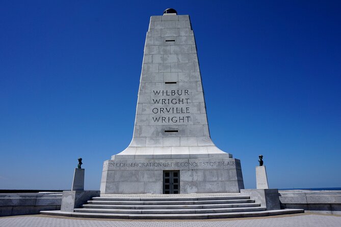
At Wright Brothers National Memorial, the audio suggests turning left onto Wright Memorial Drive. It also gives you what to look for: full-scale models of planes, markers showing distances for the flights of the Wright Flyer, and more. This stop is good because it’s less “stand in a room” and more “walk, look, and connect.”
Avalon Pier: a simple add-on if you want food and ocean views
At Avalon Pier (via E. Sportsman Drive), the audio calls out the 440-foot-long wooden pier and the ocean views from it. It also notes restaurants and shops nearby, and says fishing can be a draw. If you’re hungry or your drive is feeling too “information heavy,” this is an easy break point.
Kitty Hawk, Kill Devil Hills, and the garage origin story
Your route brings you to Kitty Hawk Woods Reserve and the naming history around early flight. The audio notes that historians credit Kitty Hawk, but the first flight actually took place a few miles south of town in Kill Devil Hills.
Then you’ll also get a stop at the Wright Brothers Garage Monument, tied to the idea that the brothers built an early glider in a garage. It’s a reminder that invention here wasn’t magic. It was work.
Duck and Corolla: small-town stops plus wild-watersport energy
Next you have Duck Town Park Boardwalk, with waterfront trails and nearby shops and restaurants. It’s a good leg-stretch option and a softer pace compared to the earlier heavy history.
Then the route hits Pine Island Audubon Sanctuary—2,600 acres of preserved land and a refuge for hundreds of bird species. The audio also references how hunting pressures changed what bird life could survive here in the past. If you like nature breaks, this is the kind of stop that pairs well with a long drive.
Finally, you enter Corolla, and the audio points out Corolla Beach and its wild horse herd. The town size is described as around 500 locals, swelling in summer. If you’re visiting outside peak season, Corolla can feel calmer without losing the “coast goes on forever” feeling.
Currituck Beach Lighthouse and Whalehead Club: big engineering and big money
At Currituck Beach Lighthouse, the audio gets specific. It calls the lighthouse a first-order lighthouse, mentions the Fresnel lens size, and notes visibility from about 21 miles away. It also gives the lighthouse height described as 162 feet. This is one of those spots where the numbers help you see the scale of what you’re looking at.
Just before the lighthouse, you’ll pass Whalehead Club. The audio describes its late-1800s/early-1900s wealthy hunting era, then narrows into Edward Collings Knight Jr., his second wife, and the building named for their lodge—an Art Nouveau style home. It’s described as about 22,000 square feet. This stop gives you a different angle on the Outer Banks: not just hardship, but wealth and leisure that depended on the same coastal access and weather.
Practical tech tips so the audio behaves
This tour is easy once it’s loaded, but it’s not mindless. Here’s what matters most:
- Download the tour while you have strong Wi‑Fi/cellular. After that, it works offline.
- Start the tour at the designated starting point. Don’t improvise.
- Keep an eye on speed limits. GPS-triggered playback tends to work best when you don’t jump ahead.
- For car audio, connect via Bluetooth, USB, or AUX. Audio playback is compatible with Apple CarPlay, and Android Auto support is described as on the way.
- If you hit trouble, there’s support availability described from 9 am to 6 pm EST.
I also suggest planning a tiny “setup buffer” before you leave your hotel. A surprising number of frustrations come from trying to download or enter passcodes while you’re already on the road.
Who this driving audio tour is best for (and who should skip)
This works best if you:
- Like learning while driving and prefer self-paced freedom
- Want a single route that includes lighthouses, rescue sites, dunes, and aviation history
- Travel as a group of up to four and want per-car value
- Don’t want to buy attraction tickets for every stop
You might want a different style of tour if you:
- Want long museum visits or guided explanations inside buildings
- Hate GPS-triggered experiences and need strict human direction
- Are traveling with minimal phone battery or no easy way to connect to car audio
Should you book the Outer Banks Self-Guided Driving Audio Tour?
I think it’s a strong yes if you want an efficient, educational drive with offline-ready storytelling and lots of real coastal stops. The per-group price makes it especially good value for friends or families, and the mix of shipwreck history, rescue stations, lighthouses, WWII memory, and aviation makes the drive feel varied without needing ticket plans.
If you’re the cautious type with apps, just do two things right: download on strong Wi‑Fi, and start at the correct starting location. When you do that, you’ll get the kind of travel day that feels like you hired a good guide, only you’re steering.
FAQ
How much does this Outer Banks self-guided driving tour cost?
It costs $24.99 per group (up to 4).
How long will it take to complete?
Plan for about 2 to 3 hours.
Is the tour available in English?
Yes. It’s offered in English.
Does it work offline without cellular service?
Yes. You need to download the tour while you have strong Wi‑Fi/cellular, and then it works offline afterward.
Do I need tickets or attraction passes to enjoy the stops?
The tour does not include attraction passes or entry tickets. However, many of the listed stops indicate free admission tickets.
Where does the tour start and end?
It starts at Cape Hatteras National Park Rd, Nags Head, NC 27959, USA and ends at 59200 Museum Dr, Hatteras, NC 27943, USA.
Can I pause the tour and start again later?
Yes. You can start anytime and pause anywhere, then continue at your own pace.
What if I need to cancel?
Free cancellation is offered. You can cancel up to 24 hours in advance for a full refund.
Does it play audio automatically based on location?
Yes. Audio stories play automatically as you reach their location cues, so you can explore hands-free.