REVIEW · JASPER
Icefields Parkway Self-Guided Driving Audio Tour
Book on Viator →Operated by Adventures with Action · Bookable on Viator
One road, 70-plus stories, zero effort. This self-guided drive on Canada’s Icefields Parkway turns a long day behind the wheel into a guided explanation of glaciers, passes, and waterfalls, with location-triggered audio that plays as you go. I also like that you get lifetime access to the tour, so you can reuse it on future trips without paying again.
The main thing to watch is setup. You’ll need to handle an app download with strong Wi‑Fi/cellular first, and then make sure you launch the correct tour version for where you’re starting (Jasper vs. Lake Louise). Once it’s rolling, you can pause, stop for photos, and keep the drive moving at your own pace.
In This Review
- What Makes This Icefields Parkway Audio Tour Worth Your Time
- Price and Value: One Purchase, One Car
- How It Works: Offline Maps, GPS Cues, and Hands-Free Audio
- Your Real Game Plan: Jasper-to-Lake Louise and Choosing the Right Version
- Jasper Beginnings: Quick Pullouts That Teach You the Area
- Valley of the Five Lakes Trailhead (about a 3-mile hike)
- Athabasca Pass Lookout (mountain-range framing)
- Horseshoe Lake (for the brave, or the curious)
- Athabasca Falls (75 feet of waterfall energy)
- Mount Kerkeslin and Mount Christie (peaks with names and stories)
- Honeymoon Lake and a quiet chance for reflections
- The Icefields Core: Falls, Glaciers, and the Stories Behind the Ice
- Sunwapta Falls (2-mile easy hike, big payoff)
- Endless Chain Ridge (geology in plain language)
- Alberta 93 (a small clue about the landscape history)
- Beauty Creek and Stanley Falls (ice sheets in colder months)
- Stutfield Glacier Viewpoint (a glacier from the parkway)
- Tangle Creek Falls (hard to miss)
- Columbia Icefield Skywalk (the one likely to require extra tickets)
- From Peaks to Glaciers: Trailheads You Can Do in Chunks
- Mount Kitchener (and the naming backstory)
- Toe of the Athabasca Glacier Trailhead (over a mile, close-up views)
- Wilcox Pass Trail (challenging, but you can shortcut the viewpoint)
- Parker Ridge Trail (4 miles, for panoramic seekers)
- Panther Falls and Bridal Veil (two waterfall wins)
- Weeping Wall viewpoint (water that may or may not show)
- Toward Banff: Lakes, Canyons, and Historic Crossings
- Saskatchewan River Crossing (1882 staging story)
- Howse Pass Viewpoint
- Mistaya Canyon Trailhead (down into the gorge)
- Mount Chephren and Waterfowl Lake (names and moods)
- Snowbird Glacier and Peyto Lake (turquoise payoffs)
- Bow Lake and Crowfoot Glacier (road views that still feel big)
- Wapta Icefield and Hector Lake (final glacial framing)
- Ending at Lake Louise
- Small Frictions: What Could Slow You Down
- Who This Tour Fits Best
- Should You Book This Icefields Parkway Audio Tour
- FAQ
- How much does the Icefields Parkway audio tour cost?
- How long does the tour take?
- Do I need cell service to use the tour?
- How do I start the audio tour once I arrive?
- Is this a guided tour with someone meeting me?
- What language is the tour offered in?
- Does the price include attraction tickets?
- Can I use the tour more than once?
- What’s the best way to listen while driving?
What Makes This Icefields Parkway Audio Tour Worth Your Time
The Icefields Parkway is already famous for views. This tour’s value is how it helps you see those views with context, so your stops feel purposeful instead of random pullouts. You’re not just “looking at mountains.” You’re learning why the lakes are turquoise, how glaciers shaped the canyon walls, and what the names refer to.
The route is also built for real road time. Plan on about 3 to 4 hours for the full drive experience, with over 140 miles of guided narration and more than 76 audio stories. Most stops are quick, which fits how the highway is designed: brief park-and-look moments, plus a handful of optional hikes.
Price and Value: One Purchase, One Car
At $16.99 per group (up to 4), this is priced like a “car tour,” not a per-person ticket. That can be a great deal if you’re traveling as a couple, two friends, or a small family in one vehicle.
It’s also a good match for a drive route like this, where you’ll want to stop whenever you feel like it. A guided bus version often has a fixed schedule. Here, you control your timing, you can linger at Horseshoe Lake, and you’re not stuck asking a guide to translate what you’re staring at.
One more money point: the tour includes narration and routing support, not attraction admissions. If you want something like the Columbia Icefield Skywalk, you’ll need to sort that separately.
How It Works: Offline Maps, GPS Cues, and Hands-Free Audio
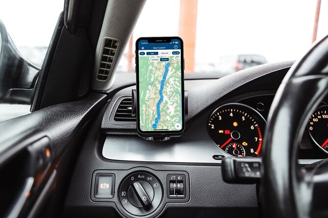
This is a self-guided driving experience, so nobody meets you at the start. You’ll stand at your chosen starting point, open the app, and start the correct tour version. From there, the audio plays automatically as you reach each story point.
A few practical details matter a lot here:
- Offline use is supported. The tour notes offline maps and no-signal operation after download.
- You’ll want to download the tour while you’re on strong Wi‑Fi/cellular, since signal can be spotty in the Icefields area.
- To hear it while driving, connect your phone to your car stereo using Bluetooth, USB, or AUX. Headphones can be handy for any short walks.
Based on the practical issues people ran into, I recommend testing audio before you roll into the long stretches. If the app doesn’t launch immediately at your starting point, don’t panic. Double-check you’re opening the right audio tour and that you entered the correct password you received by email/text.
Your Real Game Plan: Jasper-to-Lake Louise and Choosing the Right Version
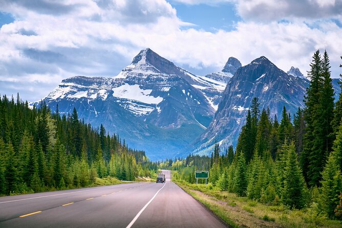
The tour content describes a Jasper-to-Banff-to-Lake Louise flow, and it also notes that there are different versions depending on where you start. In plain terms: if you begin near Jasper, use the Jasper version; if you’re starting near Lake Louise, switch to the Lake Louise version in the app.
Your meeting instructions list Lake Louise, AB as the start and end point, but the narration itself includes a Jasper-start option. That mismatch is easy to fix in the app as long as you pick the correct version for your route.
Plan for one continuous run if you can. The narration is timed to road progress, and you’ll get the best “story arc” by keeping to the tour route and speed limits.
Jasper Beginnings: Quick Pullouts That Teach You the Area
This is where the tour earns its keep. Early on, the narration points you toward viewpoints and trailheads that help you understand how the Parkway got its reputation.
Valley of the Five Lakes Trailhead (about a 3-mile hike)
You’ll be directed to a trailhead for a moderately challenging ~3-mile hike that takes about 1.5 hours. The focus here is the lakes themselves: those unreal blues and turquoise tones that look edited but aren’t. The narration connects those colors to glacial activity, which makes the scenery easier to interpret when you’re standing there.
Tip: If you’re hiking, bring a little patience. This is a steady walk, not a sprint. If weather turns, you can also turn it into a shorter out-and-back.
Athabasca Pass Lookout (mountain-range framing)
At the Athabasca Pass Lookout, you get a clean view of the South Jasper Mountain Range, with Mount Edith Cavell described as the prominent peak in your line of sight. It’s the kind of viewpoint that feels “instant,” which matters on a drive day.
Horseshoe Lake (for the brave, or the curious)
Next comes Horseshoe Lake, famous for cliff jumpers. The narration describes a U-shaped lake with about 75 feet of drop, plus the jolt of freezing water. Even if you never plan to jump, it’s a memorable roadside scene and a good place to take in the height and the rock walls.
Athabasca Falls (75 feet of waterfall energy)
Then you hit Athabasca Falls, a 75-foot waterfall plunging into a canyon. The narration adds the deep-time angle, explaining how glacial retreat allowed the Athabasca River to flow and how that shaped the canyon over tens of thousands (and more) of years.
Mount Kerkeslin and Mount Christie (peaks with names and stories)
Mount Kerkeslin and later Mount Christie show up as quick skyline anchors. The tour ties names to early explorers, including James Hector, which turns “a mountain” into “a chapter of exploration.” If you like naming origins, you’ll enjoy these little bursts.
Honeymoon Lake and a quiet chance for reflections
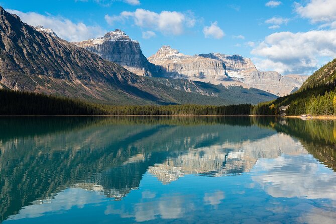
Honeymoon Lake is framed as a photogenic stop with reflected mountains in the Maligne Range. The narration also notes canoeing, which gives you a sense that this is more than a scenic roadside: it can be lived-in, especially in good weather.
The Icefields Core: Falls, Glaciers, and the Stories Behind the Ice
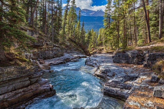
After you pass the early Jasper side highlights, the tour shifts into the Icefields heart: river canyons, glacier views from the road, and a few “yes, I should step out” moments.
Sunwapta Falls (2-mile easy hike, big payoff)
You’re sent to the Sunwapta Falls trail, described as an easy ~2-mile hike taking just over an hour. The narration emphasizes a 60-foot plummet fed by the Athabasca Glacier. Also, Sunwapta is tied to a word meaning turbulent water, which helps when you hear the sound before you see everything.
Endless Chain Ridge (geology in plain language)
Endless Chain Ridge gets real geological explanation: rock formed around 200 million years ago, then uplifted much later by forces under the earth’s crust. This is a great “slow down and look” moment, because the ridge line can look similar until you know what you’re seeing.
Alberta 93 (a small clue about the landscape history)
You’ll pass a stop described as looking like a “pile of rocks,” but with a story about how the terrain formed. This is exactly the kind of roadside detail an audio tour helps with. Without narration, it might feel forgettable.
Beauty Creek and Stanley Falls (ice sheets in colder months)
The tour then connects Beauty Creek, Stanley Falls, and cold-season ice behavior. It explains that in colder months, waterfalls can become sheer sheets of ice, not just frozen mist. It’s the kind of detail that makes you look twice at what’s normally just “winter scenery.”
Stutfield Glacier Viewpoint (a glacier from the parkway)
At Stutfield Glacier Viewpoint, you’re told you can see a huge glacier directly from the highway area, with double icefalls mentioned. It also includes glacier hazard context for climbers, which is useful because it keeps the awe from turning into recklessness.
Tangle Creek Falls (hard to miss)
Tangle Creek Falls is described as a 90-foot cascade alongside the parkway, with spray affecting the road so you’ll notice it even without trying. These are the roadside moments where the tour feels like it’s guiding your eyes to the right place.
Columbia Icefield Skywalk (the one likely to require extra tickets)
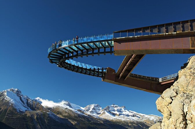
The tour includes the sensation of walking on the glass floor that snakes along the cliffside, described as extending about 100 feet across the Sunwapta Valley, with views more than 900 feet below. Since attraction passes aren’t included, plan to budget separately if you want to go onto the Skywalk.
If you’re okay with heights, this is the stop you’ll talk about later. If heights aren’t your thing, you can still enjoy the glacier-and-canyon context from the road.
From Peaks to Glaciers: Trailheads You Can Do in Chunks
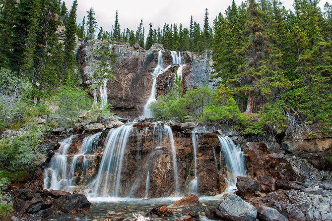
This tour doesn’t push you into long hikes, but it does give you options when your legs feel good.
Mount Kitchener (and the naming backstory)
Mount Kitchener is described as the tallest peak off to the right at 11,499 feet, named after Horatio Kitchener. The story of the sinking ship in 1916 gives the peak a human history layer.
Toe of the Athabasca Glacier Trailhead (over a mile, close-up views)
The Toe of the Athabasca Glacier trailhead is marked as a must-do for a closer look at the Athabasca Glacier. It’s described as just over one mile and moderate, which makes it a good “stretch your legs” hike without eating your whole day.
Wilcox Pass Trail (challenging, but you can shortcut the viewpoint)
The Wilcox Pass hike is listed as a challenging 7-mile route, but the narration suggests most people hike a little over a mile to reach a viewpoint and then turn back. That’s a smart way to treat the day: you get the payoff without committing to a full slog.
Parker Ridge Trail (4 miles, for panoramic seekers)
Parker Ridge Trail is described as 4 miles with alpine meadows and panoramic views, taking a little over two hours. This works best if you’re already feeling strong and want more than roadside views.
Panther Falls and Bridal Veil (two waterfall wins)
The tour sends you to Panther Falls via a 1.5-mile forest walk of about 30 minutes, then offers a continuation option to Bridal Veil, described as five times the size, about another mile onward. If you want a clean win with minimal planning, this pairing fits.
Weeping Wall viewpoint (water that may or may not show)
The Weeping Wall viewpoint is described as a set of 900-foot cliffs that can leak water under the right conditions. It’s a good reminder that nature runs on timing and weather, not on your schedule.
Toward Banff: Lakes, Canyons, and Historic Crossings
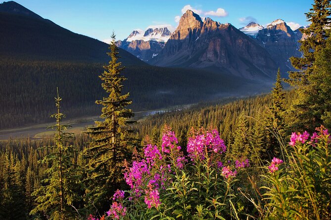
Past the Icefields core, the tour shifts again. You’re still in stunning terrain, but the story focus broadens: geography, names, and a hint of old transportation history.
Saskatchewan River Crossing (1882 staging story)
The tour includes a stop about how crossing used to work long before the Parkway existed. It describes a drifting plank, plus a horse and carriage, with a man named John Walter running it in 1882. It’s a neat way to connect today’s highway to how people moved through the region back when roads were barely roads.
Howse Pass Viewpoint
You’re directed to Howse Pass Viewpoint, described as a must-see for river and mountain views. This is the kind of stop that’s useful even if you skip the longer hikes.
Mistaya Canyon Trailhead (down into the gorge)
Next is Mistaya Canyon Trailhead, described as a moderate ~1.5-mile hike taking about 40 minutes to reach the bottom of a deep gorge flowing with water.
Mount Chephren and Waterfowl Lake (names and moods)
You’ll then hear about Mount Chephren, with its pyramid-name reasoning tied to the Egyptians and a specific Pharaoh connection. After that comes Waterfowl Lake Viewpoint, described as easy to see right from the parkway. The narration also links the lake to the 1960s hippie movement, which adds a surprising cultural note to the natural scenery.
Snowbird Glacier and Peyto Lake (turquoise payoffs)
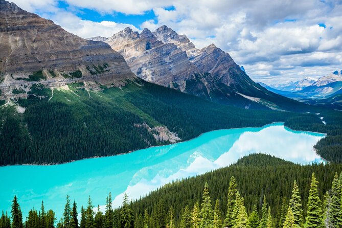
You’ll get a quick glacier viewpoint for Snowbird Glacier and then Peyto Lake, described as glacier-fed with bright turquoise color and a 2-mile trail around the lake’s circumference if you want to walk.
Bow Lake and Crowfoot Glacier (road views that still feel big)
Bow Lake is described as having blue waters reflecting Mount Jimmy Simpson. Later, Crowfoot Glacier Viewpoint explains how the glacier has receded and lost lobes that once shaped it like a crow’s foot.
Wapta Icefield and Hector Lake (final glacial framing)
The narration includes Wapta Icefield, and it notes a Stoney-Nakoda word meaning running water. Then comes Hector Lake Viewpoint, described as pristine glacial water beneath named mountains and a popular photo spot.
Ending at Lake Louise
The tour ends with directions to continue driving straight for another 5 to 10 minutes to reach Lake Louise. At this point, the narration has basically trained your eyes to notice what changed between glacier, river, and rock, not just that it’s all pretty.
Small Frictions: What Could Slow You Down
The biggest real-world downside is not the route. It’s the start-up process. One issue that pops up is simply getting audio to launch right away. If that happens, the fix is usually straightforward: confirm you’re at the right starting point, open the correct tour version, and use the password details from your email/text.
Also, some audio segments reference major attractions like the Skywalk, but the tour doesn’t include tickets. If you want those, you should plan extra time and budget so you don’t feel rushed or surprised.
Who This Tour Fits Best
This audio tour is a strong fit if you:
- Want a self-guided Icefields day with room to linger.
- Prefer learning in chunks while you drive, rather than following a strict group itinerary.
- Like lakes-and-waterfall stops, plus at least a few short hikes.
It can also work well for people who don’t want a big excursion every time, because many stops are short and most hikes have clear “how long” guidance.
If you’re the type who likes to plan every minute, you might find the audio pace too flexible. But if you want a drive day that feels natural, it’s a good match.
Should You Book This Icefields Parkway Audio Tour
Book it if you want the Icefields Parkway drive to feel like a guided experience without paying for a guide, and without losing flexibility. The $16.99 per group price can be a standout value, especially if you’re traveling with others in one car.
Skip it only if you know you hate app-based setups, or you don’t have reliable time to download and test the audio before you start driving. If you can manage that download step and choose the right tour version for your starting point, you’ll get a lot of meaning out of the miles you’re already going to drive.
FAQ
How much does the Icefields Parkway audio tour cost?
It costs $16.99 per group, and the tour fits up to 4 people.
How long does the tour take?
The tour takes about 3 to 4 hours to complete.
Do I need cell service to use the tour?
No. The tour supports offline maps, and after you download it, it should work even with no cellular or Wi‑Fi signal.
How do I start the audio tour once I arrive?
After booking, you’ll get instructions and a password. Once onsite, open the Action tour guide app, launch the correct tour version for your starting point, then go to the first story’s point; audio begins automatically and continues as you follow cues.
Is this a guided tour with someone meeting me?
No. It’s self-guided. No one meets you at the start.
What language is the tour offered in?
The tour is offered in English.
Does the price include attraction tickets?
No. The tour does not include attraction passes, entry tickets, or reservations.
Can I use the tour more than once?
Yes. The tour has new lifetime access with no expiry, so you can use it on future trips as many times as you want.
What’s the best way to listen while driving?
Connect your phone to your car stereo using Bluetooth, USB, or AUX. The audio is also compatible with Apple CarPlay, with Android Auto support noted as on the way.