REVIEW · CRATER LAKE NATIONAL PARK
Crater Lake National Park Self-Guided Driving Audio Tour
Book on Viator →Operated by Travel with Action · Bookable on Viator
Crater Lake hits you fast. This self-guided audio route turns the drive into a steady stream of stories and lookout stops, so you know what you’re seeing as the lake keeps changing. I really liked the offline audio (no cell signal needed after you download) and the hands-free pacing that plays stories as you move.
One thing to plan around: the park has closures that can block part of the usual loop, and the tour download can be finicky if you reach the park without strong Wi-Fi or service.
In This Review
- Key highlights before you go
- Getting Your Phone Ready for Crater Lake Offline Audio
- Price and Value: Paying Per Car for a 2–3 Hour Guided Drive
- Route Reality Checks: Seasonal Closures and Temporary Gaps
- Rim Village: The “Model Village” Idea and Why It Fits the Place
- Pumice Castle: When Volcanic Rock Turns Into Bubble Foam
- The Steep Option to Shore and Wizard Island
- Wizard Island: The Name Comes From a Hat-Like Peak
- Watchman Peak and the 400-Foot Climb That Pays You Back
- Merriam Point: Another “Look Again” Viewpoint
- Cleetwood Cove Trail: Descend and Then Climb Back Up
- Cloudcap Overlook: Highest Point Views and Lake Depth Clues
- Phantom Ship Overlook: Fog Turns Rock Into a Ghost Story
- Sun Notch Trail: A Short Loop With Strong Views
- Vidae Falls: Seasonal Water and the 600-Foot Drop
- Castle Crest Wildflower Garden: Flowers After Nearly 50 Feet of Snow
- Why the Audio Tour Works Better Than Just a Map
- Should You Book This Crater Lake Audio Driving Tour?
- FAQ
- How long is the Crater Lake self-guided driving audio tour?
- What is the price, and is it per person?
- Does the tour require cellular or Wi-Fi while you’re driving?
- How does the audio start and play?
- Where does the tour start and where does it end?
- Do I need a Crater Lake park entrance pass?
- What kinds of stops are included besides driving?
- Are there road closures that affect the route?
- What’s the cancellation window for a refund?
Key highlights before you go
- Offline-first setup with an Action’s Tour Guide app, so you can keep listening even with spotty service
- 40+ audio stories over 44 miles, built for a 2–3 hour self-drive with photo breaks
- Real viewpoints, real effort: Rim overlooks plus optional hikes like Watchman Peak and Cleetwood Cove
- Volcanic science in plain English at stops like Pumice Castle (yes, pumice is basically foamy rock)
- Season-aware stops such as Vidae Falls and Castle Crest Wildflower Garden
Getting Your Phone Ready for Crater Lake Offline Audio
The biggest make-or-break step is the download. The tour works offline after setup, but you have to download the tour while you have strong Wi-Fi or cellular. Crater Lake is famous for being remote, and that means you cannot count on signal when you arrive.
Here’s the setup flow you’ll want to follow:
- After booking, you’ll get an email and text with setup instructions and a password (you search for audio tour in those messages).
- Download the Action tour app, enter the password, and make sure the tour is fully downloaded while you’re still getting solid signal.
- Once you’re onsite, open the app and start the correct tour version for where you begin.
For your audio connection, the tour is designed for car listening. You can connect your phone to your car stereo with Bluetooth, USB, or AUX. If you plan to do the on-foot sections, bring headphones if you can. The audio cues are location-based, but your feet and wind will compete for your attention once you step out.
Also note the tech limits. Playback can work through Apple CarPlay, and Android Auto is also on the way. Navigation features are not the focus right now, so use your phone’s standard maps for driving. The audio is the guide.
One practical tip I’d use: start the tour only after you’ve got audio working in the car. Do a quick test before you leave the parking area so you don’t waste your first story fighting your settings.
Price and Value: Paying Per Car for a 2–3 Hour Guided Drive
At $16.99 per group (up to 4), the pricing is built for families and small friend groups. Instead of paying per person, you pay per car, which can drop the cost fast if you’re not traveling solo.
You also get new, lifetime access with no expiry. That matters at Crater Lake because conditions change by season. You might come back in spring for stronger water at Vidae Falls, or return later for Castle Crest wildflowers. If you’re the type who re-walks favorite viewpoints with different light, lifetime access is a real perk.
Time-wise, you’re looking at about 2–3 hours for the full route. The tour is longer than it looks on a map: it’s over 44 miles and includes 40+ audio stories. That’s why it feels like more than background audio. You’re getting structure: where to stop, what to look for, and what the geology or history means in human terms.
Two “value” checks for you:
- You still need the park entrance pass, and it’s not included in the tour price.
- If you end up skipping hikes, the drive-only version can be less of a workout than you expect—but you’ll also miss some of the best payoff viewpoints.
Route Reality Checks: Seasonal Closures and Temporary Gaps
Crater Lake has a few road rules that can change your plan day-to-day. The tour is designed to follow specific stops, but it can’t change the park roads.
Here’s what you should know:
- Rim Drive and the North Entrance Road are closed for the season. That can affect whether you can complete the full circle around the lake.
- Between the Sun Notch Trailhead and Cloudcap Overlook, some areas are temporarily closed. The workaround is simple but important: you drive back and access each section separately, since both Sun Notch and Cloudcap Overlook remain open.
So the tour is not just a “press play and forget it” plan. You’re still driving in a real national park with real road conditions.
If you want the smoothest experience, I’d do two things before you start:
- Check the official Crater Lake site for road status that day.
- Decide which entrance side you’ll approach and start the tour from the correct starting point in the app, because picking the wrong version can cause audio timing or location mismatches.
Rim Village: The “Model Village” Idea and Why It Fits the Place

The tour starts at Steel Information Center (Munson Valley Rd, Crater Lake, OR 97604). From there, you’ll roll into the Rim area where the park’s human planning shows up alongside the volcanic drama.
At Rim Village, the story focuses on how the government designed buildings to handle new arrivals without breaking the natural setting. The idea was a model village that looked like something people might actually live in, while still blending with the surroundings.
Why that stop works: it gives you a way to look at the park beyond the postcard view. Yes, Crater Lake is about water and steep cliffs. But it’s also about how people built facilities around a place they wanted to protect.
If you’re the kind of traveler who likes to understand the “why” behind your stops, Rim Village is a solid early win. You’ll also be setting yourself up for the driving loop that follows.
Pumice Castle: When Volcanic Rock Turns Into Bubble Foam
Next comes Pumice Castle. The story here is Mount Mazama, and the way the volcano didn’t erupt only once.
The key idea: smaller eruptions before the big one released lightweight volcanic rock with gas bubbles trapped inside. That’s pumice—so porous it’s almost full of holes, which is why it’s so light.
This is the kind of stop I recommend even if you don’t love geology. The narration doesn’t just name materials. It explains how pressure and heat translate into the rock you can actually see.
And it helps you connect the dots with the rest of the tour. When you later learn that many of the odd-looking formations around the lake are volcanic leftovers, Pumice Castle feels like the “training wheels” stop.
The Steep Option to Shore and Wizard Island
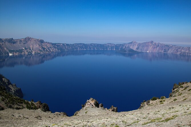
There’s a portion of the route where the tour points you toward a 2-mile hike that’s steep and strenuous if you want to reach the shore area or connect toward the ferry to Wizard Island.
This is one of those Crater Lake moments where you have to choose: do you want the easy overview experience, or do you want to earn a closer view of the lake’s edge?
If you take this hike, treat it as a workout section of your day, not a casual stroll. The cliffs and grade at Crater Lake can feel harsher than you expect, especially if you’re coming in from warmer low-elevation towns.
If you’re short on energy, you can still enjoy the drive route and save your legs for the optional viewpoints.
Wizard Island: The Name Comes From a Hat-Like Peak
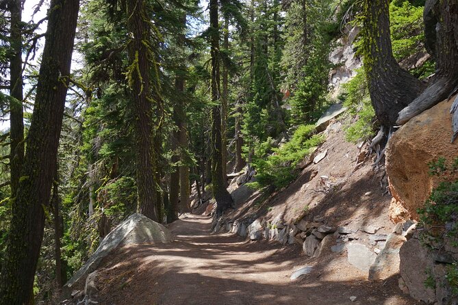
Wizard Island is another quick stop built for the view. The story doesn’t point to real witchcraft or boarding schools. Instead, it explains the name comes from the small peak on the island that looks like the sharp tip of a wizard’s hat.
That’s a fun reminder that the lake isn’t just “blue water.” It’s also a set of shapes people noticed long before they had satellites and GPS.
If the weather turns foggy, keep your eyes open. The lake can shift moods fast, and the island changes character with each layer of mist.
Watchman Peak and the 400-Foot Climb That Pays You Back
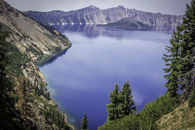
For many people, the most memorable moments come from the short hikes that create bigger viewpoints. Watchman Peak is one of the best built-in bets on this route.
The tour describes a historic watchtower with unobstructed views of Crater Lake. The trail is 2 miles with moderate difficulty, rough terrain at points, and about 400 feet of elevation gain. Plan for about an hour total.
Two reasons this hike fits the audio-tour format:
- The narration helps you understand what you’re looking at before you reach the lookout.
- The climb is hard enough to matter, but not so long that it turns your day into an all-day slog.
If you’re deciding what hikes to do, I’d prioritize Watchman Peak if you want the best “I did something” feeling without committing to an all-afternoon trail.
Merriam Point: Another “Look Again” Viewpoint
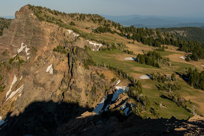
Merriam Point is a smaller stop but a strong payoff. The focus is on stunning views of the lake and its surroundings.
What I like about points like Merriam: they’re easy to miss if you only chase the famous names. But when you park here, you start seeing how the park’s edges frame the crater itself.
It’s also a good place to pause your mind. You’ll likely notice that the lake looks different from nearly every pull-off. That’s part of Crater Lake’s magic: same place, new geometry each time.
Cleetwood Cove Trail: Descend and Then Climb Back Up
Cleetwood Cove Trail is one you should respect. The tour calls it a 2-mile hike that’s steep and strenuous, with a big vertical challenge: you descend about 700 feet and then you have to climb back up.
The payoff is simple. You’re getting closer to the shoreline and the perspectives that go with it. And if you’re connecting to ferry plans, this is the kind of trail that helps you feel the scale of the crater.
If you’re wondering whether you can handle it, here’s a rule of thumb: don’t do this hike if you’re already tired from driving and don’t want a leg burn later. The climb back is the real story.
Cloudcap Overlook: Highest Point Views and Lake Depth Clues
Cloudcap Overlook is described as the highest point to catch a view of Crater Lake, giving you a clear look west. The narration also uses this stop to show how deep the water is.
Then there’s a nice visual anchor behind you: away from the lake, Mount Scott rises as the park’s highest point.
That combination works well. When you’re looking into a crater, depth can feel like a guess. Here, you get a geographic reference that makes the lake’s size feel more real.
If you’ve got limited time, Cloudcap is worth prioritizing because it’s a viewpoint that does two jobs: distance and depth.
Phantom Ship Overlook: Fog Turns Rock Into a Ghost Story
Phantom Ship Overlook is built around a myth-sounding name, but the explanation is grounded. The “phantom ship” is not an actual vessel. It’s a set of ancient volcanic rock formations that sit like an island just offshore.
The story adds atmosphere: when fog rolls in and settles on the lake, those rocks can look like a ghostly ship moving across the surface.
Even if the fog doesn’t show up, the stop still helps you read the lake. You start spotting how the crater’s floor and rock fragments shape what you see.
If you’re visiting in shoulder seasons or mornings, keep your patience for weather shifts. This is one of the stops where the conditions can make the story feel extra earned.
Sun Notch Trail: A Short Loop With Strong Views
Right near Phantom Ship, you’ll find Sun Notch Trail, an easy half-mile loop that takes about 15–20 minutes total.
This is where you can stretch your legs without taking on a big elevation challenge. The narration highlights views of Phantom Ship and also the deep blue water of Chaski Bay below.
It’s a great option if:
- you want movement, but
- you don’t want to plan your day around a long hike.
Keep an eye on footing. Even “easy” trails can have uneven ground in volcanic country.
Vidae Falls: Seasonal Water and the 600-Foot Drop
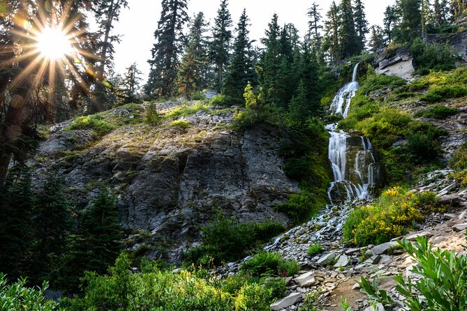
Vidae Falls looks like it’s coming from nowhere because Crater Lake sits high. The tour explains the water source: it’s spring-fed by seasonal snowmelt and rainfall.
That means timing matters. The falls are most powerful in spring and early summer, and they slow later.
The tour also reminds you of the scale: Crater Lake is about 600 feet below where you’re standing for this stop.
I like this stop because it gives you permission to adjust expectations. You don’t need to force a perfect waterfall moment. If it’s late in the season, you still get the “how it works” explanation—and that turns a disappointment into understanding.
Castle Crest Wildflower Garden: Flowers After Nearly 50 Feet of Snow
Finally, the tour wraps near Castle Crest Wildflower Garden. The story here is about timing and snowpack. It mentions early flowers like Mountain violets and Gorman buttercups emerging after being covered by nearly 50 feet of snow in an average winter.
This is a stop for people who love the slow drama of ecosystems. You’re seeing how the park wakes up.
If you’re visiting when wildflowers are active, you’ll likely feel like the tour has been setting you up for this finale. You’ve moved from geology to water to viewpoints, and now you’re ending with plant life that returns after deep winter.
Why the Audio Tour Works Better Than Just a Map
At Crater Lake, a map gets you to places. The audio tour helps you read them.
I like how the stories stay close to what you can see:
- geology that explains the rock you’re staring at,
- names that connect to real shapes (like Wizard Island),
- and viewpoints that point out depth, scale, and formations rather than just labeling them.
The tour is also flexible. You can start when you arrive, pause for snacks and photos, and skip stops you don’t care about. That matters because Crater Lake weather can change your mood in minutes. If the wind is too much at one pull-off, you can move on.
Just remember one recurring theme from real-world tech use: don’t wait until you’re inside the park to solve download issues. Plan for the park to be a low-signal zone.
And if your audio setup goes sideways, the park itself has map materials (like a newsletter with a map). It’s not the same as audio guidance, but it can get you unstuck while you troubleshoot.
Should You Book This Crater Lake Audio Driving Tour?
I’d book this tour if you:
- want a self-guided drive with real structure,
- like learning in short bursts while you stop for photos,
- and you can handle a phone setup done ahead of time so you’re ready for offline playback.
I’d skip it (or at least be cautious) if you:
- hate downloading apps or worry about tech glitches,
- didn’t plan for closures and might feel stressed by road changes,
- or you’re hoping for a fully stroller-friendly, zero-walking route. The itinerary includes hikes with real grade and elevation, like Watchman Peak and the Cleetwood descent-and-climb.
If you’re comfortable doing a little prep and you want Crater Lake with context, this tour can turn your visit into more than just great views. It helps you understand the place as you go.
FAQ
How long is the Crater Lake self-guided driving audio tour?
It takes about 2 to 3 hours to complete on average.
What is the price, and is it per person?
It costs $16.99 per group, up to 4 people.
Does the tour require cellular or Wi-Fi while you’re driving?
The tour works offline after you download it. You need strong Wi-Fi or cellular to download the tour while you have connection.
How does the audio start and play?
Once you’re onsite, you open the app and start at the first story’s point. The stories play automatically based on your location and you follow the audio cues to the next stop.
Where does the tour start and where does it end?
It starts at Steel Information Center on Munson Valley Rd in Crater Lake, OR, and it ends at Castle Crest Wildflower Garden.
Do I need a Crater Lake park entrance pass?
Yes. A park pass is required and it is not included with the tour.
What kinds of stops are included besides driving?
You’ll have optional viewpoints and hikes, including a moderately difficult 2-mile trail to Watchman Peak (about an hour total) and a steep 2-mile Cleetwood Cove Trail (descending about 700 feet and climbing back up).
Are there road closures that affect the route?
Yes. Rim Drive and the North Entrance Road are closed for the season, and some areas between Sun Notch Trailhead and Cloudcap Overlook are temporarily closed, requiring you to drive back and access sections separately.
What’s the cancellation window for a refund?
Free cancellation is available up to 24 hours in advance for a full refund. Within 24 hours, refunds are not available.