REVIEW · SEQUOIA AND KINGS CANYON NATIONAL PARK
Sequoia National Park Self-Guided Audio Tour
Book on Viator →Operated by Shaka Guide Apps · Bookable on Viator
Sequoias hit harder with the right guide. This self-guided drive pairs hands-free GPS audio with turn-by-turn directions, plus an offline map so you can keep moving even where cell service fades. My main caution: download everything before you arrive, because park Wi‑Fi can be slow or missing.
I like that the experience is built for flexibility: you control the pace, you can skip stops, and you’re not paying per person. One more consideration: parking and park entrance fees aren’t included, so budget for those separately when you’re planning your day.
In This Review
- Key Highlights at a Glance
- Price and What You Actually Get for $9.59
- GPS Audio That Keeps You Moving (Without Feeling Lost)
- The 8 to 10 Hour Route: From River-Ready Views to the Big Trees
- Entering the Park’s Story: Indian Head, Foothills, Tunnel Rock
- Stop 1: Indian Head River Trailhead
- Stop 2: Foothills Visitor Center
- Stop 3: Tunnel Rock
- Kaweah River Area Stops: Potwisha, Hospital Rock, and a Riverwalk Feel
- Stop 4: Potwisha Campground (Trailhead and Riverwalk Access)
- Stop 5: Hospital Rock
- Panoramic Stops That Make the Drive Feel Like Sightseeing
- Stop 6: Amphitheater Point
- Stop 7: Vista Point
- Stop 8: The Four Guardsmen
- Giant Forest Museum, Big Trees Trail, and General Sherman Tree
- Stop 9: Giant Forest Museum
- Stop 10: Moro Rock (350 Steps)
- Stop 11: Tunnel Log
- Stop 12: Crescent Meadow Picnic Area
- Stop 13: General Sherman Tree
- Lodgepole, Tokopah Falls, and the Comfort Break at Wuksachi
- Stop 14: Lodgepole Visitor Center
- Stop 15: Tokopah Falls (near the end of the road)
- Stop 16: Wuksachi Lodge
- The Finish: Halstead Meadow and Little Baldy for Extra View Power
- Stop 17: Halstead Meadow
- Stop 18: Little Baldy Trail
- Where This Tour Fits Best (And Where It Might Not)
- Practical Tips to Make Your Day Smoother
- Should You Book This Sequoia Self-Guided Audio Tour?
- FAQ
- How much does the Sequoia National Park self-guided audio tour cost?
- How long is the tour?
- Do I need Wi‑Fi or cell service during the tour?
- Is the tour available in English?
- Does the tour include GPS directions and auto-playing audio?
- Are park entrance fees and parking included?
- Where does the tour start and end?
- Is the tour private to my group?
Key Highlights at a Glance
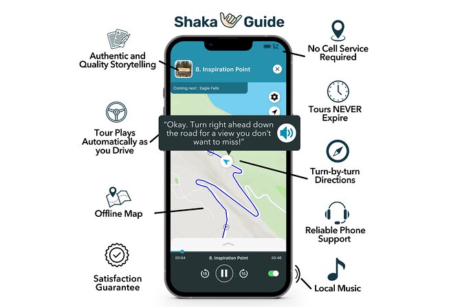
- Auto-playing stories while you drive so you can keep your eyes on the road
- Offline map support for days when your signal is weak
- A stop set built around short pull-offs and a few big walks (Sherman, Moro Rock, Tokopah Falls)
- Value for groups up to 15 people per vehicle at one low price
- Offline-ready navigation plus GPS timing so you spend less time wondering what’s next
Price and What You Actually Get for $9.59
This is priced at $9.59 per group (up to 15 people) which is a big deal in a place where a guided tour can get pricey fast. Since the tour is for your vehicle, not per person, it’s a strong option for families, friend groups, and multi-car road trips where you want the same story-driven route.
You’re not buying a driver or a live guide here. What you’re getting is an “audio + GPS” system: narration, turn-by-turn directions, and music, timed to a sequence of high-interest stops. In other words, you’re outsourcing the mental load—where to go, when to pull over, and why each spot matters.
Two added value points that matter in real life:
- It doesn’t expire, so you can spread it over multiple days if the park beats you up with hiking.
- You can start your tour when you want, which helps if your day in the area runs late.
You can also read our reviews of more tours and experiences in Sequoia and Kings Canyon National Park.
GPS Audio That Keeps You Moving (Without Feeling Lost)
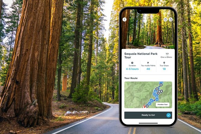
The tour is designed to work while you drive. Audio plays automatically as you approach stops, and GPS provides turn-by-turn directions. That means you’re not juggling your phone like a second job.
The practical win is simple: you’ll spend more time looking at granite domes and giant sequoias, and less time reading maps. The other practical win is the offline map. Sequoia and Kings Canyon are notorious for spotty service, so the offline setup is one less thing to go wrong on a scenic day.
One caution I’d take seriously: make sure the tour is downloaded before you reach the park. The tour instructions explicitly call out downloading in advance because Wi‑Fi may be unavailable or slow. I’d rather do that at your hotel than gamble on the park.
The 8 to 10 Hour Route: From River-Ready Views to the Big Trees
This self-guided loop is roughly 8 to 10 hours depending on how often you stop, how long you linger at viewpoints, and how much hiking you choose. The route starts and ends at Three Rivers, CA 93271, and it stays within Sequoia’s main corridors: you’ll be driving the Generals Highway area and hitting classic “pull-over-now” moments.
A useful way to plan: think of it as three layers of effort.
- Easy roadside wins: quick viewpoints and photo stops with very little walking.
- Short to moderate trail options: Potwisha, Big Trees, Moro Rock, General Sherman.
- One longer payoff hike: Tokopah Falls (and, if you want extra challenge, Little Baldy later on).
If your group has mixed hiking ability, you’ll be glad the route includes short options alongside bigger ones.
Entering the Park’s Story: Indian Head, Foothills, Tunnel Rock
Stop 1: Indian Head River Trailhead
You start at the historic Welcome to Sequoia National Park sign, then there’s a trail down toward the river. Even if you skip the walk, the parking lot view is enough to get your bearings fast—water, trees, and a sense of scale.
Why it’s worth starting here: it sets the tone. You’re not going straight to the big-ticket tree; you’re easing into the park’s geography.
Stop 2: Foothills Visitor Center
This is a practical pause. You get exhibits on park history and wildlife, plus the basics: restrooms and a souvenir shop. There’s also a water bottle filling station, which is smart because the day’s later hiking can be dry and sunny.
Use it as a reset: bathrooms, water, quick orientation, then back into the car.
Stop 3: Tunnel Rock
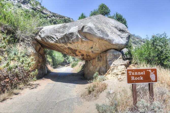
Tunnel Rock is a classic roadside “how did they do that?” moment. The original road used to go right under it, but now the alignment changed and the rock became a photo magnet. You can climb on it or walk under it (as long as park rules allow).
This is one of the stops where you’ll feel the difference between “seeing” and “understanding.” The narration helps you connect what you’re looking at to how the road and park evolved.
Kaweah River Area Stops: Potwisha, Hospital Rock, and a Riverwalk Feel
Stop 4: Potwisha Campground (Trailhead and Riverwalk Access)
The tour stop is at the Potwisha area along Generals Highway. The trailhead for Hospital Rock Trail is on the riverside dirt parking lot, and this is where you can choose your effort level:
- Hospital Rock Trail: 5 miles round trip (moderately difficult)
- Potwisha Riverwalk: half-mile round trip (easy)
I like this structure because it lets you keep the family-friendly option without losing the wow factor of the longer hike.
Stop 5: Hospital Rock
Hospital Rock is short-stop territory but big-content. You’ll see Potwisha Native American rock art on a large riverside rock. Nearby are grinding mortars, believed to be used by Potwisha women for grinding acorns into flour.
This is one of those moments where the narration really earns its place. It gives context to what would otherwise be “just a rock with markings.”
Panoramic Stops That Make the Drive Feel Like Sightseeing
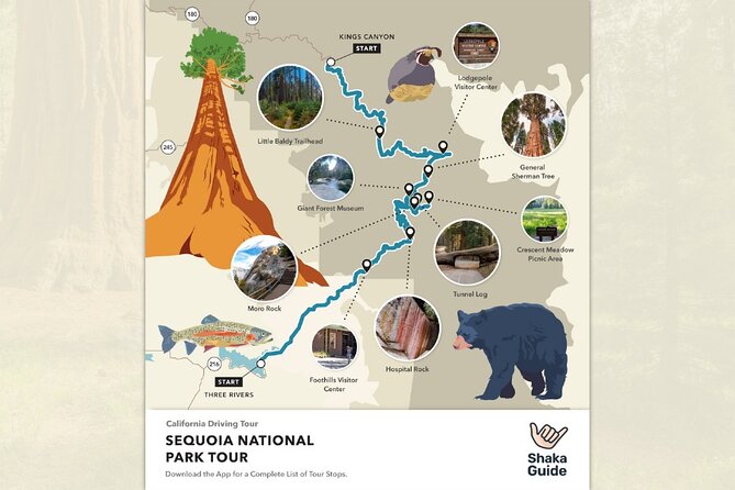
Stop 6: Amphitheater Point
This is a panoramic pull-off. You can see Moro Rock looming above the cliff, plus other peaks and ridges. The vibe here is “sit for a minute and let your eyes adjust.” The view is one of the park’s best.
Stop 7: Vista Point
Another roadside viewpoint, quick and rewarding. It sneaks up on you visually, so keep an eye on the map cues so you don’t miss the right pullover.
Stop 8: The Four Guardsmen
This one is less of a stop and more of a driving moment. You can pull over on the right side if you want, then slow down while you pass the aligned giant sequoias.
Think of it as a transition from river-and-rock focus to the “big sequoia forest” zone.
Giant Forest Museum, Big Trees Trail, and General Sherman Tree
Stop 9: Giant Forest Museum
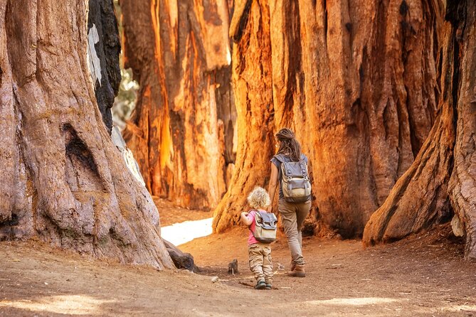
This is a smart launching point. The Giant Forest area is where you’ll meet the famous giants, including the General Sherman Tree. The museum helps you understand what you’re looking at, and it’s a natural base for choosing a hike level.
The tour favorite here: Big Trees Trail—an easy half-mile walk past meadow views and giant sequoias.
Stop 10: Moro Rock (350 Steps)
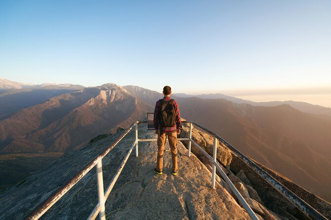
Moro Rock is short in distance but not short in effort. The climb is 350 concrete and steep steps to the top of a granite dome. Expect it to feel tiring even though it’s not long.
The payoff is the view from the top. It feels like standing above the park, and that sense of height is hard to replicate elsewhere in the valley.
Stop 11: Tunnel Log
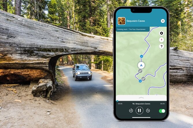
Tunnel Log is another famous “park engineering turned photo spot.” A log used to be in the way of traffic, so workers cut through it. Today, cars eight feet tall can drive through it, while others must go around.
Bring your patience for this one. It’s quick, but you may want to time your stop so you’re not stuck in traffic while you take pictures.
Stop 12: Crescent Meadow Picnic Area
Crescent Meadow is called the Gem of the Sierras by naturalist John Muir (so it’s already got a reputation). It’s also a hub for trails, including:
- A 1.5-mile loop around the meadow (easy)
- About 1.5 miles to Tharp’s Log on an easy trail
- A start point for the strenuous High Sierra Trail
You don’t need to tackle the whole thing today; just over 1.5 miles round trip takes you to Eagle View.
If you’re trying to manage energy, this stop is excellent: you can pick a short loop, a mellow out-and-back, or something slightly more ambitious.
Stop 13: General Sherman Tree
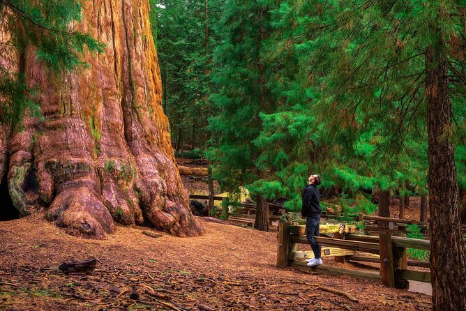
This is the star of the day. The General Sherman Tree is known as the world’s largest living tree by volume. You’ll reach it via an easy paved 1-mile trail from the parking area through a giant sequoia forest, with benches and notable tree moments along the way.
If you still have gas in the tank, you can continue via the paved Congress trail, just under 3 miles round trip, passing mature sequoias.
This is the stop where you’ll likely slow down the most. Don’t rush it. The point isn’t checking a box—it’s letting scale sink in.
Lodgepole, Tokopah Falls, and the Comfort Break at Wuksachi
Stop 14: Lodgepole Visitor Center
By now, you’ll appreciate a real breather. The Lodgepole Visitor Center gives natural and human history presentations, and Lodgepole Market is right next door for essentials and food.
If you’re traveling with kids, snacks here can be the difference between an easy afternoon and a cranky one.
Stop 15: Tokopah Falls (near the end of the road)
Tokopah Falls is the route’s big hike payoff. The trail is almost 4 miles (6 km) with an easy incline and a mix of shade and open mountain views before you reach the waterfall.
The waterfall is about 1,200 feet tall, and it can run heavily in early summer from glacial melt. By late summer it may be reduced to a trickle.
Plan around seasonal timing: if you’re visiting when water levels are lower, you’ll still enjoy the walk, but expectations for the fall itself should match the season.
Stop 16: Wuksachi Lodge
When you need to cool off after hiking, Wuksachi Lodge is a practical rest stop. It has two restaurants with full menus, plus a deck and outdoor seating. There’s also a souvenir shop with grab-and-go snacks.
This stop is valuable because it gives you a place to regroup inside the park without improvising.
The Finish: Halstead Meadow and Little Baldy for Extra View Power
Stop 17: Halstead Meadow
Halstead Meadow is a restored wetland with picnic tables and open greenery. It’s easy to access and works well for a quiet reset before you call it a day.
This is a “slow your brain down” stop. Think of it as the palate cleanser after big tree and big climb moments.
Stop 18: Little Baldy Trail
If you still want a challenge, Little Baldy is a favorite because the top views are wide. The hike is just over 3 miles round trip, climbing a couple switchbacks to reach a dome with panoramic views of the Great Western Divide and beyond.
It’s considered moderately challenging. If your group is tired after Tokopah Falls, you can skip it and still feel like you finished strong.
Where This Tour Fits Best (And Where It Might Not)
This setup is ideal if you want:
- A self-paced, car-friendly day with clear stop guidance
- A mix of quick stops and optional hikes, so everyone can tailor effort
- Strong value per vehicle, especially for groups up to 15 people
It may not be the best match if:
- You hate downloading apps or planning for offline access
- You want a strict, fixed schedule like a bus tour with zero decisions
- Your group wants a lot of food included, since meals are not part of the tour price
The best part of the design is that you can make it fit your day. You can do mostly pull-offs plus one or two trails, or go heavier on hiking and use the lodge stops to refuel.
Practical Tips to Make Your Day Smoother
A few real-world things to do before you start driving:
- Download the tour using strong Wi‑Fi before you arrive. This is the #1 fix for the most common frustration.
- Use the app’s GPS cues and suggested route speed so the narration timing lines up with where you are.
- Carry your own water planning. There are filling opportunities at the Foothills Visitor Center, but you’ll still want to be ready for long stretches.
- Plan your parking strategy. Parking fees aren’t included, so check what your route expects and budget accordingly.
Should You Book This Sequoia Self-Guided Audio Tour?
Yes, if you like driving scenic loops, want the freedom to stop as often as you want, and value a story-driven route that helps you understand what you’re seeing. At $9.59 per vehicle (up to 15 people), it’s a rare deal for a park day that can last most of the daylight.
Book it with confidence if your group includes hikers and non-hikers, because the route naturally mixes short viewpoints with optional trail goals like Moro Rock, General Sherman, and Tokopah Falls.
Skip (or think twice) if you’re arriving with shaky internet habits. The offline map is great, but the tour still needs that upfront download so it works when the signal doesn’t.
FAQ
How much does the Sequoia National Park self-guided audio tour cost?
It costs $9.59 per group (for up to 15 people).
How long is the tour?
It’s listed as 8 to 10 hours approximately.
Do I need Wi‑Fi or cell service during the tour?
No. The tour includes an offline map, so you can navigate without ongoing Wi‑Fi or data. However, you should download the tour ahead of time.
Is the tour available in English?
Yes, the tour is offered in English.
Does the tour include GPS directions and auto-playing audio?
Yes. It includes turn-by-turn GPS directions, and audio narration plays automatically as you drive.
Are park entrance fees and parking included?
No. Entrance fees and parking fees are not included (meals and refreshment also aren’t included).
Where does the tour start and end?
It starts in Three Rivers, CA 93271, and ends back at the same meeting point.
Is the tour private to my group?
Yes. It’s described as a private tour/activity, so only your group will participate.